 |
|
| Mekoryuk Airport |
| IATA: MYU – ICAO: PAMY – FAA LID: MYU |
| Summary |
| Airport type |
Public |
| Owner |
Alaska DOT&PF - Central Region |
| Serves |
Mekoryuk, Alaska |
| Elevation AMSL |
48 ft / 15 m |
| Coordinates |
60°22′17″N 166°16′14″W / 60.37139°N 166.27056°W / 60.37139; -166.27056 |
| Runways |
| Direction |
Length |
Surface |
| ft |
m |
| 5/23 |
3,070 |
936 |
Gravel |
| Source: Federal Aviation Administration |
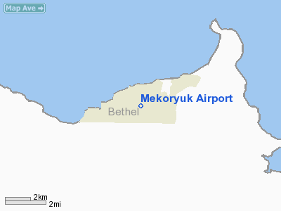
Mekoryuk Airport (IATA: MYU, ICAO: PAMY, FAA LID: MYU) is a state-owned public-use airport located three nautical miles (5.5 km) west of the central business district of Mekoryuk, a city in the Bethel Census Area of the U.S. state of Alaska. Facilities
Mekoryuk Airport covers an area of 575 acres (233 ha) at an elevation of 48 feet (15 m) above mean sea level. It has one runway designated 5/23 with a gravel surface measuring 3,070 by 75 feet (936 x 23 m).
Airlines
- Hageland Aviation Services
The above content comes from Wikipedia and is published under free licenses – click here to read more.
Location
& QuickFacts
|
FAA
Information Effective: |
2006-02-16 |
|
Airport
Identifier: |
MYU |
|
Longitude/Latitude: |
166-16-14.1900W/60-22-17.1120N
-166.270608/60.371420 (Estimated) |
|
Elevation: |
48 ft / 14.63 m (Estimated) |
|
Land: |
575 acres |
|
From
nearest city: |
3 nautical miles W of Mekoryuk, AK |
|
Location: |
Bethel County, AK |
|
Magnetic Variation: |
16E (1985) |
Owner
& Manager
|
Ownership: |
Publicly owned |
|
Owner: |
State Of Ak Dotpf/ce Region |
|
Address: |
Po Box 196900
Anchorage, AK 99519-6900 |
|
Phone number: |
907-269-0747 |
|
Manager: |
L.j. Davis |
|
Address: |
Box 505
Bethel, AK 99559 |
|
Phone number: |
907-543-2495 |
Airport
Operations and Facilities
|
Airport
Use: |
Open to public |
|
Wind
indicator: |
Yes
WINDSOCK MAY BE UNRELIABLE. |
|
Segmented
Circle: |
Yes |
|
Control
Tower: |
No |
|
Attendance
Schedule: |
UNATNDD |
|
Lighting
Schedule: |
DUSK-DAWN
ACTVT MIRL RY 05/23; VASI RYS 05 & 23 - CTAF. |
|
Beacon
Color: |
Clear-Green (lighted land airport) |
|
Landing
fee charge: |
No |
|
Sectional
chart: |
Bethel |
|
Region: |
AAL - Alaska |
|
Boundary
ARTCC: |
ZAN - Anchorage |
|
Tie-in
FSS: |
ENA - Kenai |
|
FSS
on Airport: |
No |
|
FSS
Phone: |
800-478-3576 |
|
FSS
Toll Free: |
1-800-WX-BRIEF |
|
NOTAMs
Facility: |
MYU (NOTAM-d service avaliable) |
|
Federal Agreements: |
NGY |
Airport
Communications
Airport
Services
|
Airframe
Repair: |
NONE |
|
Power
Plant Repair: |
NONE |
|
Bottled
Oxygen: |
NONE |
|
Bulk
Oxygen: |
NONE |
|
Runway Information
Runway 05/23
|
Dimension: |
3070 x 75 ft / 935.7 x 22.9 m |
|
Surface: |
GRVL, Good Condition
SHALLOW RUTS WITH PONDING AFT RAIN. |
|
Edge
Lights: |
Medium |
|
|
Runway 05 |
Runway 23 |
|
Longitude: |
166-16-42.2100W |
166-15-46.1700W |
|
Latitude: |
60-22-11.1000N |
60-22-23.1200N |
|
Elevation: |
48.00 ft |
47.00 ft |
|
Alignment: |
67 |
127 |
|
Traffic
Pattern: |
Left |
Left |
|
Crossing
Height: |
29.00 ft |
38.00 ft |
|
VASI: |
4-box on left side |
4-box on right side |
|
Visual
Glide Angle: |
3.00� |
3.00� |
|
Runway
End Identifier: |
Yes |
Yes |
|
Radio Navigation
Aids
|
ID |
Type |
Name |
Ch |
Freq |
Var |
Dist |
|
AIX |
NDB/DME |
Nanwak |
076X |
323.00 |
16E |
1.8 nm |
Remarks
- OCCASSIONAL
ANIMALS ON RWY.
- CAUTION:
RWY CONDITION NOT MONITORED; RECOMMEND VISUAL INSPECTION PRIOR TO USING.
Mekoryuk Airport
Address:
Bethel County, AK
Tel:
907-269-0747, 907-543-2495
Images
and information placed above are from
http://www.airport-data.com/airport/MYU/
We
thank them for the data!
| General
Info |
| Country |
United
States |
| State |
ALASKA
|
| FAA ID |
MYU
|
| Latitude |
60-22-17.112N
|
| Longitude |
166-16-14.190W
|
| Elevation |
48 feet
|
| Near City |
MEKORYUK
|
We don't guarantee the information is fresh and accurate. The data may
be wrong or outdated.
For more up-to-date information please refer to other sources.
|
|


