 |
|
| May Creek Airport |
| IATA: MYK – ICAO: none – FAA LID: MYK |
| Summary |
| Airport type |
Public |
| Operator |
State of Alaska DOT&PF |
| Location |
May Creek, Alaska |
| Elevation AMSL |
1,650 ft / 502.9 m |
| Coordinates |
61°20′08″N 142°41′12″W / 61.33556°N 142.68667°W / 61.33556; -142.68667Coordinates: 61°20′08″N 142°41′12″W / 61.33556°N 142.68667°W / 61.33556; -142.68667 |
| Runways |
| Direction |
Length |
Surface |
| ft |
m |
| 13/31 |
2,700 |
823 |
Grass |
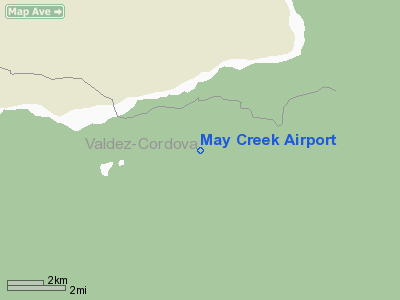
May Creek Airport (IATA: MYK, FAA LID: MYK) is a public airport located one mile (2 km) south of the central business district (CBD) of May Creek, Alaska, USA.
Airline
Airline service is subsidized by the Essential Air Service program.
The above content comes from Wikipedia and is published under free licenses – click here to read more.
Location
& QuickFacts
|
FAA
Information Effective: |
2006-02-16 |
|
Airport
Identifier: |
MYK |
|
Longitude/Latitude: |
142-41-12.3900W/61-20-08.4270N
-142.686775/61.335674 (Estimated) |
|
Elevation: |
1650 ft / 502.92 m (Estimated) |
|
Land: |
0 acres |
|
From
nearest city: |
1 nautical miles S of May Creek, AK |
|
Location: |
Cordova-mccarthy County, AK |
|
Magnetic Variation: |
28E (1985) |
Owner
& Manager
|
Ownership: |
Publicly owned |
|
Owner: |
State Of Ak Dotpf |
|
Address: |
2301 Peger Road
Fairbanks, AK 99701 |
|
Phone number: |
907-451-5217 |
|
Manager: |
Joe Junker |
|
Address: |
Po Box 7
Glenallen, AK 99588 |
|
Phone number: |
907-822-3222 |
Airport
Operations and Facilities
|
Airport
Use: |
Open to public |
|
Wind
indicator: |
Yes |
|
Segmented
Circle: |
No |
|
Control
Tower: |
No |
|
Attendance
Schedule: |
UNATNDD |
|
Landing
fee charge: |
No |
|
Sectional
chart: |
Anchorage |
|
Region: |
AAL - Alaska |
|
Boundary
ARTCC: |
ZAN - Anchorage |
|
Tie-in
FSS: |
ENA - Kenai |
|
FSS
on Airport: |
No |
|
FSS
Phone: |
800-478-3576 |
|
FSS
Toll Free: |
1-800-WX-BRIEF |
|
NOTAMs
Facility: |
MXY (NOTAM-d service avaliable) |
|
Federal Agreements: |
N |
Airport
Communications
Airport
Services
|
Airframe
Repair: |
NONE |
|
Power
Plant Repair: |
NONE |
|
Bottled
Oxygen: |
NONE |
|
Bulk
Oxygen: |
NONE |
|
Runway Information
Runway 13/31
|
Dimension: |
2700 x 100 ft / 823.0 x 30.5 m |
|
Surface: |
TURF, Fair Condition
SLOPES UP FROM RY 13 END TO RY 31 END. RY 31 THR ABOUT 100 FT HIGHER.
LOOSE
ROCKS UP TO 2 IN ON RY. |
|
|
Runway 13 |
Runway 31 |
|
Traffic
Pattern: |
Left |
Left |
|
Obstruction: |
28 ft trees, 649.0 ft from runway, 23:1 slope
to clear
MOUNTAIN 3 MI FM THR. |
64 ft trees, 490.0 ft from runway, 8:1 slope
to clear |
|
Remarks
- ROAD
ADJACENT AND ON EAST SIDE OF RWY.
- RY
CONDITION NOT MONITORED; RECOMMEND VISUAL INSPECTION PRIOR TO LANDING.
- GRASS
& WEEDS UP TO 1 FT HIGH DURING SUMMER MONTHS.
Operational Statistics
|
Aircraft
Operations: |
30/Month |
|
Air Taxi: |
42.9% |
|
General
Aviation Itinerant: |
57.1% |
May Creek Airport
Address:
Cordova-mccarthy County, AK
Tel:
907-451-5217, 907-822-3222
Images
and information placed above are from
http://www.airport-data.com/airport/MYK/
We
thank them for the data!
| General
Info |
| Country |
United
States |
| State |
ALASKA
|
| FAA ID |
MYK
|
| Latitude |
61-20-08.427N
|
| Longitude |
142-41-12.390W
|
| Elevation |
1650 feet
|
| Near City |
MAY CREEK
|
We don't guarantee the information is fresh and accurate. The data may
be wrong or outdated.
For more up-to-date information please refer to other sources.
|
|


