 |
|
|
|
|
|
Location
& QuickFacts
|
FAA
Information Effective: |
2006-02-16 |
|
Airport
Identifier: |
LSR |
|
Longitude/Latitude: |
167-09-46.7340W/65-23-46.1850N
-167.162982/65.396163 (Estimated) |
|
Elevation: |
80 ft / 24.38 m (Estimated) |
|
Land: |
0 acres |
|
From
nearest city: |
0 nautical miles of Lost River, AK |
|
Location: |
Nome County, AK |
|
Magnetic Variation: |
16E (1985) |
Owner
& Manager
|
Ownership: |
Privately owned |
|
Owner: |
Ron Sheardown |
|
Address: |
3512 Campbell Airstrip Rd
Anchorage, AK 99504 |
|
Phone
number: |
907-333-1400 |
|
Manager: |
Ron Sheardown |
|
Address: |
3512 Campbell Airstrip Rd
Anchorage, AK 99504 |
|
Phone number: |
907-333-1400 |
Airport
Operations and Facilities
|
Airport Use: |
Private |
|
Wind indicator: |
No |
|
Segmented Circle: |
No |
|
Control Tower: |
No |
|
Attendance Schedule: |
UNATNDD |
|
Landing fee charge: |
No |
|
Sectional chart: |
Nome |
|
Region: |
AAL - Alaska |
|
Boundary ARTCC: |
ZAN - Anchorage |
|
Tie-in FSS: |
OME - Nome |
|
FSS on Airport: |
No |
|
FSS Phone: |
LC 443-2291 |
|
FSS Toll Free: |
1-800-478-8400 |
|
Alternate FSS: |
FAI - Fairbanks |
|
Alt. FSS Toll Free: |
1-866-248-6516 |
Airport
Communications
Airport
Services
|
Airframe
Repair: |
NONE |
|
Power
Plant Repair: |
NONE |
|
Bottled
Oxygen: |
NONE |
|
Bulk
Oxygen: |
NONE |
|
Runway Information
Runway 18/36
|
Dimension: |
3650 x 100 ft / 1112.5 x 30.5 m |
|
Surface: |
GRAVEL, |
|
|
Runway 18 |
Runway 36 |
|
Traffic
Pattern: |
Left |
Left |
|
Markings: |
None,
/36 NOT CLEARLY DEFINED. |
None, |
|
Runway
End Identifier: |
No |
No |
|
Centerline
Lights: |
No |
No |
|
Touchdown
Lights: |
No |
No |
|
Radio Navigation
Aids
|
ID |
Type |
Name |
Ch |
Freq |
Var |
Dist |
|
TNC |
NDB/DME |
Tin City |
119Y |
347.00 |
13E |
21.4 nm |
Remarks
- RWY
18/36 NOT MAINTAINED. COND- GOOD.
- ESTABD
PRIOR TO 1959.
Operational Statistics
|
Aircraft
Operations: |
10/Week |
|
Air Taxi: |
80.0% |
|
General
Aviation Itinerant: |
20.0% |
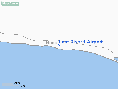
Lost River 1 Airport
Address:
Nome County, AK
Tel:
907-333-1400
Images
and information placed above are from
http://www.airport-data.com/airport/LSR/
We
thank them for the data!
| General
Info |
| Country |
United
States |
| State |
ALASKA
|
| FAA ID |
LSR
|
| Latitude |
65-23-46.185N
|
| Longitude |
167-09-46.734W
|
| Elevation |
80 feet
|
| Near City |
LOST RIVER
|
We don't guarantee the information is fresh and accurate. The data may
be wrong or outdated.
For more up-to-date information please refer to other sources.
|
|


