 |
|
|
|
|
|
Location
& QuickFacts
|
FAA
Information Effective: |
2006-02-16 |
|
Airport
Identifier: |
4AK |
|
Longitude/Latitude: |
148-40-09.0160W/65-28-21.4240N
-148.669171/65.472618 (Estimated) |
|
Elevation: |
425 ft / 129.54 m (Estimated) |
|
Land: |
0 acres |
|
From
nearest city: |
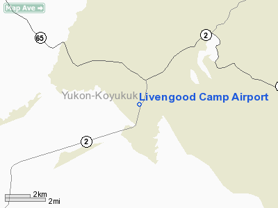
3 nautical miles N of Livengood, AK |
|
Location: |
Yukon-koyukuk County, AK |
|
Magnetic Variation: |
27E (1985) |
Owner
& Manager
|
Ownership: |
Publicly owned |
|
Owner: |
State Of Ak Dotpf |
|
Address: |
2301 Peger Rd
Fairbanks, AK 99709 |
|
Phone number: |
907-451-2206 |
|
Manager: |
Dwight Stuller |
|
Address: |
2301 Peger Rd
Fairbanks, AK 99709 |
|
Phone number: |
907-451-2206 |
Airport
Operations and Facilities
|
Airport
Use: |
Open to public |
|
Wind
indicator: |
Yes |
|
Segmented
Circle: |
No |
|
Control
Tower: |
No |
|
Attendance
Schedule: |
UNATNDD |
|
Landing
fee charge: |
No |
|
Sectional
chart: |
Fairbanks |
|
Region: |
AAL - Alaska |
|
Boundary
ARTCC: |
ZAN - Anchorage |
|
Tie-in
FSS: |
FAI - Fairbanks |
|
FSS
Phone: |
907-474-0788 |
|
FSS
Toll Free: |
1-866-248-6516 |
|
NOTAMs
Facility: |
FAI (NOTAM-d service avaliable) |
Airport
Communications
Airport
Services
|
Airframe
Repair: |
NONE |
|
Power
Plant Repair: |
NONE |
|
Bottled
Oxygen: |
NONE |
|
Bulk
Oxygen: |
NONE |
|
Runway Information
Runway 15/33
|
Dimension: |
1415
x 50 ft / 431.3 x 15.2 m
NO SAFETY AREA OVERRUN AT NORTH END OF RUNWAY. |
|
Surface: |
GRAVEL, Good Condition |
|
|
Runway 15 |
Runway 33 |
|
Traffic
Pattern: |
Left |
Left |
|
Markings: |
Nonstandard,
RWY 15/33 THLDS MARKED WITH NSTD MARKERS. RWY MARKED WITH
4 CONES AT MID-FIELD, TWO EACH SIDE. |
,
RY THSDS MARKDED WITH NON-STANDARD MARKERS. RY MARKED WITH
4 CONES AT MID-FIELD, TWO EACH SIDE. |
|
Obstruction: |
80 ft trees, 1500.0 ft from runway, 18:1 slope
to clear |
130 ft trees, 2000.0 ft from runway, 125 ft
right of centerline, 15:1 slope to clear |
|
Radio Navigation
Aids
|
ID |
Type |
Name |
Ch |
Freq |
Var |
Dist |
|
FOX |
NDB |
Fox |
|
356.00 |
28E |
40.9 nm |
|
CUN |
NDB |
Chena |
|
257.00 |
28E |
48.3 nm |
|
FAI |
VORTAC |
Fairbanks |
023X |
108.60 |
28E |
43.7 nm |
Remarks
- RY
NOT MAINTAINED & CONDITION NOT MONITORED, RECOMMEND VISUAL INSPECTION
PRIOR TO LANDING.
Operational Statistics
|
Aircraft
Operations: |
9/Month |
|
Air Taxi: |
100.0% |
Livengood Camp Airport
Address:
Yukon-koyukuk County, AK
Tel:
907-451-2206
Images
and information placed above are from
http://www.airport-data.com/airport/4AK/
We
thank them for the data!
| General
Info |
| Country |
United
States |
| State |
ALASKA
|
| FAA ID |
4AK
|
| Latitude |
65-28-21.424N
|
| Longitude |
148-40-09.016W
|
| Elevation |
425 feet
|
| Near City |
LIVENGOOD
|
We don't guarantee the information is fresh and accurate. The data may
be wrong or outdated.
For more up-to-date information please refer to other sources.
|
|


