 |
|
| Levelock Airport |
| IATA: KLL – ICAO: none – FAA LID: 9Z8 |
| Summary |
| Airport type |
Public |
| Owner |
Alaska DOT&PF |
| Serves |
Levelock, Alaska |
| Elevation AMSL |
39 ft / 12 m |
| Coordinates |
59°07′41″N 156°51′31″W / 59.12806°N 156.85861°W / 59.12806; -156.85861 |
| Runways |
| Direction |
Length |
Surface |
| ft |
m |
| 1/19 |
3,281 |
1,000 |
Gravel |
| Statistics (2006) |
| Aircraft operations |
1,466 |
| Enplanements (2008) |
527 |
| Source: Federal Aviation Administration |
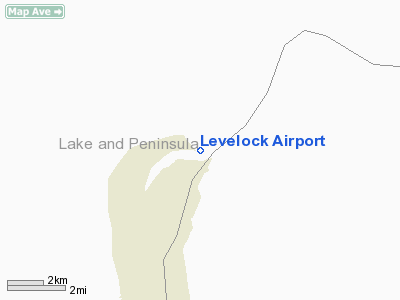
Levelock Airport (IATA: KLL, FAA LID: 9Z8) is a state-owned, public-use airport located one nautical mile (1.85 km) north of the central business district of Levelock, in the Lake and Peninsula Borough of the U.S. state of Alaska. Scheduled airline service to King Salmon Airport is provided by Peninsula Airways (PenAir).
As per Federal Aviation Administration records, this airport had 527 commercial passenger boardings (enplanements) in calendar year 2008, a decrease of 22% from the 675 enplanements in 2007. Levelock Airport is included in the FAA's National Plan of Integrated Airport Systems (2009-2013), which categorizes it as a general aviation facility.
Although most U.S. airports use the same three-letter location identifier for the FAA and IATA, this airport is assigned 9Z8 by the FAA and KLL by the IATA.. Airlines and destinations
Facilities and aircraft
Levelock Airport has one runway designated 1/19 with a gravel surface measuring 3,281 by 59 feet (1,000 x 18 m). The airport is unattended. For the 12-month period ending December 31, 2006, the airport had 1,466 aircraft operations, an average of 122 per month: 65% general aviation and 35% air taxi.
The above content comes from Wikipedia and is published under free licenses – click here to read more.
Location
& QuickFacts
|
FAA
Information Effective: |
2006-02-16 |
|
Airport
Identifier: |
9Z8 |
|
Longitude/Latitude: |
156-51-31.1000W/59-07-41.1000N
-156.858639/59.128083 (Estimated) |
|
Elevation: |
39 ft / 11.89 m () |
|
Land: |
0 acres |
|
From
nearest city: |
1 nautical miles N of Levelock, AK |
|
Location: |
Bristol Bay County, AK |
|
Magnetic Variation: |
18E (2000) |
Owner
& Manager
|
Ownership: |
Publicly owned |
|
Owner: |
State Of Alaska,
STATE OF ALASKA, DOT & PF, CENTRAL REGION |
|
Address: |
P. O. Box 146900
Anchorage, AK 99519 |
|
Phone
number: |
907-269-0767 |
|
Manager: |
King Salmon Airport Manager |
|
Address: |
P. O. Box 65
King Salmon, AK 99613 |
|
Phone number: |
907-246-3325 |
Airport
Operations and Facilities
|
Airport
Use: |
Open to public |
|
Wind
indicator: |
Yes |
|
Segmented
Circle: |
Yes |
|
Control
Tower: |
No |
|
Attendance
Schedule: |
UNATNDD |
|
Lighting
Schedule: |
DUSK-DAWN
ACTVT MIRL RY 01/19 - CTAF. |
|
Beacon
Color: |
Clear-Green (lighted land airport) |
|
Sectional
chart: |
Kodiak |
|
Region: |
AAL - Alaska |
|
Boundary
ARTCC: |
ZAN - Anchorage |
|
Tie-in
FSS: |
ENA - Kenai |
|
FSS
Phone: |
800-478-3576 |
|
FSS
Toll Free: |
1-800-WX-BRIEF |
|
NOTAMs
Facility: |
AKN (NOTAM-d service avaliable) |
|
Federal Agreements: |
NGY |
Airport
Communications
|
CTAF: |
122.900 |
|
Unicom: |
122.950 |
|
Runway Information
Runway 01/19
|
Dimension: |
3281 x 59 ft / 1000.0 x 18.0 m |
|
Surface: |
GRVL, |
|
Edge
Lights: |
Medium |
|
|
Runway 01 |
Runway 19 |
|
Traffic
Pattern: |
Left |
Left |
|
Radio Navigation
Aids
|
ID |
Type |
Name |
Ch |
Freq |
Var |
Dist |
|
AK |
NDB |
Saldo |
|
355.00 |
21E |
23.6 nm |
|
HCP |
NDB |
Kulik Lake |
|
334.00 |
21E |
39.4 nm |
|
AKN |
VORTAC |
King Salmon |
075X |
112.80 |
21E |
24.5 nm |
Remarks
- RY
CONDITION NOT MONITORED.
- RECOMMEND
VISUAL INSPECTION PRIOR TO LANDING.
- PRVDD
THAT PROPOSED ARPT DEVELOPMENT THAT REQUIRES ENVIRONMENTAL PROCESSING
SHALL NOT BE UNDERTAKEN WITHOUT PRIOR WRITTEN ENVIRONMENTAL APPROVAL
BY THE FAA.
Based Aircraft
|
Aircraft
based on field: |
2 |
|
Single
Engine Airplanes: |
2 |
Operational Statistics
|
Aircraft
Operations: |
29/Week |
|
Air Taxi: |
34.9% |
|
General
Aviation Local: |
13.9% |
|
General
Aviation Itinerant: |
51.2% |
Levelock Airport
Address:
Bristol Bay County, AK
Tel:
907-269-0767,
907-246-3325
Images
and information placed above are from
http://www.airport-data.com/airport/9Z8/
We
thank them for the data!
| General
Info |
| Country |
United
States |
| State |
ALASKA
|
| FAA ID |
9Z8
|
| Latitude |
59-07-41.100N
|
| Longitude |
156-51-31.100W
|
| Elevation |
39 feet
|
| Near City |
LEVELOCK
|
We don't guarantee the information is fresh and accurate. The data may
be wrong or outdated.
For more up-to-date information please refer to other sources.
|
|


