 |
|
|
|
|
|
Location
& QuickFacts
|
FAA
Information Effective: |
2006-02-16 |
|
Airport
Identifier: |
9Z9 |
|
Longitude/Latitude: |
149-22-12.7060W/60-24-39.9470N
-149.370196/60.411096 (Estimated) |
|
Elevation: |
475 ft / 144.78 m (Estimated) |
|
Land: |
21 acres |
|
From
nearest city: |
1 nautical miles N of Lawing, AK |
|
Location: |
Kenai-cook Inlet County, AK |
|
Magnetic Variation: |
25E (1985) |
Owner
& Manager
|
Ownership: |
Publicly owned |
|
Owner: |
State Of Ak Dotpf-central Rgn |
|
Address: |
Pouch 196900
Anchorage, AK 99519-6900 |
|
Phone
number: |
907-269-0767 |
|
Manager: |
Bob Bondurant/carl High |
|
Address: |
P. O. Box 1327
Soldotna, AK 99669 |
|
Phone number: |
907-262-5762 |
Airport
Operations and Facilities
|
Airport
Use: |
Open to public |
|
Wind
indicator: |
Yes
WINDSOCK FADED. |
|
Segmented
Circle: |
No |
|
Control
Tower: |
No |
|
Attendance
Schedule: |
UNATNDD |
|
Landing
fee charge: |
No |
|
Sectional
chart: |
Anchorage |
|
Region: |
AAL - Alaska |
|
Boundary
ARTCC: |
ZAN - Anchorage |
|
Tie-in
FSS: |
ENA - Kenai |
|
FSS
on Airport: |
No |
|
FSS
Phone: |
800-478-3576 |
|
FSS
Toll Free: |
1-800-WX-BRIEF |
|
NOTAMs
Facility: |
SWD (NOTAM-d service avaliable) |
Airport
Communications
Airport
Services
|
Airframe
Repair: |
NONE |
|
Power
Plant Repair: |
NONE |
|
Bottled
Oxygen: |
NONE |
|
Bulk
Oxygen: |
NONE |
|
Runway Information
Runway 15/33
|
Dimension: |
2200 x 50 ft / 670.6 x 15.2 m |
|
Surface: |
GRVL, Fair Condition |
|
|
Runway 15 |
Runway 33 |
|
Traffic
Pattern: |
Left |
Left |
|
Obstruction: |
30 ft trees, 120.0 ft from runway, 4:1 slope
to clear |
40 ft tree, 166.0 ft from runway, 4:1 slope
to clear |
|
Radio Navigation
Aids
|
ID |
Type |
Name |
Ch |
Freq |
Var |
Dist |
|
CMQ |
NDB |
Campbell Lake |
|
338.00 |
21E |
49.8 nm |
|
OLT |
NDB/DME |
Soldotna |
106X |
346.00 |
24E |
44.9 nm |
|
ANC |
VOT |
Anchorage |
|
108.40 |
|
49.4 nm |
Remarks
- RWY
UNDULATES; SOFT DRG SPRING THAW; RUTS ON EAST SIDE.
- STATE
MAINTENACE ON IRREGULAR BASIS.
- RY
COND NOT MONITORED; RECOMMEND VISUAL INSPECTION PRIOR TO USING.
- FIRST
1000 FT RWY 33 RUTS UP TO 6 INCHES 8-10 FT R OF CNTRLN RUNING PARALLEL
TO RY. OVERRUN
SLOPES DOWN 5%.
- ALL
TERRAIN VEHICLES USING RY AS A ROAD.
- ROCKS
TO 4 INCHES NEAR RY 15/33 TURNAROUND ENDS.
- RY
15/33 PANELS DAMAGED.
- NO
STATE MAINTENANCE PERFORMED ON ARPT.
Based Aircraft
|
Aircraft
based on field: |
2 |
|
Single
Engine Airplanes: |
2 |
Operational Statistics
|
Aircraft
Operations: |
14/Week |
|
Air Taxi: |
14.3% |
|
General
Aviation Local: |
14.3% |
|
General
Aviation Itinerant: |
71.4% |
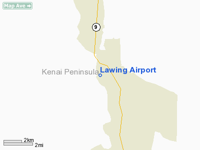
Lawing Airport
Address:
Kenai-cook Inlet County, AK
Tel:
907-269-0767,
907-262-5762
Images
and information placed above are from
http://www.airport-data.com/airport/9Z9/
We
thank them for the data!
| General
Info |
| Country |
United
States |
| State |
ALASKA
|
| FAA ID |
9Z9
|
| Latitude |
60-24-39.947N
|
| Longitude |
149-22-12.706W
|
| Elevation |
475 feet
|
| Near City |
LAWING
|
We don't guarantee the information is fresh and accurate. The data may
be wrong or outdated.
For more up-to-date information please refer to other sources.
|
|


