 |
|
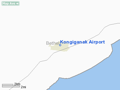
| Kongiganak Airport |
| IATA: KKH – ICAO: PADY – FAA LID: DUY |
| Summary |
| Airport type |
Public |
| Owner |
Alaska DOT&PF - Central Region |
| Serves |
Kongiganak, Alaska |
| Elevation AMSL |
30 ft / 9 m |
| Coordinates |
59°57′39″N 162°52′52″W / 59.96083°N 162.88111°W / 59.96083; -162.88111 |
| Runways |
| Direction |
Length |
Surface |
| ft |
m |
| 18/36 |
1,885 |
575 |
Gravel |
| Statistics (2005) |
| Aircraft operations |
1,200 |
| Source: Federal Aviation Administration |
Kongiganak Airport (IATA: KKH, ICAO: PADY, FAA LID: DUY) is a state-owned public-use airport located eight nautical miles (15 km) northeast of the central business district of Kongiganak, in the Bethel Census Area of the U.S. state of Alaska.
Although most U.S. airports use the same three-letter location identifier for the FAA and IATA, this airport is assigned DUY by the FAA and KKH by the IATA. The airport's ICAO identifier is PADY. Facilities and aircraft
Kongiganak Airport has one runway designated 18/36 with a gravel surface measuring 1,885 by 35 feet (575 x 11 m). For the 12-month period ending August 26, 2005, the airport had 1,200 general aviation aircraft operations, an average of 100 per month.
Airlines and non-stop destinations
- Aero Flight (Bethel, Kwigillingok)
- Flight Alaska (Kwigillingok)
- Frontier Flying Service (Kwigillingok, Tuntatuliak)
- Hageland Aviation Services
The above content comes from Wikipedia and is published under free licenses – click here to read more.
Location
& QuickFacts
|
FAA
Information Effective: |
2006-02-16 |
|
Airport
Identifier: |
DUY |
|
Longitude/Latitude: |
162-52-52.5000W/59-57-38.9000N
-162.881250/59.960806 (Estimated) |
|
Elevation: |
30
ft / 9.14 m (Estimated) |
|
Land: |
0
acres |
|
From
nearest city: |
8 nautical miles NE of Kongiganak, AK |
|
Location: |
Bethel County, AK |
|
Magnetic
Variation: |
18E (1985) |
Owner
& Manager
|
Ownership: |
Publicly owned |
|
Owner: |
State Of Ak Dot/pf Centrl Reg |
|
Address: |
Po Box 196900
Anchorage, AK 99519-6900 |
|
Phone
number: |
907-269-0747 |
|
Manager: |
L.j. Davis |
|
Address: |
Box 505
Bethel, AK 99559 |
|
Phone
number: |
907-543-2495 |
Airport
Operations and Facilities
|
Airport
Use: |
Open to public |
|
Wind
indicator: |
Yes
WINDSOCK MAYBE UNRELIABLE. |
|
Segmented
Circle: |
No |
|
Control
Tower: |
No |
|
Attendance
Schedule: |
UNATNDD |
|
Landing
fee charge: |
No |
|
Sectional
chart: |
Bethel |
|
Region: |
AAL - Alaska |
|
Boundary
ARTCC: |
ZAN - Anchorage |
|
Tie-in
FSS: |
ENA - Kenai |
|
FSS
on Airport: |
No |
|
FSS
Phone: |
800-478-3576 |
|
FSS
Toll Free: |
1-800-WX-BRIEF |
|
NOTAMs
Facility: |
BET (NOTAM-d service avaliable) |
|
Federal
Agreements: |
NGY |
Airport
Communications
Airport
Services
|
Airframe
Repair: |
NONE |
|
Power
Plant Repair: |
NONE |
|
Bottled
Oxygen: |
NONE |
|
Bulk
Oxygen: |
NONE |
|
Runway Information
Runway 18/36
|
Dimension: |
1885 x 35 ft / 574.5 x 10.7 m |
|
Surface: |
GRVL, Poor Condition
RUTS, DIPS, PUDDLES TO 3 INCHES SOUTH 1100 FT.
ROUGH FULL LENGTH. |
|
|
Runway 18 |
Runway 36 |
|
Longitude: |
162-52-45.6557W |
162-52-59.4047W |
|
Latitude: |
59-57-47.5152N |
59-57-30.2761N |
|
Elevation: |
28.00
ft |
30.00
ft |
|
Alignment: |
127 |
21 |
|
Traffic
Pattern: |
Left |
Left |
|
Radio Navigation
Aids
|
ID |
Type |
Name |
Ch |
Freq |
Var |
Dist |
|
IIK |
VOR/DME |
Kipnuk |
106X |
115.90 |
17E |
34.7 nm |
Remarks
- CAUTION:
RUNWAY CONDITION NOT MONITORED; RECOMMEND VISUAL INSPECTION PRIOR TO
USING.
- RY
18/36 HIGH IN CNTR - NO LINE OF SIGHT BTN RY ENDS.
- PILOTS
ARE REQUESTED TO SELF-ANNOUNCE ON CTAF PRIOR TO TAXIING ON RWY FOR DEPARTURE;
LEAVING THE RWY AND WITHIN 10 NM OF THE ARPT WHEN APPROACHING TO LAND.
Operational Statistics
|
Aircraft
Operations: |
24/Week |
|
General
Aviation Itinerant: |
100.0% |
Kongiganak Airport
Address: Bethel County, AK
Tel:
907-269-0747, 907-543-2495
Images
and information placed above are from
http://www.airport-data.com/airport/DUY/
We
thank them for the data!
| General
Info |
| Country |
United
States |
| State |
ALASKA
|
| FAA ID |
DUY
|
| Latitude |
59-57-38.900N
|
| Longitude |
162-52-52.500W
|
| Elevation |
30 feet
|
| Near City |
KONGIGANAK
|
We don't guarantee the information is fresh and accurate. The data may
be wrong or outdated.
For more up-to-date information please refer to other sources.
|
|


