 |
|
|
|
|
|
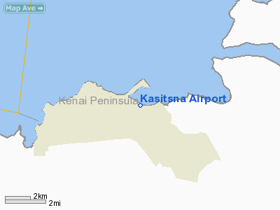
Location & QuickFacts
|
FAA
Information Effective: |
2006-02-16 |
|
Airport Identifier: |
5Z7 |
|
Longitude/Latitude: |
151-34-23.5840W/59-28-07.7770N
-151.573218/59.468827 (Estimated) |
|
Elevation: |
5
ft / 1.52 m (Estimated) |
|
Land: |
0
acres |
|
From nearest
city: |
0
nautical miles N of Kasitsna Bay, AK |
|
Location: |
Kenai-cook
Inlet County, AK |
|
Magnetic
Variation: |
23E
(1985) |
Owner & Manager
|
Ownership: |
Publicly
owned |
|
Owner: |
Public
Domain |
|
Address: |
|
|
Address: |
|
Airport Operations
and Facilities
|
Airport
Use: |
Open to
public |
|
Wind indicator: |
Yes
WIND SOCK IS NOT USABLE. |
|
Segmented
Circle: |
No |
|
Control Tower: |
No |
|
Attendance
Schedule: |
UNATNDD |
|
Landing fee
charge: |
No |
|
Sectional
chart: |
Kodiak |
|
Region: |
AAL
- Alaska |
|
Boundary
ARTCC: |
ZAN
- Anchorage |
|
Tie-in FSS: |
HOM
- Homer |
|
FSS on Airport: |
No |
|
FSS Phone: |
907-235-8588 |
|
FSS Toll
Free: |
LC235-8588 |
|
Alternate
FSS: |
ENA
- Kenai |
|
Alt. FSS
Toll Free: |
1-800-WX-BRIEF |
|
NOTAMs Facility: |
HOM
(NOTAM-d service avaliable) |
Airport Communications
Airport Services
|
Airframe
Repair: |
NONE |
|
Power
Plant Repair: |
NONE |
|
Bottled Oxygen: |
NONE |
|
Bulk Oxygen: |
NONE |
|
Runway Information
Runway 10/28
|
Dimension: |
800 x 75 ft / 243.8
x 22.9 m |
|
Surface: |
GRAVEL, Fair Condition
SURFACE IS SAND AND GRAVEL BEACH. RWY SIDE SLOPE IS 10%. |
|
|
Runway 10 |
Runway 28 |
|
Traffic Pattern: |
Right |
Left |
|
Markings: |
None, |
None, |
|
Runway End
Identifier: |
No |
No |
|
Centerline
Lights: |
No |
No |
|
Touchdown Lights: |
No |
No |
|
Obstruction: |
150 ft trees, 50 ft right of centerline |
120 ft trees, 100.0 ft from runway, 50 ft left
of centerline |
|
Radio Navigation Aids
|
ID |
Type |
Name |
Ch |
Freq |
Var |
Dist |
|
ACE |
NDB |
Kachemak |
|
277.00 |
24E |
10.6
nm |
|
HOM |
VOR/DME |
Homer |
093X |
114.60 |
24E |
14.9
nm |
Remarks
- APCH
TO RWY 28 BLOCKED BY HILL RWY HAS SLIGHT DOGLEG; RWY FLOODED AT 16.5'
TIDE.
- LARGE
ROCK ON BEACH APPROXIMATELY MIDPOINT OF LANDING AREA.
- ESTABD
PRIOR TO 1959.
Operational Statistics
|
Aircraft
Operations: |
2/Month |
|
Air Taxi: |
33.3% |
|
General Aviation
Itinerant: |
66.7% |
Kasitsna Airport
Address: Kenai-cook
Inlet County, AK
Tel:
Images
and information placed above are from
http://www.airport-data.com/airport/5Z7/
We
thank them for the data!
| General
Info |
| Country |
United
States |
| State |
ALASKA
|
| FAA ID |
5Z7
|
| Latitude |
59-28-07.777N
|
| Longitude |
151-34-23.584W
|
| Elevation |
5 feet
|
| Near City |
KASITSNA
BAY |
We don't guarantee the information is fresh and accurate. The data may be
wrong or outdated.
For more up-to-date information please refer to other sources.
|
|


