 |
|
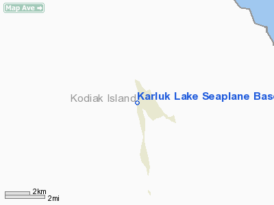
Karluk Lake Seaplane Base |
|
|
Location & QuickFacts
|
FAA
Information Effective: |
2006-02-16 |
|
Airport Identifier: |
KKL |
|
Longitude/Latitude: |
154-01-39.3280W/57-22-01.3290N
-154.027591/57.367036 (Estimated) |
|
Elevation: |
368
ft / 112.17 m (Surveyed) |
|
Land: |
0
acres |
|
From nearest
city: |
0
nautical miles W of Karluk Lake, AK |
|
Location: |
Kodiak
County, AK |
|
Magnetic
Variation: |
22E
(1985) |
Owner & Manager
|
Ownership: |
Publicly
owned |
|
Owner: |
St
Of Alas D F G |
|
Address: |
Box
1841 Subport Bldg
Juneau, AK 99801 |
|
Address: |
|
Airport Operations
and Facilities
|
Airport
Use: |
Open to
public |
|
Wind indicator: |
No |
|
Segmented
Circle: |
No |
|
Control Tower: |
No |
|
Attendance
Schedule: |
UNATNDD |
|
Landing fee
charge: |
No |
|
Sectional
chart: |
Kodiak |
|
Region: |
AAL
- Alaska |
|
Boundary
ARTCC: |
ZAN
- Anchorage |
|
Tie-in FSS: |
ENA
- Kenai |
|
FSS on Airport: |
No |
|
FSS Phone: |
800-478-3576 |
|
FSS Toll
Free: |
1-800-WX-BRIEF |
|
NOTAMs Facility: |
ADQ
(NOTAM-d service avaliable) |
Airport Communications
Airport Services
|
Fuel
available: |
80
FUEL IN CANS AVBL EMERG ONLY. |
|
Airframe
Repair: |
NONE |
|
Power
Plant Repair: |
NONE |
|
Bottled Oxygen: |
NONE |
|
Bulk Oxygen: |
NONE |
|
Runway Information
Runway NW/SE
|
Dimension: |
10000 x 1000 ft
/ 3048.0 x 304.8 m |
|
Surface: |
WATER,
|
|
|
Runway NW |
Runway SE |
|
Elevation: |
368.00 ft |
368.00 ft |
|
Traffic Pattern: |
Left |
Left |
|
Runway End
Identifier: |
No |
No |
|
Centerline
Lights: |
No |
No |
|
Touchdown Lights: |
No |
No |
|
Radio Navigation Aids
|
ID |
Type |
Name |
Ch |
Freq |
Var |
Dist |
Remarks
- N-S
PREVAILING WINDS; GOOD BEACHING AREA IN FRONT OF MAIN BLDG.
- LAKE
IS OFTEN VERY STILL & CLEAR, GIVING A DECEPIVE IDEA OF THE ACTUAL
SURFACE.
Operational Statistics
|
Aircraft
Operations: |
13/Month |
|
Air Taxi: |
33.3% |
|
General Aviation
Itinerant: |
66.7% |
Karluk Lake Seaplane Base
Address: Kodiak
County, AK
Tel:
Images
and information placed above are from
http://www.airport-data.com/airport/KKL/
We
thank them for the data!
| General
Info |
| Country |
United
States |
| State |
ALASKA
|
| FAA ID |
KKL
|
| Latitude |
57-22-01.329N
|
| Longitude |
154-01-39.328W
|
| Elevation |
368 feet
|
| Near City |
KARLUK
LAKE |
We don't guarantee the information is fresh and accurate. The data may be
wrong or outdated.
For more up-to-date information please refer to other sources.
|
|


