 |
|
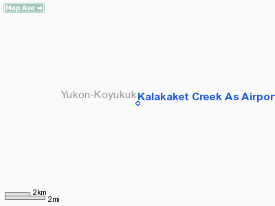
Kalakaket Creek As Airport |
Location & QuickFacts
|
FAA
Information Effective: |
2006-02-16 |
|
Airport Identifier: |
1KC |
|
Longitude/Latitude: |
156-50-36.0200W/64-25-28.0100N
-156.843339/64.424447 (Estimated) |
|
Elevation: |
1598
ft / 487.07 m (Estimated) |
|
Land: |
0
acres |
|
From nearest
city: |
0
nautical miles of Kalakaket Creek, AK |
|
Location: |
Yukon-koyukuk
County, AK |
|
Magnetic
Variation: |
20E
(1995) |
Owner & Manager
|
Ownership: |
Air Force
owned |
|
Owner: |
Public
Domain |
|
Address: |
|
|
Address: |
|
Airport Operations
and Facilities
|
Airport
Use: |
Private |
|
Segmented
Circle: |
No |
|
Control Tower: |
No |
|
Attendance
Schedule: |
UNATNDD |
|
Sectional
chart: |
Fairbanks |
|
Region: |
AAL
- Alaska |
|
Boundary
ARTCC: |
ZAN
- Anchorage |
|
Responsible
ARTCC: |
ZAN
- Anchorage |
|
Tie-in FSS: |
FAI
- Fairbanks |
|
FSS Phone: |
907-474-0788 |
|
FSS Toll
Free: |
1-866-248-6516 |
Airport Communications
|
Runway Information
Runway 09/27
|
Dimension: |
4000 x 140 ft /
1219.2 x 42.7 m |
|
Surface: |
GRVL,
|
|
|
Runway 09 |
Runway 27 |
|
Traffic Pattern: |
Left |
Left |
|
Radio Navigation Aids
|
ID |
Type |
Name |
Ch |
Freq |
Var |
Dist |
|
BZP |
NDB |
Bishop |
|
331.00 |
21E |
18.8
nm |
|
GAL |
VORTAC |
Galena |
095X |
114.80 |
23E |
18.9
nm |
Remarks
- CLSD
TO THE PUBLIC.
- PPR
11AF/DOOU 552-4292/5346.
- ARPT
ON TOP OF MOUNTAIN, WINDS IN EXCESS OF 10 KTS FROM 300-360 DEGS MAY
PRODUCE SEVERE TURBULENCE.
- CAUTION:
1980' MT 3000' NW OF RYS.
- RY
18/36 NOT RECOMMENDED FOR FIXED WING ACFT.
- USAF
INSTALLATION, ALL CIVIL ACFT OPERS REQ CIVIL ACFT LNDG PERMITS PRIOR
TO LANDING AT FACILITY. FINES WILL BE LEVIED AGAINST VIOLATORS &
REPORTS WILL BE FWDD TO FAA FSDOS IAW 32CFR855 & USAF OPERG INSTRGS.
OPERS MUST HAVE ON BOARD A COPY OF CURRENT PERMIT. FOR PERMITS CALL
907-552-7384/3636/5265.
Operational Statistics
|
Aircraft
Operations: |
25/Month |
|
Air Taxi: |
33.3% |
|
General Aviation
Itinerant: |
66.7% |
Kalakaket Creek As Airport
Address: Yukon-koyukuk
County, AK
Tel:
Images
and information placed above are from
http://www.airport-data.com/airport/1KC/
We
thank them for the data!
| General
Info |
| Country |
United
States |
| State |
ALASKA
|
| FAA ID |
1KC
|
| Latitude |
64-25-28.010N
|
| Longitude |
156-50-36.020W
|
| Elevation |
1598 feet
|
| Near City |
KALAKAKET
CREEK |
We don't guarantee the information is fresh and accurate. The data may be
wrong or outdated.
For more up-to-date information please refer to other sources.
|
|


