 |
|
|
|
|
|
Location & QuickFacts
|
FAA
Information Effective: |
2006-02-16 |
|
Airport Identifier: |
JVM |
|
Longitude/Latitude: |
148-55-39.9380W/61-43-53.0990N
-148.927761/61.731416 (Estimated) |
|
Elevation: |
870
ft / 265.18 m (Estimated) |
|
Land: |
0
acres |
|
From nearest
city: |
2
nautical miles NW of Sutton, AK |
|
Location: |
Mata-sus
Borough County, AK |
|
Magnetic
Variation: |
26E
(1985) |
Owner & Manager
|
Ownership: |
Privately
owned |
|
Owner: |
Canadian
Mine & Smeltering Co |
|
Address: |
Sutton, AK |
|
Address: |
|
|
Phone number: |
907-552-1040 |
Airport Operations
and Facilities
|
Airport
Use: |
Open to
public |
|
Wind indicator: |
No |
|
Segmented
Circle: |
No |
|
Control Tower: |
No |
|
Attendance
Schedule: |
UNATNDD |
|
Landing fee
charge: |
No |
|
Sectional
chart: |
Anchorage |
|
Region: |
AAL
- Alaska |
|
Boundary
ARTCC: |
ZAN
- Anchorage |
|
Tie-in FSS: |
ENA
- Kenai |
|
FSS on Airport: |
No |
|
FSS Phone: |
800-478-3576 |
|
FSS Toll
Free: |
1-800-WX-BRIEF |
|
NOTAMs Facility: |
JVM
(NOTAM-d service avaliable) |
Airport Communications
Airport Services
|
Airframe
Repair: |
NONE |
|
Power
Plant Repair: |
NONE |
|
Bottled Oxygen: |
NONE |
|
Bulk Oxygen: |
NONE |
|
Runway Information
Runway 03/21
|
Dimension: |
1450 x 90 ft / 442.0
x 27.4 m |
|
Surface: |
GRAVEL, |
|
|
Runway 03 |
Runway 21 |
|
Traffic Pattern: |
Left |
Left |
|
Markings: |
None, |
None, |
|
Runway End
Identifier: |
No |
No |
|
Centerline
Lights: |
No |
No |
|
Touchdown Lights: |
No |
No |
|
Radio Navigation Aids
|
ID |
Type |
Name |
Ch |
Freq |
Var |
Dist |
|
CMQ |
NDB |
Campbell Lake |
|
338.00 |
21E |
46.6
nm |
|
PEE |
NDB |
Peters Creek |
|
305.00 |
26E |
48.8
nm |
|
BOB |
NDB |
Bruck |
|
387.00 |
21E |
49.4
nm |
|
EDF |
TACAN |
Elmendorf |
081X |
|
21E |
37.5
nm |
|
TKA |
VOR/DME |
Talkeetna |
109X |
116.20 |
26E |
47.6
nm |
|
BGQ |
VORTAC |
Big
Lake |
072X |
112.50 |
25E |
31.2
nm |
|
MRI |
VOT |
Merrill |
|
111.00 |
|
40.7
nm |
|
ANC |
VOT |
Anchorage |
|
108.40 |
|
45.1
nm |
Remarks
- (ARPT
STATUS) ARPT CLSD INDEFLY.
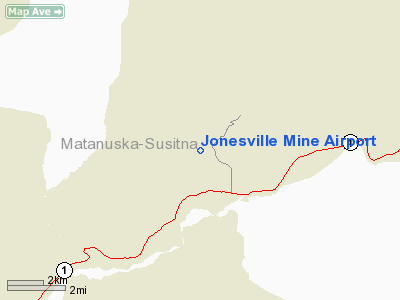
Jonesville Mine Airport
Address: Mata-sus
Borough County, AK
Tel:
907-552-1040
Images
and information placed above are from
http://www.airport-data.com/airport/JVM/
We
thank them for the data!
| General
Info |
| Country |
United
States |
| State |
ALASKA
|
| FAA ID |
JVM
|
| Latitude |
61-43-53.099N
|
| Longitude |
148-55-39.938W
|
| Elevation |
870 feet
|
| Near City |
SUTTON
|
We don't guarantee the information is fresh and accurate. The data may be
wrong or outdated.
For more up-to-date information please refer to other sources.
|
|


