 |
|
|
|
|
|
Location & QuickFacts
|
FAA
Information Effective: |
2006-02-16 |
|
Airport Identifier: |
Z52 |
|
Longitude/Latitude: |
160-15-58.3390W/56-02-12.0680N
-160.266205/56.036686 (Estimated) |
|
Elevation: |
130
ft / 39.62 m (Estimated) |
|
Land: |
0
acres |
|
From nearest
city: |
1
nautical miles S of Bear Lake, AK |
|
Location: |
Aleutian
Islands County, AK |
|
Magnetic
Variation: |
18E
(1985) |
Owner & Manager
|
Ownership: |
Publicly
owned |
|
Owner: |
Public
Domain
ARPT PARTIALLY ON PRIVATE LAND. PRIVATE OWNER D.JOHNSON.BOX
54, KENAI, AK 99611 907-283-7828. |
|
Address: |
|
|
Manager: |
D
Johnson |
|
Address: |
Box
54
Kenai, AK 99611 |
|
Phone number: |
907-283-7828 |
Airport Operations
and Facilities
|
Airport
Use: |
Open to
public |
|
Wind indicator: |
Yes |
|
Segmented
Circle: |
No |
|
Control Tower: |
No |
|
Attendance
Schedule: |
UNATNDD |
|
Landing fee
charge: |
No |
|
Sectional
chart: |
Kodiak |
|
Region: |
AAL
- Alaska |
|
Boundary
ARTCC: |
ZAN
- Anchorage |
|
Tie-in FSS: |
CDB
- Cold Bay |
|
FSS on Airport: |
No |
|
FSS Phone: |
907-532-2454 |
|
FSS Toll
Free: |
1-800-478-7250 |
|
Alternate
FSS: |
ENA
- Kenai |
|
Alt. FSS
Toll Free: |
1-800-WX-BRIEF |
|
NOTAMs Facility: |
SDP
(NOTAM-d service avaliable) |
Airport Communications
Airport Services
|
Airframe
Repair: |
NONE |
|
Power
Plant Repair: |
NONE |
|
Bottled Oxygen: |
NONE |
|
Bulk Oxygen: |
NONE |
|
Runway Information
Runway 09/27
|
Dimension: |
1130 x 30 ft / 344.4
x 9.1 m |
|
Surface: |
GRAVEL, Poor Condition
& 18/36 LOOSE; SOFT GRAVEL. ROLLING DIPS & RUTS TO 6 IN.
RY 36 FIRST 70 FT UNEVEN GRADE. |
|
|
Runway 09 |
Runway 27 |
|
Traffic Pattern: |
Left |
Left |
|
Runway 18/36
|
Dimension: |
820 x 20 ft / 249.9
x 6.1 m |
|
Surface: |
GRAVEL, Poor Condition
& 18/36 LOOSE; SOFT GRAVEL. ROLLING DIPS & RUTS TO 6 IN.
RY 36 FIRST 70 FT UNEVEN GRADE. |
|
|
Runway 18 |
Runway 36 |
|
Traffic Pattern: |
Left |
Left |
|
Radio Navigation Aids
|
ID |
Type |
Name |
Ch |
Freq |
Var |
Dist |
|
HBT |
NDB/DME |
Borland |
079X |
390.00 |
18E |
44.2
nm |
Remarks
- PILE
OF STEEL BARRELS ADJACENT RY 36 THR.
- PRIVATE
PROPERTY LINE RUNS DOWN C/L OF RY 09/27. PRIVATE LAND S OF RY 09/27.
- PENDING.
Based Aircraft
|
Aircraft
based on field: |
2 |
|
Single Engine Airplanes: |
2 |
Operational Statistics
|
Aircraft
Operations: |
25/Month |
|
General Aviation
Local: |
66.7% |
|
General Aviation
Itinerant: |
33.3% |
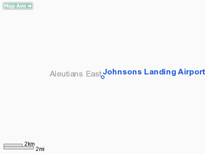
Johnsons Landing Airport
Address: Aleutian
Islands County, AK
Tel:
907-283-7828
Images
and information placed above are from
http://www.airport-data.com/airport/Z52/
We
thank them for the data!
| General
Info |
| Country |
United
States |
| State |
ALASKA
|
| FAA ID |
Z52
|
| Latitude |
56-02-12.068N
|
| Longitude |
160-15-58.339W
|
| Elevation |
130 feet
|
| Near City |
BEAR LAKE
|
We don't guarantee the information is fresh and accurate. The data may be
wrong or outdated.
For more up-to-date information please refer to other sources.
|
|


