 |
|
|
|
|
|
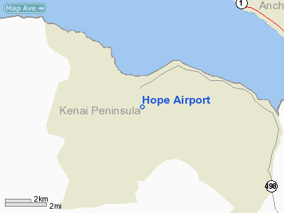
Location & QuickFacts
|
FAA
Information Effective: |
2006-02-16 |
|
Airport Identifier: |
5HO |
|
Longitude/Latitude: |
149-37-25.8200W/60-54-14.9410N
-149.623839/60.904150 (Estimated) |
|
Elevation: |
200
ft / 60.96 m (Estimated) |
|
Land: |
62
acres |
|
From nearest
city: |
1
nautical miles SE of Hope, AK |
|
Location: |
Seward
County, AK |
|
Magnetic
Variation: |
25E
(1985) |
Owner & Manager
|
Ownership: |
Publicly
owned |
|
Owner: |
State
Of Ak Dotpf-central Rgn |
|
Address: |
Pouch
196900
Anchorage, AK 99519-6900 |
|
Phone number: |
907-266-1450 |
|
Manager: |
Ray
Defrance |
|
Address: |
5820
Tudor Rd
Anchorage, AK 99502 |
|
Phone number: |
907-269-5672 |
Airport Operations
and Facilities
|
Airport
Use: |
Open to
public |
|
Wind indicator: |
Yes |
|
Segmented
Circle: |
No |
|
Control Tower: |
No |
|
Attendance
Schedule: |
UNATNDD |
|
Landing fee
charge: |
No |
|
Sectional
chart: |
Anchorage |
|
Region: |
AAL
- Alaska |
|
Boundary
ARTCC: |
ZAN
- Anchorage |
|
Tie-in FSS: |
ENA
- Kenai |
|
FSS on Airport: |
No |
|
FSS Phone: |
800-478-3576 |
|
FSS Toll
Free: |
1-800-WX-BRIEF |
|
NOTAMs Facility: |
ANC
(NOTAM-d service avaliable) |
|
Federal Agreements: |
N |
Airport Communications
Airport Services
|
Airframe
Repair: |
NONE |
|
Power
Plant Repair: |
NONE |
|
Bottled Oxygen: |
NONE |
|
Bulk Oxygen: |
NONE |
|
Runway Information
Runway 16/34
|
Dimension: |
2000 x 60 ft / 609.6
x 18.3 m
RWY EDGES ERODED, REMEASURED WIDTH 60 FEET. |
|
Surface: |
GRAVEL, Poor Condition
RY 16/34 SURFACE RUTTED WITH ROCKS TO 5 INCHES - RY AND SAFETY AREAS
SOFT DURING SPRING THAW AND AFTER HEAVY RAINS |
|
|
Runway 16 |
Runway 34 |
|
Traffic Pattern: |
Left |
Left |
|
Obstruction: |
45 ft trees, 900.0 ft from runway, 20:1 slope
to clear |
53 ft trees, 588.0 ft from runway, 11:1 slope
to clear |
|
Radio Navigation Aids
|
ID |
Type |
Name |
Ch |
Freq |
Var |
Dist |
|
CMQ |
NDB |
Campbell Lake |
|
338.00 |
21E |
20.2
nm |
|
BOB |
NDB |
Bruck |
|
387.00 |
21E |
22.6
nm |
|
OLT |
NDB/DME |
Soldotna |
106X |
346.00 |
24E |
45.0
nm |
|
EDF |
TACAN |
Elmendorf |
081X |
|
21E |
21.5
nm |
|
ANC |
VOR/DME |
Anchorage |
090X |
114.30 |
25E |
22.5
nm |
|
ENA |
VOR/DME |
Kenai |
123X |
117.60 |
25E |
49.3
nm |
|
BGQ |
VORTAC |
Big
Lake |
072X |
112.50 |
25E |
41.2
nm |
|
ANC |
VOT |
Anchorage |
|
108.40 |
|
19.4
nm |
|
MRI |
VOT |
Merrill |
|
111.00 |
|
19.7
nm |
Remarks
- CLEARED
AREAS SOFT & RUTTED.
- BE
ALERT RWY CONDITION NOT MONITORED. RECOMMEND VISUAL INSPECTION PRIOR
TO LANDING.
- SAFETY
AREA NORTH END CLEARED 470 FT, SAFETY AREA SOUTH END CLEARED 580 FT.
- PILOTS
ARE REQUESTED TO SELF-ANNOUNCE ON CTAF PRIOR TO TAXIING ON RWY FOR DEPARTURE;
LEAVING THE RWY AND WITHIN 10 NM OF THE ARPT WHEN APPROACHING TO LAND.
- ESTABD
PRIOR TO 1959.
Based Aircraft
|
Aircraft
based on field: |
7 |
|
Single Engine Airplanes: |
7 |
Operational Statistics
|
Aircraft
Operations: |
10/Week |
|
Air Taxi: |
10.4% |
|
General Aviation
Local: |
58.3% |
|
General Aviation
Itinerant: |
31.3% |
Hope Airport
Address: Seward
County, AK
Tel:
907-266-1450,
907-269-5672
Images
and information placed above are from
http://www.airport-data.com/airport/5HO/
We
thank them for the data!
| General
Info |
| Country |
United
States |
| State |
ALASKA
|
| FAA ID |
5HO
|
| Latitude |
60-54-14.941N
|
| Longitude |
149-37-25.820W
|
| Elevation |
200 feet
|
| Near City |
HOPE
|
We don't guarantee the information is fresh and accurate. The data may be wrong or outdated.
For more up-to-date information please refer to other sources.
|
|


