 |
|
Location & QuickFacts
|
FAA
Information Effective: |
2006-02-16 |
|
Airport Identifier: |
47AK |
|
Longitude/Latitude: |
149-31-57.0000W/61-17-33.0000N
-149.532500/61.292500 (Estimated) |
|
Elevation: |
650
ft / 198.12 m (Estimated) |
|
Land: |
0
acres |
|
From nearest
city: |
2
nautical miles SE of Eagle River, AK |
|
Location: |
Anchorage
County, AK |
|
Magnetic
Variation: |
22E
(2000) |
Owner & Manager
|
Ownership: |
Privately
owned |
|
Owner: |
Bernard
D. Stewart |
|
Address: |
Hc85
Box 9100
Eagle River, AK 99577 |
|
Phone number: |
907-694-3305 |
|
Manager: |
Bernard
D. Stewart |
|
Address: |
Hc85
Box 9100
Eagle River, AK 99577 |
|
Phone number: |
907-694-3305 |
Airport Operations
and Facilities
|
Airport
Use: |
Private |
|
Segmented
Circle: |
No |
|
Control Tower: |
No |
|
Attendance
Schedule: |
UNATNDD |
|
Sectional
chart: |
Anchorage |
|
Region: |
AAL
- Alaska |
|
Boundary
ARTCC: |
ZAN
- Anchorage |
|
Responsible
ARTCC: |
ZAN
- Anchorage |
|
Tie-in FSS: |
ENA
- Kenai |
|
FSS Phone: |
800-478-3576 |
|
FSS Toll
Free: |
1-800-WX-BRIEF |
|
Runway Information
Runway 06/24
|
Dimension: |
1400 x 50 ft / 426.7
x 15.2 m |
|
Surface: |
TURF,
|
|
|
Runway 06 |
Runway 24 |
|
Traffic Pattern: |
Left |
Left |
|
Radio Navigation Aids
|
ID |
Type |
Name |
Ch |
Freq |
Var |
Dist |
|
CMQ |
NDB |
Campbell Lake |
|
338.00 |
21E |
16.6
nm |
|
BOB |
NDB |
Bruck |
|
387.00 |
21E |
20.1
nm |
|
EDF |
TACAN |
Elmendorf |
081X |
|
21E |
7.2
nm |
|
ANC |
VOR/DME |
Anchorage |
090X |
114.30 |
25E |
21.3
nm |
|
BGQ |
VORTAC |
Big
Lake |
072X |
112.50 |
25E |
20.8
nm |
|
MRI |
VOT |
Merrill |
|
111.00 |
|
10.2
nm |
|
ANC |
VOT |
Anchorage |
|
108.40 |
|
14.8
nm |
Based Aircraft
|
Aircraft
based on field: |
4 |
|
Single Engine Airplanes: |
4 |
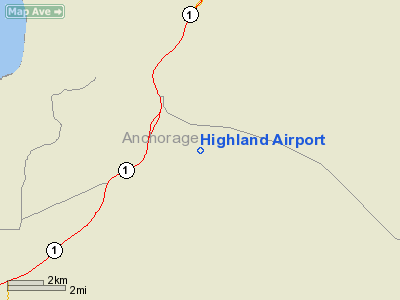
Highland Airport
Address: Anchorage
County, AK
Tel:
907-694-3305
Images
and information placed above are from
http://www.airport-data.com/airport/47AK/
We
thank them for the data!
| General
Info |
| Country |
United
States |
| State |
ALASKA
|
| FAA ID |
47AK
|
| Latitude |
61-17-32.060N
|
| Longitude |
149-31-58.370W
|
| Elevation |
500 feet
|
| Near City |
EAGLE
RIVER |
We don't guarantee the information is fresh and accurate. The data may be wrong or outdated.
For more up-to-date information please refer to other sources.
|
|


