 |
|
| Grayling Airport |
| IATA: KGX – ICAO: none – FAA LID: KGX |
| Summary |
| Airport type |
Public |
| Owner |
State of Alaska DOT&PF - Northern Region |
| Location |
Grayling, Alaska |
| Elevation AMSL |
99 ft / 30 m |
| Coordinates |
62°53′40″N 160°03′54″W / 62.89444°N 160.065°W / 62.89444; -160.065 |
| Runways |
| Direction |
Length |
Surface |
| ft |
m |
| 15/33 |
2,315 |
706 |
Gravel |
| Source: Federal Aviation Administration |
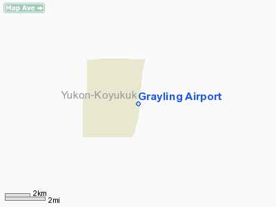
Grayling Airport (IATA: KGX, FAA LID: KGX) is a state-owned public-use airport located one mile (2 km) south of the central business district of Grayling, a city in the Yukon-Koyukuk Census Area of the U.S. state of Alaska. Facilities
Grayling Airport has one runway (15/33) with a gravel surface measuring 2,315 x 60 ft. (706 x 18 m).
Airlines and non-stop destinations
- Frontier Flying Service (Anvik, Shageluk)
- Hageland Aviation Services (Anvik, Shageluk)
The above content comes from Wikipedia and is published under free licenses – click here to read more.
Location & QuickFacts
|
FAA
Information Effective: |
2006-02-16 |
|
Airport Identifier: |
KGX |
|
Longitude/Latitude: |
160-03-53.6550W/62-53-40.4180N
-160.064904/62.894561 (Estimated) |
|
Elevation: |
99
ft / 30.18 m (Estimated) |
|
Land: |
0
acres |
|
From nearest
city: |
1
nautical miles S of Grayling, AK |
|
Location: |
Kuskokwim
County, AK |
|
Magnetic
Variation: |
20E
(1985) |
Owner & Manager
|
Ownership: |
Publicly
owned |
|
Owner: |
St
Of Ak Dotpf Northern Rgn |
|
Address: |
2301
Peger Road
Fairbanks, AK 99709 |
|
Phone number: |
907-443-3444 |
|
Manager: |
George
Beans |
|
Address: |
Box
135
St Mary's, AK 99658 |
|
Phone number: |
907-438-2416 |
Airport Operations
and Facilities
|
Airport
Use: |
Open to
public |
|
Wind indicator: |
Yes |
|
Segmented
Circle: |
Yes |
|
Control Tower: |
No |
|
Attendance
Schedule: |
UNATNDD |
|
Lighting
Schedule: |
RDO-CTL
ACTVT ROTG BCN & MIRL RY 15/33 - CTAF. |
|
Beacon Color: |
Clear-Green
(lighted land airport) |
|
Landing fee
charge: |
No |
|
Sectional
chart: |
Mc
Grath |
|
Region: |
AAL
- Alaska |
|
Boundary
ARTCC: |
ZAN
- Anchorage |
|
Tie-in FSS: |
ENA
- Kenai |
|
FSS on Airport: |
No |
|
FSS Phone: |
800-478-3576 |
|
FSS Toll
Free: |
1-800-WX-BRIEF |
|
NOTAMs Facility: |
ANV
(NOTAM-d service avaliable) |
|
Federal Agreements: |
NGY |
Airport Communications
Airport Services
|
Airframe
Repair: |
NONE |
|
Power
Plant Repair: |
NONE |
|
Bottled Oxygen: |
NONE |
|
Bulk Oxygen: |
NONE |
|
Runway Information
Runway 15/33
|
Dimension: |
2315 x 60 ft / 705.6
x 18.3 m |
|
Surface: |
GRAVEL, Good Condition |
|
Edge Lights: |
Medium |
|
|
Runway 15 |
Runway 33 |
|
Traffic Pattern: |
Left |
Right |
|
Obstruction: |
,
50:1 slope to clear |
35 ft brush, 507.0 ft from runway, 131 ft left
of centerline, 14:1 slope to clear |
|
Radio Navigation Aids
|
ID |
Type |
Name |
Ch |
Freq |
Var |
Dist |
|
ANV |
NDB/DME |
Anvik |
071X |
365.00 |
20E |
15.6
nm |
Remarks
- N
END RWY & TWY FLOODS IN SPRING; NORTH 200' SOFT DURING BREAKUP &
RAIN.
- RY
CONDITON NOT MONITORED; RECOMMEND VISUAL INSPECTION PRIOR TO LANDING.
Grayling Airport
Address: Kuskokwim
County, AK
Tel:
907-443-3444,
907-438-2416
Images
and information placed above are from
http://www.airport-data.com/airport/KGX/
We
thank them for the data!
| General
Info |
| Country |
United
States |
| State |
ALASKA
|
| FAA ID |
KGX
|
| Latitude |
62-53-40.418N
|
| Longitude |
160-03-53.655W
|
| Elevation |
99 feet
|
| Near City |
GRAYLING
|
We don't guarantee the information is fresh and accurate. The data may be wrong or outdated.
For more up-to-date information please refer to other sources.
|
|


