 |
|
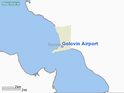
| Golovin Airport |
| IATA: GLV – ICAO: PAGL – FAA LID: GLV
Location of airport in Alaska
|
| Summary |
| Airport type |
Public |
| Owner |
State of Alaska DOT&PF - Northern Region |
| Serves |
Golovin, Alaska |
| Elevation AMSL |
59 ft / 18 m |
| Coordinates |
64°33′02″N 163°00′26″W / 64.55056°N 163.00722°W / 64.55056; -163.00722 |
| Runways |
| Direction |
Length |
Surface |
| ft |
m |
| 2/20 |
4,000 |
1,219 |
Gravel |
| Statistics (2008) |
| Enplanements |
1,838 |
| Source: Federal Aviation Administration |
Golovin Airport (IATA: GLV, ICAO: PAGL, FAA LID: GLV, formerly N93) is a state-owned public-use airport located in Golovin, a city in the Nome Census Area of the U.S. state of Alaska.
As per Federal Aviation Administration records, the airport had 1,838 passenger boardings (enplanements) in calendar year 2008, a decrease of 29% from the 2,605 enplanements in 2007. This airport is included in the FAA's National Plan of Integrated Airport Systems for 2009–2013, which categorized it as commercial service - non-primary. Based on 2008 enplanements it would be categorized as general aviation, since the commercial service category requires at least 2,500 enplanements per year. Facilities
Golovin Airport covers an area of 225 acres (91 ha) at an elevation of 59 feet (18 m) above mean sea level. It has one runway designated 2/20 with a gravel surface measuring 4,000 by 75 feet (1,219 x 23 m).
Airlines and non-stop destinations
- Bering Air (Elim, White Mountain)
- Frontier Flying Service (Elim, Nome, White Mountain)
- Hageland Aviation Services (Elim, White Mountain)
The above content comes from Wikipedia and is published under free licenses – click here to read more.
Location & QuickFacts
|
FAA
Information Effective: |
2006-02-16 |
|
Airport Identifier: |
N93 |
|
Longitude/Latitude: |
163-00-25.8130W/64-33-01.6390N
-163.007170/64.550455 (Estimated) |
|
Elevation: |
59
ft / 17.98 m (Surveyed) |
|
Land: |
225
acres |
|
From nearest
city: |
0
nautical miles N of Golovin, AK |
|
Location: |
Nome
County, AK |
|
Magnetic
Variation: |
16E
(2005) |
Owner & Manager
|
Ownership: |
Publicly
owned |
|
Owner: |
State
Of Ak Dot/pf N Region |
|
Address: |
2301
Peger Rd
Fairbanks, AK 99709 |
|
Phone number: |
907-451-5217 |
|
Manager: |
Jerry
Oliver |
|
Address: |
Po
Box 1048
Nome, AK 99762 |
|
Phone number: |
907-443-2500 |
Airport Operations
and Facilities
|
Airport
Use: |
Open to
public |
|
Wind indicator: |
Yes |
|
Segmented
Circle: |
Yes |
|
Control Tower: |
No |
|
Attendance
Schedule: |
UNATNDD |
|
Lighting
Schedule: |
RDO-CTL
ACTVT MIRL RY 02/20; PAPI RY 02 & ROTG BEACON - CTAF. |
|
Beacon Color: |
Clear-Green
(lighted land airport) |
|
Sectional
chart: |
Nome |
|
Region: |
AAL
- Alaska |
|
Boundary
ARTCC: |
ZAN
- Anchorage |
|
Tie-in FSS: |
OME
- Nome |
|
FSS Phone: |
LC
443-2291 |
|
FSS Toll
Free: |
1-800-478-8400 |
|
Alternate
FSS: |
FAI
- Fairbanks |
|
Alt. FSS
Toll Free: |
1-866-248-6516 |
|
NOTAMs Facility: |
GLV
(NOTAM-d service avaliable) |
|
Federal Agreements: |
N |
Airport Communications
|
Runway Information
Runway 02/20
|
Dimension: |
4000 x 75 ft / 1219.2
x 22.9 m |
|
Surface: |
GRVL-DIRT, Good Condition |
|
Edge Lights: |
Medium |
|
|
Runway 02 |
Runway 20 |
|
Longitude: |
163-00-52.6900W |
162-59-58.9350W |
|
Latitude: |
64-32-45.7070N |
64-33-17.5700N |
|
Elevation: |
59.00 ft |
36.00 ft |
|
Alignment: |
36 |
127 |
|
Traffic Pattern: |
Left |
Left |
|
Crossing Height: |
30.00 ft |
0.00 ft |
|
VASI: |
4-light PAPI on left side |
|
|
Visual Glide
Angle: |
3.00� |
0.00� |
|
Radio Navigation Aids
|
ID |
Type |
Name |
Ch |
Freq |
Var |
Dist |
|
OAY |
NDB |
Norton Bay |
|
263.00 |
19E |
25.9
nm |
|
MOS |
VOR/DME |
Moses
Point |
110X |
116.30 |
19E |
25.7
nm |
Remarks
- RY
CONDITION NOT MONITORED.RECOMMEND VISUAL INSPECTION PRIOR TO LANDING.
- PENDING
Golovin Airport
Address: Nome
County, AK
Tel:
907-451-5217,
907-443-2500
Images
and information placed above are from
http://www.airport-data.com/airport/N93/
We
thank them for the data!
| General
Info |
| Country |
United
States |
| State |
ALASKA
|
| FAA ID |
N93
|
| Latitude |
64.550456
64� 33' 01.64" N |
| Longitude |
-163.006944
163� 00' 25.00" W |
| Elevation |
59 feet
18 meters |
| Magnetic
Variation |
015� E
(01/06) |
| Beacon |
Yes
|
| Operating
Agency |
U.S.CIVIL
AIRPORT WHEREIN PERMIT COVERS USE BY TRANSIT MILITARY AIRCRAFT
|
We don't guarantee the information is fresh and accurate. The data may be wrong or outdated.
For more up-to-date information please refer to other sources.
|
|


