 |
|
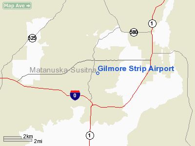
Location & QuickFacts
|
FAA
Information Effective: |
2006-02-16 |
|
Airport Identifier: |
39AK |
|
Longitude/Latitude: |
149-14-09.5300W/61-35-09.7000N
-149.235981/61.586028 (Estimated) |
|
Elevation: |
340
ft / 103.63 m (Estimated) |
|
Land: |
0
acres |
|
From nearest
city: |
4
nautical miles SW of Palmer, AK |
|
Location: |
Mata-sus
Borough County, AK |
|
Magnetic
Variation: |
23E
(2000) |
Owner & Manager
|
Ownership: |
Privately
owned |
|
Owner: |
Robert
J. Gilmore |
|
Address: |
P.o.
Box 226
Palmer, AK 99645 |
|
Phone number: |
907-745-2532 |
|
Manager: |
Robert
J. Gilmore |
|
Address: |
P.o.
Box 226
Palmer, AK 99645 |
|
Phone number: |
907-745-2532 |
Airport Operations
and Facilities
|
Airport
Use: |
Private |
|
Segmented
Circle: |
No |
|
Control Tower: |
No |
|
Attendance
Schedule: |
UNATNDD |
|
Sectional
chart: |
Anchorage |
|
Region: |
AAL
- Alaska |
|
Boundary
ARTCC: |
ZAN
- Anchorage |
|
Tie-in FSS: |
ENA
- Kenai |
|
FSS Phone: |
800-478-3576 |
|
FSS Toll
Free: |
1-800-WX-BRIEF |
|
Runway Information
Runway 02/20
|
Dimension: |
1200 x 100 ft /
365.8 x 30.5 m |
|
Surface: |
TURF,
|
|
|
Runway 02 |
Runway 20 |
|
Traffic Pattern: |
Left |
Left |
|
Obstruction: |
|
40 ft trees, 100.0 ft from runway |
|
Radio Navigation Aids
|
ID |
Type |
Name |
Ch |
Freq |
Var |
Dist |
|
CMQ |
NDB |
Campbell Lake |
|
338.00 |
21E |
34.2
nm |
|
BOB |
NDB |
Bruck |
|
387.00 |
21E |
37.0
nm |
|
EDF |
TACAN |
Elmendorf |
081X |
|
21E |
25.1
nm |
|
ANC |
VOR/DME |
Anchorage |
090X |
114.30 |
25E |
38.3
nm |
|
TKA |
VOR/DME |
Talkeetna |
109X |
116.20 |
26E |
49.4
nm |
|
BGQ |
VORTAC |
Big
Lake |
072X |
112.50 |
25E |
20.9
nm |
|
MRI |
VOT |
Merrill |
|
111.00 |
|
28.4
nm |
|
ANC |
VOT |
Anchorage |
|
108.40 |
|
32.7
nm |
Based Aircraft
|
Aircraft
based on field: |
1 |
|
Single Engine Airplanes: |
1 |
Gilmore Strip Airport
Address: Mata-sus
Borough County, AK
Tel:
907-745-2532
Images
and information placed above are from
http://www.airport-data.com/airport/39AK/
We
thank them for the data!
| General
Info |
| Country |
United
States |
| State |
ALASKA
|
| FAA ID |
39AK
|
| Latitude |
61-35-09.700N
|
| Longitude |
149-14-09.530W
|
| Elevation |
340 feet
|
| Near City |
PALMER
|
We don't guarantee the information is fresh and accurate. The data may be wrong or outdated.
For more up-to-date information please refer to other sources.
|
|


