 |
|
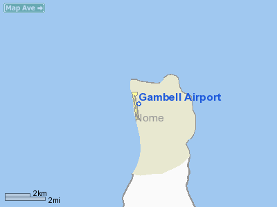
| Gambell Airport |
| IATA: GAM – ICAO: PAGM – FAA LID: GAM |
| Summary |
| Airport type |
Public |
| Owner |
State of Alaska DOT&PF - Northern Region |
| Location |
Gambell, Alaska |
| Elevation AMSL |
27 ft / 8 m |
| Coordinates |
63°46′00″N 171°43′58″W / 63.7666667°N 171.73278°W / 63.7666667; -171.73278 |
| Runways |
| Direction |
Length |
Surface |
| ft |
m |
| 16/34 |
4,500 |
1,372 |
Asphalt/Concrete |
| Source: Federal Aviation Administration |
Gambell Airport (IATA: GAM, ICAO: PAGM, FAA LID: GAM) is a public airport located in Gambell, a city in the Nome Census Area of the U.S. state of Alaska. The airport is owned by the state. Facilities
Gambell Airport covers an area of 200 acres (81 ha) which contains one asphalt and concrete paved runway (16/34) measuring 4,500 x 96 ft (1,372 x 29 m).
Airlines and non-stop destinations
- Bering Air (Nome, Savoonga)
- Frontier Flying Service (Nome)
- Hageland Aviation Services (Nome, Savoonga)
World War II
Gambell Airport was used as a transport base during World War II, facilitating the transit of Lend-Lease aircraft to the Soviet Union. It was also used by the USAAF as an emergency landing field for aircraft patrolling the west coast of Alaska.
The above content comes from Wikipedia and is published under free licenses – click here to read more.
Location & QuickFacts
|
FAA
Information Effective: |
2006-02-16 |
|
Airport Identifier: |
GAM |
|
Longitude/Latitude: |
171-43-58.1650W/63-46-00.3560N
-171.732824/63.766766 (Estimated) |
|
Elevation: |
27
ft / 8.23 m (Surveyed) |
|
Land: |
200
acres |
|
From nearest
city: |
0
nautical miles S of Gambell, AK |
|
Location: |
Nome
County, AK |
|
Magnetic
Variation: |
12E
(1985) |
Owner & Manager
|
Ownership: |
Publicly
owned |
|
Owner: |
St Of Ak
Dotpf/n Region |
|
Address: |
2301 Peger
Rd
Fairbanks, AK 99709 |
|
Phone number: |
907-443-3444 |
|
Manager: |
Jerry Oliver |
|
Address: |
Box 1048
Nome, AK 99762 |
|
Phone number: |
907-443-2500 |
Airport Operations
and Facilities
|
Airport
Use: |
Open to
public |
|
Wind indicator: |
Yes |
|
Segmented
Circle: |
Yes |
|
Control Tower: |
No |
|
Attendance
Schedule: |
UNATNDD |
|
Lighting
Schedule: |
DUSK-DAWN
FOR ODALS RY 34 KEY - 122.7 - 3 TIMES LOW 4 TIMES MED 5
TIMES HIGH; FOR VASI RYS 16 & 34 KEY - 122.7 - 3 TIMES;
ACTVT MIRLS RY 16/34 - CTAF. |
|
Beacon Color: |
Clear-Green
(lighted land airport) |
|
Landing fee
charge: |
No |
|
Sectional
chart: |
Bethel |
|
Region: |
AAL
- Alaska |
|
Boundary
ARTCC: |
ZAN
- Anchorage |
|
Tie-in FSS: |
OME
- Nome |
|
FSS on Airport: |
No |
|
FSS Phone: |
LC
443-2291 |
|
FSS Toll
Free: |
1-800-478-8400 |
|
Alternate
FSS: |
FAI
- Fairbanks |
|
Alt. FSS
Toll Free: |
1-866-248-6516 |
|
NOTAMs Facility: |
GAM
(NOTAM-d service avaliable) |
|
Federal Agreements: |
NGSY |
Airport Communications
Airport Services
|
Airframe
Repair: |
NONE |
|
Power
Plant Repair: |
NONE |
|
Bottled Oxygen: |
NONE |
|
Bulk Oxygen: |
NONE |
|
Runway Information
Runway 16/34
|
Dimension: |
4500 x 96 ft / 1371.6
x 29.3 m |
|
Surface: |
ASPH-CONC, Poor Condition
UNSEALED CRACKS 1-2 INCHES WIDE SPANNING WIDTH OF RY EVERY 50-200
FEET. |
|
Weight Limit: |
Single wheel: 22000 lbs. |
|
Edge Lights: |
Medium |
|
|
Runway 16 |
Runway 34 |
|
Longitude: |
171-44-04.9730W |
171-43-51.1310W |
|
Latitude: |
63-46-21.7500N |
63-45-37.8720N |
|
Elevation: |
27.00 ft |
26.00 ft |
|
Alignment: |
127 |
127 |
|
Traffic Pattern: |
Right |
Left |
|
Markings: |
Non-precision instrument, Fair Condition |
Non-precision instrument, Fair Condition |
|
Crossing Height: |
39.00 ft |
39.00 ft |
|
VASI: |
4-box on left side |
4-box on right side |
|
Visual Glide
Angle: |
3.00� |
3.00� |
|
Approach lights: |
|
ODALS |
|
Runway End
Identifier: |
Yes |
|
|
Obstruction: |
98 ft ant, 3400.0 ft from runway, 250 ft left
of centerline, 32:1 slope to clear |
,
50:1 slope to clear |
|
Radio Navigation Aids
|
ID |
Type |
Name |
Ch |
Freq |
Var |
Dist |
|
GAM |
NDB/DME |
Gambell |
092X |
369.00 |
12E |
0.9
nm |
|
ULL |
VOR/DME |
Kukuliak |
120X |
117.30 |
13E |
33.9
nm |
Remarks
- 98'
TWR (LGTD) 3400' FROM APCH END RWY 16.
- SAFETY
AREAS RY 16/34 SOFT,LOOSE GRAVEL AND LITTERED WITH SCRAP IRON.
- RY
CONDITION NOT MONITORED; RECOMMEND VISUAL INSPECTION PRIOR TO LANDING.
Gambell Airport
Address: Nome
County, AK
Tel:
907-443-3444,
907-443-2500
Images
and information placed above are from
http://www.airport-data.com/airport/GAM/
We
thank them for the data!
| General
Info |
| Country |
United
States |
| State |
ALASKA
|
| FAA ID |
GAM
|
| Latitude |
63-46-00.356N
|
| Longitude |
171-43-58.165W
|
| Elevation |
27 feet
|
| Near City |
GAMBELL
|
We don't guarantee the information is fresh and accurate. The data may be wrong or outdated.
For more up-to-date information please refer to other sources.
|
|


