 |
|
| Fort Yukon Airport |
| IATA: FYU – ICAO: PFYU – FAA LID: FYU |
| Summary |
| Airport type |
Public |
| Owner |
Alaska DOT&PF - Northern Region |
| Location |
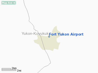
Fort Yukon, Alaska |
| Elevation AMSL |
433 ft / 132 m |
| Coordinates |
66°34′17″N 145°15′02″W / 66.57139°N 145.25056°W / 66.57139; -145.25056 |
| Runways |
| Direction |
Length |
Surface |
| ft |
m |
| 3/21 |
5,810 |
1,771 |
Gravel |
| Statistics (2005) |
| Aircraft operations |
8,350 |
| Based aircraft |
13 |
| Source: Federal Aviation Administration |
Fort Yukon Airport (IATA: FYU, ICAO: PFYU, FAA LID: FYU) is a state-owned public-use airport located in the city of Fort Yukon in the Yukon-Koyukuk Census Area of the U.S. state of Alaska. Facilities and aircraft
Fort Yukon Airport covers an area of 261 acres (106 ha) and has one gravel runway (3/21) measuring 5,810 x 150 ft (1,771 x 46 m).
For 12-month period ending December 31, 2005, the airport had 8,350 aircraft operations, an average of 22 per day: 60% air taxi, 37% general aviation and 3% military. There are 13 aircraft based at this airport: 85% single engine and 15% multi-engine.
Airlines and non-stop destinations
- Arctic Circle Air (Fairbanks)
- Frontier Flying Service (Fairbanks)
- Wright Air Service (Arctic Village, Birch Creek, Fairbanks, Venetie)
The above content comes from Wikipedia and is published under free licenses – click here to read more.
Location & QuickFacts
|
FAA
Information Effective: |
2006-02-16 |
|
Airport Identifier: |
FYU |
|
Longitude/Latitude: |
145-15-01.5010W/66-34-17.3650N
-145.250417/66.571490 (Estimated) |
|
Elevation: |
433
ft / 131.98 m (Surveyed) |
|
Land: |
261
acres |
|
From nearest
city: |
0
nautical miles N of Fort Yukon, AK |
|
Location: |
Upper
Yukon County, AK |
|
Magnetic
Variation: |
30E
(1985) |
Owner & Manager
|
Ownership: |
Publicly
owned |
|
Owner: |
St
Of Ak Dot/pf North'n Reg |
|
Address: |
2301
Peger Rd
Fairbanks, AK 99709 |
|
Phone number: |
907-451-2294 |
|
Manager: |
Bill
O'halloran |
|
Address: |
2301
Peger Rd
Fairbanks, AK 99709 |
|
Phone number: |
907-451-5217 |
Airport Operations
and Facilities
|
Airport
Use: |
Open to
public |
|
Wind indicator: |
Yes |
|
Segmented
Circle: |
Yes |
|
Control Tower: |
No |
|
Attendance
Schedule: |
UNATNDD |
|
Lighting
Schedule: |
DUSK-DAWN
ACTVT MIRL RY 03/21 & VASI RYS 03 & 21 & MALSF
RY 21 - CTAF. |
|
Beacon Color: |
Clear-Green
(lighted land airport) |
|
Landing fee
charge: |
No |
|
Sectional
chart: |
Fairbanks |
|
Region: |
AAL
- Alaska |
|
Boundary
ARTCC: |
ZAN
- Anchorage |
|
Tie-in FSS: |
FAI
- Fairbanks |
|
FSS on Airport: |
No |
|
FSS Phone: |
907-474-0788 |
|
FSS Toll
Free: |
1-866-248-6516 |
|
NOTAMs Facility: |
FYU
(NOTAM-d service avaliable) |
|
Federal Agreements: |
NGSY |
Airport Communications
Airport Services
|
Airframe
Repair: |
NONE |
|
Power
Plant Repair: |
NONE |
|
Bottled Oxygen: |
NONE |
|
Bulk Oxygen: |
NONE |
|
Runway Information
Runway 03/21
|
Dimension: |
5810 x 150 ft /
1770.9 x 45.7 m |
|
Surface: |
GRVL,
Good Condition |
|
Edge Lights: |
Medium |
|
|
Runway 03 |
Runway 21 |
|
Longitude: |
145-16-03.9060W |
145-13-59.1540W |
|
Latitude: |
66-34-03.1960N |
66-34-31.4980N |
|
Elevation: |
431.00 ft |
433.00 ft |
|
Alignment: |
60 |
127 |
|
Traffic Pattern: |
Left |
Left |
|
Crossing Height: |
26.00 ft |
27.00 ft |
|
Displaced threshold: |
810.00 ft |
0.00 ft |
|
VASI: |
4-box on left side |
4-box on left side |
|
Visual Glide
Angle: |
3.00� |
3.00� |
|
Approach lights: |
|
MALSF |
|
Obstruction: |
70 ft tree, 466.0 ft from runway, 175 ft right
of centerline, 6:1 slope to clear
APCH SLOPE 18:1 TO DSPLCD THR. |
23 ft brush, 500.0 ft from runway, 130 ft right
of centerline, 21:1 slope to clear |
|
Radio Navigation Aids
|
ID |
Type |
Name |
Ch |
Freq |
Var |
Dist |
|
FTO |
NDB |
Yukon
River |
|
242.00 |
31E |
1.0
nm |
|
FYU |
VORTAC |
Fort
Yukon |
091X |
114.40 |
31E |
0.6
nm |
Remarks
- FLOAT
PLANE OPERATORS DO NOT CROSS RY 03/21. KEEP ALL TRAFFIC PATTERNS FOR
HOSPITAL LAKE NW OF ARPT.
- TO
ASSIST IN DUST CTL MGMT REQS DEPS FROM RWY 3 COMMENCE AT DSPLCD THR.
- LINE
OF SIGHT MAY BE NONEXISTENT BETWEEN WATERLANE & THRS ON RY 03/21
DEPENDING ON POSITION ON WATERLANE. MONITOR CTAF ESPECIALLY BEFORE MAKING
DEPARTURES.
- SNOW
REMOVAL OPERATIONS DURING WINTER--MONITOR CTAF.
- RY
CONDITION NOT MONITORED; RECOMMEND VISUAL INSPECTION PRIOR TO LANDING.
- RY
03 - LAST 2000 FT - AMBER EDGE LIGHTS.
- SUAIS
- 125.3 (1-800-758-8723).
- WX
OBSERVER AVBL FOR LOCAL ARPT WX ON CTAF (CALL SIGN: FORT YUKON WEATHER)
PHONE 907-662-2948 FM 0700-1900.
- LARGE
CONCENTRATION OF BIRDS INVOF LANDFILL LOCATED 1/4 MILE NW OF RY.
Based Aircraft
|
Aircraft
based on field: |
13 |
|
Single Engine Airplanes: |
11 |
|
Multi Engine Airplanes: |
2 |
Operational Statistics
|
Aircraft
Operations: |
161/Week |
|
Air Taxi: |
59.9% |
|
General Aviation
Local: |
29.9% |
|
General Aviation
Itinerant: |
7.2% |
|
Military: |
3.0% |
Fort Yukon Airport
Address: Upper
Yukon County, AK
Tel:
907-451-2294,
907-451-5217
Images
and information placed above are from
http://www.airport-data.com/airport/FYU/
We
thank them for the data!
| General
Info |
| Country |
United
States |
| State |
ALASKA
|
| FAA ID |
FYU
|
| Latitude |
66-34-17.365N
|
| Longitude |
145-15-01.501W
|
| Elevation |
433 feet
|
| Near City |
FORT YUKON
|
We don't guarantee the information is fresh and accurate. The data may be wrong or outdated.
For more up-to-date information please refer to other sources.
|
|


