 |
|
|
|
|
|
Location & QuickFacts
|
FAA
Information Effective: |
2006-02-16 |
|
Airport Identifier: |
2AK3 |
|
Longitude/Latitude: |
133-37-53.2250W/57-16-11.7710N
-133.631451/57.269936 (Estimated) |
|
Elevation: |
48
ft / 14.63 m (Estimated) |
|
Land: |
0
acres |
|
From nearest
city: |
0
nautical miles N of Five Finger, AK |
|
Location: |
Juneau
County, AK |
|
Magnetic
Variation: |
27E
(1985) |
Owner & Manager
|
Ownership: |
Publicly
owned |
|
Owner: |
U
S Govt |
|
Address: |
Uscg
17th Dist Box 3-5000
Juneau, AK 99801 |
|
Manager: |
O
I C |
|
Address: |
Five
Finger Light Stn
Ak |
|
Phone number: |
907-586-7351 |
Airport Operations
and Facilities
|
Airport
Use: |
Private |
|
Wind indicator: |
Yes |
|
Segmented
Circle: |
No |
|
Control Tower: |
No |
|
Attendance
Schedule: |
UNATNDD |
|
Landing fee
charge: |
No |
|
Sectional
chart: |
Juneau |
|
Region: |
AAL
- Alaska |
|
Boundary
ARTCC: |
ZAN
- Anchorage |
|
Tie-in FSS: |
SIT
- Sitka |
|
FSS on Airport: |
No |
|
FSS Phone: |
907-966-2221 |
|
FSS Toll
Free: |
1-478-6300 |
|
Alternate
FSS: |
JNU
- Juneau |
|
Alt. FSS
Toll Free: |
1-800-WX-BRIEF |
Airport Services
|
Airframe
Repair: |
NONE |
|
Power
Plant Repair: |
NONE |
|
Bottled Oxygen: |
NONE |
|
Bulk Oxygen: |
NONE |
|
Runway Information
Helipad H1
|
Dimension: |
50 x 50 ft / 15.2
x 15.2 m |
|
Surface: |
WOOD,
|
|
Weight Limit: |
Single wheel: 8000 lbs. |
|
|
Runway H1 |
Runway |
|
Elevation: |
48.00 ft |
0.00 ft |
|
Traffic Pattern: |
Left |
Left |
|
Markings: |
Basic, Good Condition |
,
|
|
Radio Navigation Aids
|
ID |
Type |
Name |
Ch |
Freq |
Var |
Dist |
|
FPN |
NDB |
Fredericks Point |
|
372.00 |
28E |
39.1
nm |
|
AFE |
NDB/DME |
Kake |
091X |
223.00 |
26E |
20.5
nm |
Operational Statistics
|
Aircraft
Operations: |
5/Month |
|
Military: |
100.0% |
Five
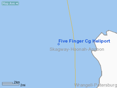
Finger Cg Heliport
Address: Juneau
County, AK
Tel:
907-586-7351
Images
and information placed above are from
http://www.airport-data.com/airport/2AK3/
We
thank them for the data!
| General
Info |
| Country |
United
States |
| State |
ALASKA
|
| FAA ID |
2AK3
|
| Latitude |
57-16-11.771N
|
| Longitude |
133-37-53.225W
|
| Elevation |
48 feet
|
| Near City |
FIVE FINGER
|
We don't guarantee the information is fresh and accurate. The data may be wrong or outdated.
For more up-to-date information please refer to other sources.
|
|


