 |
|
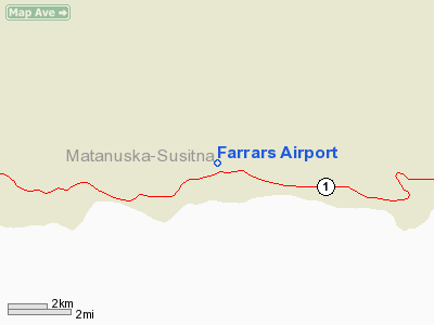
Location & QuickFacts
|
FAA
Information Effective: |
2006-02-16 |
|
Airport Identifier: |
28AK |
|
Longitude/Latitude: |
147-51-33.6470W/61-48-31.9560N
-147.859346/61.808877 (Estimated) |
|
Elevation: |
1875
ft / 571.50 m (Estimated) |
|
Land: |
0
acres |
|
From nearest
city: |
31
nautical miles E of Sutton, AK |
|
Location: |
Mata-sus
Borough County, AK |
|
Magnetic
Variation: |
26E
(1985) |
Owner & Manager
|
Ownership: |
Privately
owned |
|
Owner: |
Henry
E. Farrar |
|
Address: |
Box
8424
Palmer, AK 99645 |
|
Phone number: |
907-745-7177 |
|
Manager: |
Henry
E. Farrar |
|
Address: |
Box
8424
Palmer, AK 99645 |
|
Phone number: |
907-745-7177 |
Airport Operations
and Facilities
|
Airport
Use: |
Private |
|
Wind indicator: |
Yes |
|
Segmented
Circle: |
No |
|
Control Tower: |
No |
|
Attendance
Schedule: |
UNATNDD |
|
Landing fee
charge: |
No |
|
Sectional
chart: |
Anchorage |
|
Region: |
AAL
- Alaska |
|
Boundary
ARTCC: |
ZAN
- Anchorage |
|
Tie-in FSS: |
ENA
- Kenai |
|
FSS on Airport: |
No |
|
FSS Phone: |
800-478-3576 |
|
FSS Toll
Free: |
1-800-WX-BRIEF |
|
Runway Information
Runway 06/24
|
Dimension: |
2175 x 50 ft / 662.9
x 15.2 m |
|
Surface: |
DIRT,
|
|
|
Runway 06 |
Runway 24 |
|
Traffic Pattern: |
Left |
Left |
|
Radio Navigation Aids
|
ID |
Type |
Name |
Ch |
Freq |
Var |
Dist |
Remarks
- AVBL
FOR EMERGENCY USE; PPR FOR ALL OTHER OPNS.
Based Aircraft
|
Aircraft
based on field: |
1 |
|
Single Engine Airplanes: |
1 |
Farrars
Airport
Address: Mata-sus
Borough County, AK
Tel:
907-745-7177
Images
and information placed above are from
http://www.airport-data.com/airport/28AK/
We
thank them for the data!
| General
Info |
| Country |
United
States |
| State |
ALASKA
|
| FAA ID |
28AK
|
| Latitude |
61-48-31.956N
|
| Longitude |
147-51-33.647W
|
| Elevation |
1875 feet
|
| Near City |
SUTTON
|
We don't guarantee the information is fresh and accurate. The data may be wrong or outdated.
For more up-to-date information please refer to other sources.
|
|


