 |
|
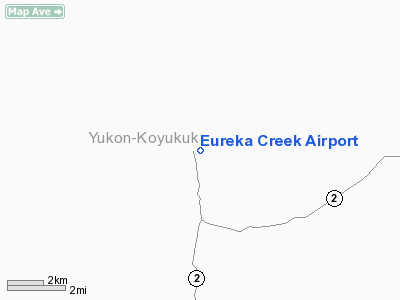
Location & QuickFacts
|
FAA
Information Effective: |
2006-02-16 |
|
Airport Identifier: |
2Z2 |
|
Longitude/Latitude: |
150-13-13.9390W/65-10-33.2810N
-150.220539/65.175911 (Estimated) |
|
Elevation: |
700
ft / 213.36 m (Estimated) |
|
Land: |
0
acres |
|
From nearest
city: |
0
nautical miles S of Eureka Creek, AK |
|
Location: |
Yukon-koyukuk
County, AK |
|
Magnetic
Variation: |
26E
(1985) |
Owner & Manager
|
Ownership: |
Publicly
owned |
|
Owner: |
Unknown |
|
Address: |
|
|
Address: |
|
Airport Operations
and Facilities
|
Airport
Use: |
Open to
public |
|
Segmented
Circle: |
No |
|
Control Tower: |
No |
|
Attendance
Schedule: |
UNATNDD |
|
Landing fee
charge: |
No |
|
Sectional
chart: |
Fairbanks |
|
Region: |
AAL
- Alaska |
|
Boundary
ARTCC: |
ZAN
- Anchorage |
|
Tie-in FSS: |
FAI
- Fairbanks |
|
FSS on Airport: |
No |
|
FSS Phone: |
907-474-0788 |
|
FSS Toll
Free: |
1-866-248-6516 |
|
NOTAMs Facility: |
FAI
(NOTAM-d service avaliable) |
Airport Communications
Airport Services
|
Airframe
Repair: |
NONE |
|
Power
Plant Repair: |
NONE |
|
Bottled Oxygen: |
NONE |
|
Bulk Oxygen: |
NONE |
|
Runway Information
Runway 16/34
|
Dimension: |
1500 x 50 ft / 457.2
x 15.2 m |
|
Surface: |
DIRT,
Poor Condition
SOFT WHEN WET; RUTTED; BRUSH GROWING ON RY; ROCKS TO 2 INCHES ON
RY SFC. EROSION HAS DETERIORATED FIRST 400 FT OF APCH RY 34. |
|
|
Runway 16 |
Runway 34 |
|
Traffic Pattern: |
Left |
Left |
|
Obstruction: |
30 ft trees, 80.0 ft from runway, 50 ft right
of centerline, 2:1 slope to clear |
20 ft trees, 50.0 ft from runway, 2:1 slope
to clear
APCH - 50' WIDE CUT THRU TREES, 30' TREES EITHER SIDE OF PATH. |
|
Radio Navigation Aids
|
ID |
Type |
Name |
Ch |
Freq |
Var |
Dist |
|
ICW |
NDB |
Ice
Pool |
|
525.00 |
23E |
47.8
nm |
|
TAL |
VOR/DME |
Tanana |
113X |
116.60 |
26E |
49.4
nm |
|
ENN |
VORTAC |
Nenana |
105X |
115.80 |
27E |
45.8
nm |
Remarks
- RWY
NOT MONITORED; RECOMMEND VISUAL INSPECTION PRIOR TO LDG.
- 3'
BERM EACH SIDE OF RWY WITHIN 40' OF CENTERLINE.
- TREES
& BRUSH TO 20' WITHIN 50' EACH SIDE OF RWY CENTERLINE.
- RY
16/34 NOT MAINTAINED, HAZARDOUS & RECOMMEND FOR EMERGENCY USE ONLY.
- 2
FT DEEP PIT E OF RY 16/34; 240 FT FM RY 34 THR.
Operational Statistics
|
Aircraft
Operations: |
17/Month |
|
Air Taxi: |
50.0% |
|
General Aviation
Itinerant: |
50.0% |
Eureka
Creek Airport
Address: Yukon-koyukuk
County, AK
Tel:
Images
and information placed above are from
http://www.airport-data.com/airport/2Z2/
We
thank them for the data!
| General
Info |
| Country |
United
States |
| State |
ALASKA
|
| FAA ID |
2Z2
|
| Latitude |
65-10-33.281N
|
| Longitude |
150-13-13.939W
|
| Elevation |
700 feet
|
| Near City |
EUREKA
CREEK |
We don't guarantee the information is fresh and accurate. The data may be wrong or outdated.
For more up-to-date information please refer to other sources.
|
|


