 |
|
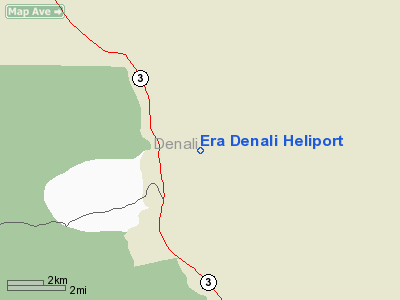
Location & QuickFacts
|
FAA
Information Effective: |
2006-02-16 |
|
Airport Identifier: |
7AK7 |
|
Longitude/Latitude: |
148-52-54.2990W/63-44-18.3550N
-148.881750/63.738432 (Estimated) |
|
Elevation: |
1580
ft / 481.58 m (Estimated) |
|
Land: |
2
acres |
|
From nearest
city: |
8
nautical miles SE of Healy, AK |
|
Location: |
Yukon-koyukuk
County, AK |
|
Magnetic
Variation: |
26E
(1990) |
Owner & Manager
|
Ownership: |
Privately
owned |
|
Owner: |
Era
Aviation, Inc |
|
Address: |
6160
S. Airpark Drive
Anchorage, AK 99502 |
|
Phone number: |
907-248-4422 |
|
Manager: |
Richard
Larew |
|
Address: |
6160
S. Airpark Drive
Anchorage, AK 99502 |
|
Phone number: |
907-248-4422 |
Airport Operations
and Facilities
|
Airport
Use: |
Private |
|
Segmented
Circle: |
No |
|
Control Tower: |
No |
|
Attendance
Schedule: |
MAY-SEP/ALL/0800-1800 |
|
Sectional
chart: |
Anchorage |
|
Region: |
AAL
- Alaska |
|
Boundary
ARTCC: |
ZAN
- Anchorage |
|
Tie-in FSS: |
ENA
- Kenai |
|
FSS Phone: |
800-478-3576 |
|
FSS Toll
Free: |
1-800-WX-BRIEF |
|
Runway Information
Helipad H1
|
Dimension: |
20 x 20 ft / 6.1
x 6.1 m |
|
Surface: |
WOOD,
|
|
|
Runway H1 |
Runway |
|
Traffic Pattern: |
Left |
Left |
|
Helipad H2
|
Dimension: |
20 x 20 ft / 6.1
x 6.1 m |
|
Surface: |
WOOD,
|
|
|
Runway H2 |
Runway |
|
Traffic Pattern: |
Left |
Left |
|
Helipad H3
|
Dimension: |
20 x 20 ft / 6.1
x 6.1 m |
|
Surface: |
WOOD,
|
|
|
Runway H3 |
Runway |
|
Traffic Pattern: |
Left |
Left |
|
Helipad H4
|
Dimension: |
20 x 20 ft / 6.1
x 6.1 m |
|
Surface: |
WOOD,
|
|
|
Runway H4 |
Runway |
|
Traffic Pattern: |
Left |
Left |
|
Radio Navigation Aids
|
ID |
Type |
Name |
Ch |
Freq |
Var |
Dist |
|
UMM |
NDB |
Summit |
|
326.00 |
27E |
25.5
nm |
|
ICW |
NDB |
Ice
Pool |
|
525.00 |
23E |
48.8
nm |
Remarks
- (E111-3)
ANNOUNCE INTENTIONS ON CTAF FREQ 122.8 WITHIN 10 NM OF MCKINGLY PARK
ARPT; AND DEPARTING/ARRIVING AIRCRAFT ADHERE TO CONDITION NUMBER 4 IN
AIRSPACE LETTER.
- PRVDD
ALL DEP/APCH TFC TO/FROM HELIPORT USE DESIGNATED INGRESS/EGRESS ROUTES
(290 DEG INBOUND/110 DEG OUTBOUND); ALL ARRIVING/DEPARTING TFC REAMIN
300 FT AGL BETWEEN HELIPORT AND A POINT 1/2 NM SE OF HELIPORT; ALL ARR/DEP
TFC SHALL
Based Aircraft
|
Aircraft
based on field: |
4 |
|
Helicopters: |
4 |
Era
Denali Heliport
Address: Yukon-koyukuk
County, AK
Tel:
907-248-4422
Images
and information placed above are from
http://www.airport-data.com/airport/7AK7/
We
thank them for the data!
| General
Info |
| Country |
United
States |
| State |
ALASKA
|
| FAA ID |
7AK7
|
| Latitude |
63-44-18.355N
|
| Longitude |
148-52-54.299W
|
| Elevation |
1580 feet
|
| Near City |
HEALY
|
We don't guarantee the information is fresh and accurate. The data may be wrong or outdated.
For more up-to-date information please refer to other sources.
|
|


