 |
|
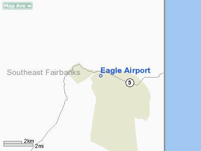
| Eagle Airport |
| IATA: EAA – ICAO: PAEG – FAA LID: EAA |
| Summary |
| Airport type |
Public |
| Owner |
Alaska DOT&PF - Northen Region |
| Serves |
Eagle, Alaska |
| Elevation AMSL |
908 ft / 277 m |
| Coordinates |
64°46′41″N 141°08′59″W / 64.77806°N 141.14972°W / 64.77806; -141.14972 |
| Runways |
| Direction |
Length |
Surface |
| ft |
m |
| 6/24 |
3,600 |
1,097 |
Gravel |
| Statistics (2005) |
| Aircraft operations |
2,400 |
| Source: Federal Aviation Administration |
Eagle Airport (IATA: EAA, ICAO: PAEG, FAA LID: EAA) is a state-owned public-use airport located two nautical miles (4 km) east of the central business district of Eagle, a city in the Southeast Fairbanks Census Area of the U.S. state of Alaska. Facilities and aircraft
Eagle Airport covers an area of 87 acres (35 ha) at an elevation of 908 feet (277 m) above mean sea level. It has one runway designated 6/24 with a gravel surface measuring 3,600 by 75 feet (1,097 x 23 m). For the 12-month period ending December 31, 2005, the airport had 2,400 aircraft operations, an average of 200 per month: 83% general aviation and 17% air taxi.
Airlines and destinations
- Arctic Circle Air (Fairbanks)
- Everts Air
The above content comes from Wikipedia and is published under free licenses – click here to read more.
Location & QuickFacts
|
FAA
Information Effective: |
2006-02-16 |
|
Airport Identifier: |
EAA |
|
Longitude/Latitude: |
141-09-03.3140W/64-46-35.0150N
-141.150921/64.776393 (Estimated) |
|
Elevation: |
880
ft / 268.22 m (Estimated) |
|
Land: |
87
acres |
|
From nearest
city: |
2
nautical miles E of Eagle, AK |
|
Location: |
Upper
Yukon County, AK |
|
Magnetic
Variation: |
31E
(1985) |
Owner & Manager
|
Ownership: |
Publicly
owned |
|
Owner: |
State
Of Ak Dotpf-n Region |
|
Address: |
2301
Peger Rd
Fairbanks, AK 99709 |
|
Phone number: |
907-451-2294 |
|
Manager: |
James
Fehrenbacjer |
|
Address: |
P
O Box 356
Tok, AK 99780 |
|
Phone number: |
907-883-5128 |
Airport Operations
and Facilities
|
Airport
Use: |
Open to
public |
|
Wind indicator: |
Yes |
|
Segmented
Circle: |
Yes |
|
Control Tower: |
No |
|
Attendance
Schedule: |
UNATNDD |
|
Lighting
Schedule: |
RDO-CTL
ACTVT ROTG BCN - CTAF. |
|
Beacon Color: |
Clear-Green
(lighted land airport) |
|
Landing fee
charge: |
No |
|
Sectional
chart: |
Dawson |
|
Region: |
AAL
- Alaska |
|
Boundary
ARTCC: |
ZAN
- Anchorage |
|
Tie-in FSS: |
ORT
- Northway |
|
FSS on Airport: |
No |
|
FSS Phone: |
907-778-2219 |
|
FSS Toll
Free: |
1-478-6611 |
|
Alternate
FSS: |
FAI
- Fairbanks |
|
Alt. FSS
Toll Free: |
1-866-248-6516 |
|
NOTAMs Facility: |
EAA
(NOTAM-d service avaliable) |
|
Federal Agreements: |
NGY |
Airport Communications
|
CTAF: |
122.800 |
|
Unicom: |
122.800
|
Airport Services
|
Fuel
available: |
100LLA |
|
Airframe
Repair: |
NONE |
|
Power
Plant Repair: |
NONE |
|
Bottled Oxygen: |
NONE |
|
Bulk Oxygen: |
NONE |
|
Runway Information
Runway 06/24
|
Dimension: |
3600 x 75 ft / 1097.3
x 22.9 m |
|
Surface: |
GRVL,
Fair Condition
SOFT WHEN WET; NUMEROUS SMALL SINK HOLES. |
|
Edge Lights: |
Medium |
|
|
Runway 06 |
Runway 24 |
|
Elevation: |
751.00 ft |
0.00 ft |
|
Traffic Pattern: |
Left |
Left |
|
VASI: |
4-box on left side |
|
|
Obstruction: |
43 ft trees, 600.0 ft from runway, 100 ft left
of centerline, 13:1 slope to clear |
50 ft trees, 1000.0 ft from runway, 20:1 slope
to clear |
|
Radio Navigation Aids
|
ID |
Type |
Name |
Ch |
Freq |
Var |
Dist |
|
SLX |
NDB |
Slate
Creek |
|
280.00 |
30E |
37.4
nm |
Remarks
- RY
CONDITION NOT MONITORED; RECOMMEND VISUAL INSPECTION PRIOR TO LANDING.
- SUAIS
- 125.3(1-800-758-8723).
- WX
CAMERA AVBL ON INTERNET AT HTTP://AKWEATHERCAMS.FAA.GOV
Based Aircraft
|
Aircraft
based on field: |
4 |
|
Single Engine Airplanes: |
4 |
Operational Statistics
|
Aircraft
Operations: |
47/Week |
|
Air Taxi: |
16.7% |
|
General Aviation
Local: |
33.3% |
|
General Aviation
Itinerant: |
50.0% |
Eagle
Airport
Address: Upper
Yukon County, AK
Tel:
907-451-2294,
907-883-5128
Images
and information placed above are from
http://www.airport-data.com/airport/EAA
We
thank them for the data!
| General
Info |
| Country |
United
States |
| State |
ALASKA
|
| FAA ID |
EAA
|
| Latitude |
64-46-35.015N
|
| Longitude |
141-09-03.314W
|
| Elevation |
880 feet
|
| Near City |
EAGLE
|
We don't guarantee the information is fresh and accurate. The data may be wrong or outdated.
For more up-to-date information please refer to other sources.
|
|


