 |
|
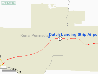
Dutch Landing Strip Airport |
Location & QuickFacts
|
FAA
Information Effective: |
2006-02-16 |
|
Airport Identifier: |
88AK |
|
Longitude/Latitude: |
150-52-05.0000W/60-32-25.0000N
-150.868056/60.540278 (Estimated) |
|
Elevation: |
300
ft / 91.44 m (Estimated) |
|
Land: |
0
acres |
|
From nearest
city: |
0
nautical miles N of Sterling, AK |
|
Location: |
Kenai
Peninsula County, AK |
|
Magnetic
Variation: |
23E
(1995) |
Owner & Manager
|
Ownership: |
Privately
owned |
|
Owner: |
Jerry
Holland |
|
Address: |
Po
Box 2288
Soldotna, AK 99669 |
|
Phone number: |
907-262-4316 |
|
Manager: |
Jerry
Holland |
|
Address: |
Po
Box 2288
Soldotna, AK 99669 |
|
Phone number: |
907-262-4316 |
Airport Operations
and Facilities
|
Airport
Use: |
Private |
|
Segmented
Circle: |
No |
|
Control Tower: |
No |
|
Attendance
Schedule: |
UNATNDD |
|
Sectional
chart: |
Anchorage |
|
Region: |
AAL
- Alaska |
|
Boundary
ARTCC: |
ZAN
- Anchorage |
|
Responsible
ARTCC: |
ZAN
- Anchorage |
|
Tie-in FSS: |
ENA
- Kenai |
|
FSS Phone: |
800-478-3576 |
|
FSS Toll
Free: |
1-800-WX-BRIEF |
|
Runway Information
Runway 07/25
|
Dimension: |
1300 x 100 ft /
396.2 x 30.5 m |
|
Surface: |
GRVL,
|
|
|
Runway 07 |
Runway 25 |
|
Traffic Pattern: |
Left |
Right |
|
Obstruction: |
30 ft trees, 300.0 ft from runway |
30 ft trees, 300.0 ft from runway |
|
Radio Navigation Aids
|
ID |
Type |
Name |
Ch |
Freq |
Var |
Dist |
|
IWW |
NDB |
Wildwood |
|
379.00 |
20E |
10.7
nm |
|
GRP |
NDB |
Granite Point |
|
356.00 |
24E |
28.8
nm |
|
DRF |
NDB |
Drift
River |
|
368.00 |
24E |
37.8
nm |
|
BOB |
NDB |
Bruck |
|
387.00 |
21E |
42.8
nm |
|
CMQ |
NDB |
Campbell Lake |
|
338.00 |
21E |
44.9
nm |
|
OLT |
NDB/DME |
Soldotna |
106X |
346.00 |
24E |
3.9
nm |
|
ENA |
VOR/DME |
Kenai |
123X |
117.60 |
25E |
10.6
nm |
|
ANC |
VOR/DME |
Anchorage |
090X |
114.30 |
25E |
41.5
nm |
|
ANC |
VOT |
Anchorage |
|
108.40 |
|
46.2
nm |
Remarks
- PRVDD
ALL RECOMMENDATIONS IN AIRSPACE DETERMINATION DATED AUG 10, 1998, ARE
MET.
Dutch Landing Strip Airport
Address: Kenai
Peninsula County, AK
Tel:
907-262-4316
Images
and information placed above are from
http://www.airport-data.com/airport/88AK/
We
thank them for the data!
| General
Info |
| Country |
United
States |
| State |
ALASKA
|
| FAA ID |
88AK
|
| Latitude |
60-32-25.000N
|
| Longitude |
150-52-05.000W
|
| Elevation |
300 feet
|
| Near City |
STERLING
|
We don't guarantee the information is fresh and accurate. The data may be wrong or outdated.
For more up-to-date information please refer to other sources.
|
|


