 |
|
|
|
|
|
Location & QuickFacts
|
FAA
Information Effective: |
2006-02-16 |
|
Airport Identifier: |
3AK5 |
|
Longitude/Latitude: |
152-09-43.1180W/60-35-19.9230N
-152.161977/60.588867 (Estimated) |
|
Elevation: |
30 ft /
9.14 m (Estimated) |
|
Land: |
58 acres |
|
From nearest
city: |
26 nautical
miles W of Kenai, AK |
|
Location: |
Kenai-cook
Inlet County, AK |
|
Magnetic
Variation: |
24E (1985) |
Owner & Manager
|
Ownership: |
Privately
owned |
|
Owner: |
Cook Inlet
Pipeline Co |
|
Address: |
P.o. Box
191009
Anchorage, AK 99519 |
|
Phone number: |
907-243-1166 |
|
Manager: |
T. L. Terry
Parrent |
|
Address: |
P.o. Box
191009
Anchorage, AK 99519 |
|
Phone number: |
907-243-1166 |
Airport Operations
and Facilities
|
Airport
Use: |
Private |
|
Wind indicator: |
Yes |
|
Segmented
Circle: |
No |
|
Control Tower: |
No |
|
Attendance
Schedule: |
ALL/ALL/ALL |
|
Lighting
Schedule: |
24 HRS |
|
Beacon Color: |
Clear-Green
(lighted land airport) |
|
Landing fee
charge: |
No |
|
Sectional
chart: |
Mc Grath |
|
Region: |
AAL - Alaska |
|
Boundary
ARTCC: |
ZAN - Anchorage |
|
Tie-in FSS: |
ENA - Kenai |
|
FSS on Airport: |
No |
|
FSS Phone: |
800-478-3576 |
|
FSS Toll
Free: |
1-800-WX-BRIEF |
Airport Communications
|
CTAF: |
122.700 |
|
Unicom: |
122.800
|
Airport Services
|
Airframe
Repair: |
NONE |
|
Power
Plant Repair: |
NONE |
|
Bottled Oxygen: |
NONE |
|
Bulk Oxygen: |
NONE |
|
Runway Information
Runway 05/23
|
Dimension: |
4100 x 150 ft /
1249.7 x 45.7 m |
|
Surface: |
GRAVEL, |
|
Edge Lights: |
Medium |
|
|
Runway 05 |
Runway 23 |
|
Traffic Pattern: |
Left |
Left |
|
Runway End
Identifier: |
No |
No |
|
Centerline
Lights: |
No |
No |
|
Touchdown Lights: |
No |
No |
|
Helipad H1
|
Dimension: |
40 x 20 ft / 12.2
x 6.1 m |
|
Surface: |
GRAVEL, |
|
|
Runway H1 |
Runway |
|
Elevation: |
35.00 ft |
0.00 ft |
|
Traffic Pattern: |
Left |
Left |
|
Centerline
Lights: |
No |
|
|
Radio Navigation Aids
|
ID |
Type |
Name |
Ch |
Freq |
Var |
Dist |
|
DRF |
NDB |
Drift
River |
|
368.00 |
24E |
0.6
nm |
|
IWW |
NDB |
Wildwood |
|
379.00 |
20E |
28.1
nm |
|
GRP |
NDB |
Granite Point |
|
356.00 |
24E |
33.0
nm |
|
OLT |
NDB/DME |
Soldotna |
106X |
346.00 |
24E |
38.6
nm |
|
ENA |
VOR/DME |
Kenai |
123X |
117.60 |
25E |
28.6
nm |
Remarks
- ACFT
SHLD REMAIN WELL CLEAR OF TANK FARM & DOCK AREAS DUE TO FUMES FM
TANKERS.
Based Aircraft
|
Aircraft
based on field: |
1 |
|
Helicopters: |
1 |
Operational Statistics
|
Aircraft
Operations: |
15/Week |
|
Air Taxi: |
80.0% |
|
General Aviation
Local: |
6.7% |
|
General Aviation
Itinerant: |
13.3% |
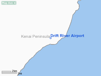
Drift
River Airport
Address: Kenai-cook
Inlet County, AK
Tel:
907-243-1166
Images
and information placed above are from
http://www.airport-data.com/airport/3AK5/
We
thank them for the data!
| General
Info |
| Country |
United
States |
| State |
ALASKA
|
| FAA ID |
3AK5
|
| Latitude |
60-35-19.923N
|
| Longitude |
152-09-43.118W
|
| Elevation |
30 feet
|
| Near City |
KENAI
|
We don't guarantee the information is fresh and accurate. The data may be wrong or outdated.
For more up-to-date information please refer to other sources.
|
|


