 |
|
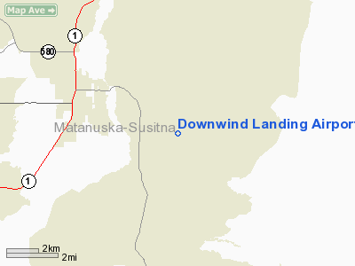
Location & QuickFacts
|
FAA
Information Effective: |
2006-02-16 |
|
Airport Identifier: |
AK53 |
|
Longitude/Latitude: |
148-59-49.1300W/61-34-56.3200N
-148.996981/61.582311 (Estimated) |
|
Elevation: |
220 ft
/ 67.06 m (Estimated) |
|
Land: |
0 acres |
|
From nearest
city: |
3 nautical
miles SE of Palmer, AK |
|
Location: |
Anchorage
County, AK |
|
Magnetic
Variation: |
24E (1995) |
Owner & Manager
|
Ownership: |
Privately
owned |
|
Owner: |
Downwind
Landing, Subd Owners |
|
Address: |
Po Box
196
Palmer, AK 99645 |
|
Phone number: |
907-745-3980 |
|
Manager: |
Gordon
Aklestad |
|
Address: |
Po Box
1961
Palmer, AK 99645 |
|
Phone number: |
907-745-3980 |
Airport Operations
and Facilities
|
Airport
Use: |
Private |
|
Wind indicator: |
Yes |
|
Segmented
Circle: |
No |
|
Control Tower: |
No |
|
Attendance
Schedule: |
UNATNDD |
|
Sectional
chart: |
Anchorage |
|
Region: |
AAL - Alaska |
|
Boundary
ARTCC: |
ZAN - Anchorage |
|
Responsible
ARTCC: |
ZAN - Anchorage |
|
Tie-in FSS: |
PAQ - Palmer |
|
FSS Phone: |
907-745-2495 |
|
FSS Toll
Free: |
LC745-2495 |
|
Alternate
FSS: |
ENA - Kenai |
|
Alt. FSS
Toll Free: |
1-800-WX-BRIEF |
|
Runway Information
Runway 16/34
|
Dimension: |
1800 x 75 ft / 548.6
x 22.9 m |
|
Surface: |
TURF,
Fair Condition |
|
|
Runway 16 |
Runway 34 |
|
Traffic Pattern: |
Left |
Left |
|
Displaced threshold: |
400.00 ft |
400.00 ft |
|
Obstruction: |
80 ft trees,
100.0 ft from runway |
80 ft trees,
100.0 ft from runway |
|
Radio Navigation Aids
|
ID |
Type |
Name |
Ch |
Freq |
Var |
Dist |
|
CMQ |
NDB |
Campbell Lake |
|
338.00 |
21E |
39.1
nm |
|
BOB |
NDB |
Bruck |
|
387.00 |
21E |
42.1
nm |
|
EDF |
TACAN |
Elmendorf |
081X |
|
21E |
29.7
nm |
|
ANC |
VOR/DME |
Anchorage |
090X |
114.30 |
25E |
43.4
nm |
|
BGQ |
VORTAC |
Big
Lake |
072X |
112.50 |
25E |
27.8
nm |
|
MRI |
VOT |
Merrill |
|
111.00 |
|
32.9
nm |
|
ANC |
VOT |
Anchorage |
|
108.40 |
|
37.4
nm |
Remarks
- RY
16/34 CLSD DURG WINTER - SNOW DEEP & SURFACE RUTTED. SNOW RUTTED
NOT PLOWED.
- RY
16/34 HAS ROAD THAT CROSSES - WATCH FOR CARS ON & INVOF RY.
- RY
16 RUNS DOWNHILL. DROP IS APRXLY 80 FT FM NORTH TO SOUTH.
- PVDD
LEFT TFC RY 16 & RIGHT TFC RY 34 ALL ACFT REMAIN AT OR BLO 600 FT
AGL UNTIL CLEAR OF PALMER MUNI ARPT TFC PATTERN; ALL ARRIVING/DEPARTING
SHALL ANNOUNCE THEIR INTENTIONS ON THE PALMER ARPT ADVISORY FREQ 123.6;
AND ALL USERS UTILIZING STOP ARE FAMILIAR WITH AND COMPLY WITH OPERNG
PROCEDURES.
Based Aircraft
|
Aircraft
based on field: |
8 |
|
Single Engine Airplanes: |
6 |
|
Ultralights: |
2 |
Downwind
Landing Airport
Address: Anchorage
County, AK
Tel:
907-745-3980
Images
and information placed above are from
http://www.airport-data.com/airport/AK53/
We
thank them for the data!
| General
Info |
| Country |
United
States |
| State |
ALASKA
|
| FAA ID |
AK53
|
| Latitude |
61-34-56.320N
|
| Longitude |
148-59-49.130W
|
| Elevation |
220 feet
|
| Near City |
PALMER
|
We don't guarantee the information is fresh and accurate. The data may be wrong or outdated.
For more up-to-date information please refer to other sources.
|
|


