 |
|
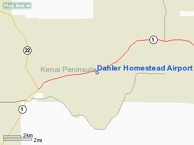
Location & QuickFacts
|
FAA
Information Effective: |
2006-02-16 |
|
Airport Identifier: |
7AK5 |
|
Longitude/Latitude: |
150-56-07.9810W/60-30-12.9480N
-150.935550/60.503597 (Estimated) |
|
Elevation: |
300
ft / 91.44 m (Estimated) |
|
Land: |
0
acres |
|
From nearest city: |
4
nautical miles NE of Soldotna, AK |
|
Location: |
Kenai-cook
Inlet County, AK |
|
Magnetic Variation: |
24E
(1985) |
Owner & Manager
|
Ownership: |
Privately owned |
|
Owner: |
Virgil
Dahler |
|
Address: |
Box
53
Soldotna, AK 99669 |
|
Address: |
|
Airport Operations and Facilities
|
Airport
Use: |
Private |
|
Segmented Circle: |
No |
|
Control Tower: |
No |
|
Attendance Schedule: |
UNATNDD |
|
Landing fee charge: |
No |
|
Sectional chart: |
Anchorage |
|
Region: |
AAL
- Alaska |
|
Boundary ARTCC: |
ZAN
- Anchorage |
|
Tie-in FSS: |
ENA
- Kenai |
|
FSS on Airport: |
No |
|
FSS Phone: |
800-478-3576 |
|
FSS Toll Free: |
1-800-WX-BRIEF |
Airport Services
|
Airframe
Repair: |
NONE |
|
Power
Plant Repair: |
NONE |
|
Bottled Oxygen: |
NONE |
|
Bulk Oxygen: |
NONE |
Runway Information
Runway 03/21
|
Dimension: |
1400 x 120 ft /
426.7 x 36.6 m |
|
Surface: |
TURF,
|
|
|
Runway 03 |
Runway 21 |
|
Traffic Pattern: |
Left |
Left |
|
Markings: |
None, |
None, |
|
Runway End
Identifier: |
No |
No |
|
Centerline
Lights: |
No |
No |
|
Touchdown Lights: |
No |
No |
|
Obstruction: |
30 ft pline, 285.0 ft from runway, 10:1 slope
to clear |
35 ft trees, 1200.0 ft from runway, 20:1 slope
to clear |
|
Radio Navigation Aids
|
ID |
Type |
Name |
Ch |
Freq |
Var |
Dist |
|
IWW |
NDB |
Wildwood |
|
379.00 |
20E |
10.0
nm |
|
GRP |
NDB |
Granite Point |
|
356.00 |
24E |
29.9
nm |
|
DRF |
NDB |
Drift
River |
|
368.00 |
24E |
36.1
nm |
|
BOB |
NDB |
Bruck |
|
387.00 |
21E |
45.7
nm |
|
CMQ |
NDB |
Campbell Lake |
|
338.00 |
21E |
47.8
nm |
|
OLT |
NDB/DME |
Soldotna |
106X |
346.00 |
24E |
2.4
nm |
|
ENA |
VOR/DME |
Kenai |
123X |
117.60 |
25E |
10.2
nm |
|
ANC |
VOR/DME |
Anchorage |
090X |
114.30 |
25E |
44.4
nm |
|
ANC |
VOT |
Anchorage |
|
108.40 |
|
49.1
nm |
Remarks
- PLINE
ON SW END OF RY ABOUT 285' FM END OF RY.
- ASP
DTRMN PENDING.
Based Aircraft
|
Aircraft
based on field: |
1 |
|
Single Engine Airplanes: |
1 |
Operational Statistics
|
Aircraft
Operations: |
9/Month |
|
General Aviation
Local: |
50.0% |
|
General Aviation
Itinerant: |
50.0% |
Dahler
Homestead Airport
Address: Kenai-cook
Inlet County, AK
Tel:
Images
and information placed above are from
http://www.airport-data.com/airport/7AK5/
We
thank them for the data!
| General
Info |
| Country |
United
States |
| State |
ALASKA
|
| FAA ID |
7AK5
|
| Latitude |
60-30-12.948N
|
| Longitude |
150-56-07.981W
|
| Elevation |
300 feet
|
| Near City |
SOLDOTNA
|
We don't guarantee the information is fresh and accurate. The data may be wrong or outdated.
For more up-to-date information please refer to other sources.
|
|


