 |
|
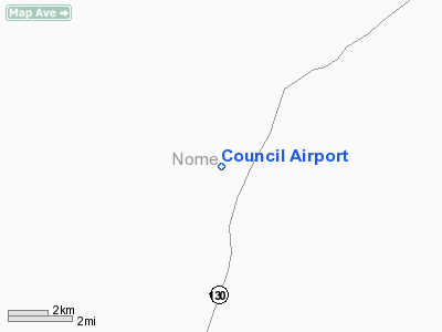
| Council Airport |
| IATA: CIL – ICAO: none – FAA LID: K29 |
| Summary |
| Airport type |
Public |
| Owner |
Alaska DOT&PF - Northern Region |
| Serves |
Council, Alaska |
| Elevation AMSL |
85 ft / 26 m |
| Coordinates |
64°53′52″N 163°42′12″W / 64.89778°N 163.70333°W / 64.89778; -163.70333 |
| Runways |
| Direction |
Length |
Surface |
| ft |
m |
| 10/28 |
3,000 |
914 |
Gravel/Dirt |
| Source: Federal Aviation Administration |
Council Airport (IATA: CIL, FAA LID: K29) is a state-owned public-use airport located one nautical mile (1.8 km) north of the central business district of Council, in the Nome Census Area in the U.S. state of Alaska. Facilities
Council Airport covers an area of 114 acres (46 ha) at an elevation of 85 feet (26 m) above mean sea level. It has one runway designated 10/28 with a gravel and dirt surface measuring 3,000 by 60 feet (914 x 18 m).
Airlines and destinations
The above content comes from Wikipedia and is published under free licenses – click here to read more.
Location & QuickFacts
|
FAA
Information Effective: |
2006-02-16 |
|
Airport Identifier: |
K29 |
|
Longitude/Latitude: |
163-42-12.4100W/64-53-52.3780N
-163.703447/64.897883 (Estimated) |
|
Elevation: |
85
ft / 25.91 m (Estimated) |
|
Land: |
114
acres |
|
From nearest city: |
1
nautical miles N of Council, AK |
|
Location: |
Nome
County, AK |
|
Magnetic Variation: |
18E
(1985) |
Owner & Manager
|
Ownership: |
Publicly owned |
|
Owner: |
State
Of Ak Dot/pf N Region |
|
Address: |
2301
Peger Rd
Fairbanks, AK 99701 |
|
Phone number: |
907-451-2200 |
|
Manager: |
Joel
Craft |
|
Address: |
Po
Box 1048
Nome, AK 99762 |
|
Phone number: |
907-443-3444 |
Airport Operations and Facilities
|
Airport
Use: |
Open to public |
|
Wind indicator: |
Yes
WIND TEE LUMINESCENT - GLOWS IN DARK. |
|
Segmented Circle: |
Yes |
|
Control Tower: |
No |
|
Attendance Schedule: |
UNATNDD |
|
Sectional chart: |
Nome |
|
Region: |
AAL
- Alaska |
|
Boundary ARTCC: |
ZAN
- Anchorage |
|
Tie-in FSS: |
OME
- Nome |
|
FSS on Airport: |
No |
|
FSS Phone: |
LC
443-2291 |
|
FSS Toll Free: |
1-800-478-8400 |
|
Alternate FSS: |
FAI
- Fairbanks |
|
Alt. FSS Toll Free: |
1-866-248-6516 |
|
NOTAMs Facility: |
OME
(NOTAM-d service avaliable) |
|
Federal Agreements: |
N |
Airport Communications
Runway Information
Runway 10/28
|
Dimension: |
3000 x 60 ft / 914.4
x 18.3 m |
|
Surface: |
GRVL-DIRT, Good Condition |
|
|
Runway 10 |
Runway 28 |
|
Traffic Pattern: |
Left |
Left |
|
Obstruction: |
17 ft trees, 648.0 ft from runway, 45 ft left
of centerline, 38:1 slope to clear |
,
50:1 slope to clear |
|
Radio Navigation Aids
|
ID |
Type |
Name |
Ch |
Freq |
Var |
Dist |
|
OAY |
NDB |
Norton Bay |
|
263.00 |
19E |
43.7
nm |
|
FDV |
NDB |
Fort
Davis |
|
529.00 |
14E |
48.0
nm |
|
MOS |
VOR/DME |
Moses
Point |
110X |
116.30 |
19E |
43.5
nm |
|
OME |
VOR/DME |
Nome |
097X |
115.00 |
17E |
46.9
nm |
Remarks
- RY
CONDITION NOT MONITORED; RECOMMEND VISUAL INSPECTION PRIOR TO LANDING.
- RY
NOT MAINTAINED DURING WINTER.
- DETERMINATION
PENDING.
Council Airport
Address: Nome
County, AK
Tel:
907-451-2200,
907-443-3444
Images
and information placed above are from
http://www.airport-data.com/airport/K29/
We
thank them for the data!
| General
Info |
| Country |
United
States |
| State |
ALASKA
|
| FAA ID |
K29
|
| Latitude |
64-53-52.378N
|
| Longitude |
163-42-12.410W
|
| Elevation |
85 feet
|
| Near City |
COUNCIL
|
We don't guarantee the information is fresh and accurate. The data may be wrong or outdated.
For more up-to-date information please refer to other sources.
|
|


