|
|
Cordova Municipal Airport |
| Cordova Municipal Airport |
 |
| IATA: CKU – ICAO: none – FAA LID: CKU |
| Summary |
| Airport type |
Public |
| Owner |
State of Alaska DOT&PF - Northern Region |
| Serves |
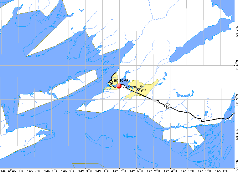
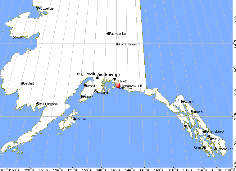
Cordova, Alaska |
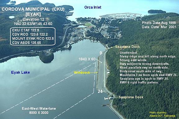
| Elevation AMSL |
12 ft / 4 m |
| Coordinates |
60°32′38″N 145°43′36″W / 60.54389°N 145.72667°W / 60.54389; -145.72667 |
| Runways |
| Direction |
Length |
Surface |
| ft |
m |
| 6/24 |
1,800 |
549 |
Gravel |
| 9W/27W |
8,000 |
2,438 |
Water |
| Statistics (2005) |
| Aircraft operations |
8,800 |
| Source: Federal Aviation Administration |
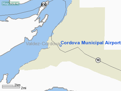
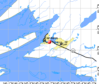
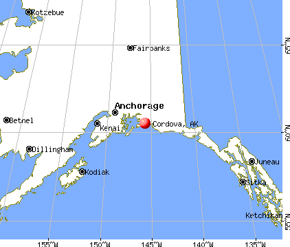
Cordova Municipal Airport (IATA: CKU, FAA LID: CKU) is a state-owned public-use airport located one nautical mile (1.8 km) east of the central business district of Cordova, a city in the Valdez-Cordova Census Area of the U.S. state of Alaska. It is located on Eyak Lake on which it also has a landing area for seaplanes.
Cordova is also served by the Merle K. (Mudhole) Smith Airport which offers scheduled commercial flights.
Facilities and aircraft
Cordova Municipal Airport has one runway (6/24) with a 1,800 by 60 ft (549 x 18 m) gravel surface. It also has one seaplane landing area (9W/27W) measuring 8,000 by 3,000 ft (2,438 x 914 m). For the 12-month period ending December 31, 2005, the airport had 8,800 aircraft operations, an average of 24 per day: 60% general aviation and 40% air taxi.
The above content comes from Wikipedia and is published under free licenses – click here to read more.
|
 |
(Click on the photo to
enlarge) |
|
 |
(Click on the photo to
enlarge) |
Location & QuickFacts
|
FAA
Information Effective: |
2006-02-16 |
|
Airport Identifier: |
CKU |
|
Longitude/Latitude: |
145-43-36.1350W/60-32-38.0520N
-145.726704/60.543903 (Estimated) |
|
Elevation: |
12
ft / 3.66 m (Estimated) |
|
Land: |
0
acres |
|
From nearest city: |
1
nautical miles E of Cordova, AK |
|
Location: |
Cordova-mccarthy
County, AK |
|
Magnetic Variation: |
26E
(1985) |
Owner & Manager
|
Ownership: |
Publicly owned |
|
Owner: |
State
Of Ak Dot Northern Reg |
|
Address: |
2301peger
Rd
Fairbanks, AK 99709 |
|
Phone number: |
907-451-5250 |
|
Manager: |
Tom
Justice |
|
Address: |
Box
598
Cordova, AK 99574 |
|
Phone number: |
907-424-3202 |
Airport Operations and Facilities
|
Airport
Use: |
Open to public |
|
Wind indicator: |
Yes |
|
Segmented Circle: |
No |
|
Control Tower: |
No |
|
Attendance Schedule: |
UNATNDD |
|
Landing fee charge: |
No |
|
Sectional chart: |
Anchorage |
|
Region: |
AAL
- Alaska |
|
Boundary ARTCC: |
ZAN
- Anchorage |
|
Tie-in FSS: |
JNU
- Juneau |
|
FSS on Airport: |
No |
|
FSS Phone: |
907-586-7380 |
|
FSS Toll Free: |
1-800-WX-BRIEF |
|
NOTAMs Facility: |
CDV
(NOTAM-d service avaliable) |
|
Federal Agreements: |
N |
Airport Communications
Airport Services
|
Airframe
Repair: |
MAJOR |
|
Power
Plant Repair: |
MAJOR |
|
Bottled Oxygen: |
NONE |
|
Bulk Oxygen: |
NONE |
Runway Information
Runway 06/24
|
Dimension: |
1800 x 60 ft / 548.6
x 18.3 m
LARGER GRAVEL AT APPROACH END OF RUNWAY 24. |
|
Surface: |
GRVL,
Fair Condition
LARGER GRAVEL AT APPROACH END OF RUNWAY 24. |
|
|
Runway 06 |
Runway 24 |
|
Traffic Pattern: |
Right |
Left |
|
Obstruction: |
105 ft trees, 1260.0 ft from runway, 150 ft
left of centerline, 12:1 slope to clear |
88 ft trees, 600.0 ft from runway, 300 ft right
of centerline, 6:1 slope to clear |
|
Runway 09W/27W
|
Dimension: |
8000 x 3000 ft /
2438.4 x 914.4 m
LARGER GRAVEL AT APPROACH END OF RUNWAY 24. |
|
Surface: |
WATER,
LARGER GRAVEL AT APPROACH END OF RUNWAY 24. |
|
|
Runway 09W |
Runway 27W |
|
Elevation: |
5.00 ft |
5.00 ft |
|
Traffic Pattern: |
Left |
Left |
|
Radio Navigation Aids
|
ID |
Type |
Name |
Ch |
Freq |
Var |
Dist |
|
GCR |
NDB |
Glacier River |
|
404.00 |
22E |
7.9
nm |
|
HBK |
NDB |
Hinchinbrook |
|
362.00 |
27E |
14.0
nm |
|
ALJ |
NDB |
Orca
Bay |
|
233.00 |
23E |
25.8
nm |
|
MNL |
NDB |
Mineral Creek |
|
524.00 |
27E |
39.4
nm |
|
JOH |
VOR/DME |
Johnstone Point |
114X |
116.70 |
27E |
26.1
nm |
Remarks
- STEEP
RIDGE & HILL ALONG N EDGE; STRONG E WINDS; RWY SUBJ TO STRONG DOWNDRAFTS;
BIRDS ROOST ON S SIDE; MOUNTAINS 3 MI FM AER RWY 24.
- SEAPLANE
OPERS IN APCH TO RY 24.
- SPB
OPERS IN EYAK LAKE; EYAK LAKE FREEZES IN WINTER-TIDEWATER REMAINS OPEN.
- RY
COND NOT MONITORED; RECOMMEND VISUAL INSPECTION PRIOR TO LANDING.
- SNOW
REMOVAL ON IRREGULAR BASIS.
- AIRCRAFT
TIEDOWNS LOCATED NORTH OF ROAD THAT PARALLELS THE RUNWAY. PILOTS USE
CAUTION TAXIING ACROSS ROAD.
- JOHNSTONE
POINT WX CAMERA AVBL ON INTERNET AT HTTP://AKWEATHERCAMS.FAA.GOV
- RY
EDGE CONES REMOVED FOR WINTER 15 OCT THRU 1 MAY.
- ESTABD
PRIOR TO 1959.
Based Aircraft
|
Aircraft
based on field: |
40 |
|
Single Engine Airplanes: |
40 |
Operational Statistics
|
Aircraft
Operations: |
170/Week |
|
Air Taxi: |
39.8% |
|
General Aviation
Local: |
28.4% |
|
General Aviation
Itinerant: |
31.8% |
Cordova Municipal Airport
Address: Cordova-mccarthy
County, AK
Tel:
907-451-5250,
907-424-3202
|
 |
(Click on the photo to
enlarge) |
Images
and information placed above are from
http://www.airport-data.com/airport/CKU/
http://www.city-data.com/city/Cordova-Alaska.html
We
thank them for the data!
| General
Info |
| Country |
United
States |
| State |
ALASKA
|
| FAA ID |
CKU
|
| Latitude |
60-32-38.052N
|
| Longitude |
145-43-36.135W
|
| Elevation |
12 feet
|
| Near City |
CORDOVA
|
We don't guarantee the information is fresh and accurate. The data may be wrong or outdated.
For more up-to-date information please refer to other sources.
|
|