 |
|
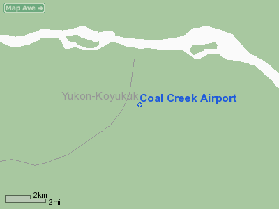
Location & QuickFacts
|
FAA
Information Effective: |
2006-02-16 |
|
Airport Identifier: |
L20 |
|
Longitude/Latitude: |
143-08-07.6260W/65-18-40.8080N
-143.135452/65.311336 (Estimated) |
|
Elevation: |
850
ft / 259.08 m (Estimated) |
|
Land: |
0
acres |
|
From nearest city: |
1
nautical miles W of Yukon Charley Rivers, AK |
|
Location: |
Upper
Yukon County, AK |
|
Magnetic Variation: |
30E
(1990) |
Owner & Manager
|
Ownership: |
Publicly owned |
|
Owner: |
Us
Natl. Park Service |
|
Address: |
Po
Box 167
Eagle, AK 99738 |
|
Phone number: |
907-547-2233 |
|
Manager: |
Park
Superintendent |
|
Address: |
Po
Box 167
Eagle, AK 99738 |
|
Phone number: |
907-547-2233 |
Airport Operations and Facilities
|
Airport
Use: |
Open to public |
|
Wind indicator: |
Yes |
|
Segmented Circle: |
No |
|
Control Tower: |
No |
|
Attendance Schedule: |
UNATNDD |
|
Sectional chart: |
Dawson |
|
Region: |
AAL
- Alaska |
|
Boundary ARTCC: |
ZAN
- Anchorage |
|
Tie-in FSS: |
FAI
- Fairbanks |
|
FSS Phone: |
907-474-0788 |
|
FSS Toll Free: |
1-866-248-6516 |
|
NOTAMs Facility: |
FAI
(NOTAM-d service avaliable) |
Airport Communications
Runway Information
Runway 01/19
|
Dimension: |
2500 x 80 ft /
762.0 x 24.4 m |
|
Surface: |
GRAVEL, Fair Condition
SFC ROUGH - ROCKS TO 2 INCHES. |
| |
Runway
01 |
Runway
19 |
|
Traffic Pattern: |
Left |
Left |
|
Displaced
threshold: |
100.00
ft |
0.00
ft |
|
Obstruction: |
5
ft tailings, 5.0 ft from runway, 1:1 slope to clear |
,
50:1 slope to clear |
|
Radio Navigation Aids
|
ID |
Type |
Name |
Ch |
Freq |
Var |
Dist |
|
SLX |
NDB |
Slate Creek |
|
280.00 |
30E |
47.7 nm |
Remarks
- RY
01/19 NOT MAINTAINED DURING WINTER & EARLY SPRING.
- RY
CONDITION NOT MONITORED. RECOMMEND VISUAL INSPECTION PRIOR TO USING.
- RY
01/19 IS A DREDGED CREEK BOTTOM SLOPING UPHILL NORTH TO SOUTH.
- 8
FT HIGH DREDGE TAILINGS ON BOTH SIDES FULL LENGTH OF RY 01/19.
- RY
01/19 SUBJECT TO ERRATIC WINDS.
- WATCH
FOR VEHICLES & PEDESTRIANS EAST EDGE OF RY 01/19.
- LIMITED
ACFT PARKING ALONG EAST SIDE NEAR SOUTH END OF RY 01/19.
- SUAIS
- 125.3(1-800-758-8723).
Based Aircraft
|
Aircraft
based on field: |
1 |
|
Single Engine Airplanes: |
1 |
Operational Statistics
|
Aircraft
Operations: |
17/Month |
|
Air Taxi: |
50.0% |
|
General Aviation
Itinerant: |
50.0% |
Coal Creek Airport
Address: Upper
Yukon County, AK
Tel:
907-547-2233
Images
and information placed above are from
http://www.airport-data.com/airport/L20/
We
thank them for the data!
| General
Info |
| Country |
United
States |
| State |
ALASKA
|
| FAA ID |
L20
|
| Latitude |
65-18-40.808N
|
| Longitude |
143-08-07.626W
|
| Elevation |
850 feet
|
| Near City |
YUKON
CHARLEY RIVERS |
We don't guarantee the information is fresh and accurate. The data may be wrong or outdated.
For more up-to-date information please refer to other sources.
|
|


