 |
|
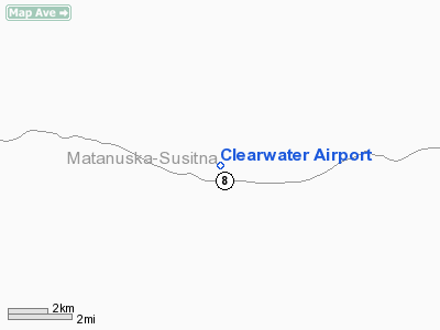
Location & QuickFacts
|
FAA
Information Effective: |
2006-02-16 |
|
Airport Identifier: |
Z86 |
|
Longitude/Latitude: |
147-10-43.1050W/63-01-36.3890N
-147.178640/63.026775 (Estimated) |
|
Elevation: |
2900
ft / 883.92 m (Estimated) |
|
Land: |
0
acres |
|
From nearest city: |
0
nautical miles S of Clearwater, AK |
|
Location: |
Southeast
Fairbanks County, AK |
|
Magnetic Variation: |
27E
(1985) |
Owner & Manager
|
Ownership: |
Publicly owned |
|
Owner: |
Public
Domain |
|
Address: |
|
|
Address: |
|
Airport Operations and Facilities
|
Airport
Use: |
Open to public |
|
Wind indicator: |
No |
|
Segmented Circle: |
No |
|
Control Tower: |
No |
|
Attendance Schedule: |
UNATNDD |
|
Landing fee charge: |
No |
|
Sectional chart: |
Anchorage |
|
Region: |
AAL
- Alaska |
|
Boundary ARTCC: |
ZAN
- Anchorage |
|
Tie-in FSS: |
ENA
- Kenai |
|
FSS on Airport: |
No |
|
FSS Phone: |
800-478-3576 |
|
FSS Toll Free: |
1-800-WX-BRIEF |
|
NOTAMs Facility: |
PXK
(NOTAM-d service avaliable) |
Airport Communications
Airport Services
|
Airframe
Repair: |
NONE |
|
Power
Plant Repair: |
NONE |
|
Bottled Oxygen: |
NONE |
|
Bulk Oxygen: |
NONE |
Runway Information
Runway 07/25
|
Dimension: |
750 x 50 ft / 228.6
x 15.2 m |
|
Surface: |
GRVL-DIRT, Poor Condition
SOFT & IRREGULAR; ROCKS TO 6 INCHES ON RY SCATTERED BRUSH &
TREES TO 5 FT THROUGHOUT RY. |
|
|
Runway 07 |
Runway 25 |
|
Traffic Pattern: |
Left |
Left |
|
Obstruction: |
15 ft trees, 15 ft left of centerline |
20 ft trees, 0.0 ft from runway |
|
Radio Navigation Aids
|
ID |
Type |
Name |
Ch |
Freq |
Var |
Dist |
Remarks
- SCATTERED
BRUSH & TREES TO 8 FT FROM EDGE TO 35 FT FROM CENTERLINE EACH SIDE
OF RY FULL LENGTH.
- SUAIS
- 125.3(1-800-758-8723).
- SCATTERED
TREES TO 30', 40' FROM CENTERLINE EACH SIDE OF RY FULL LENGTH.
- SCATTERED
TREES TO 40' APPROACH PATH RY 25.
- SCATTERED
TREES TO 20' APPROACH PATH RY 07.
- BRUSH
& TREES TO 5 FT ACROSS WIDTH OF RY AT A POINT 350 FT FROM RY 7 THR.
- CAMPFIRE
RINGS AT RY ENDS.
- RY
USED AS A ROAD.
- BARREL;
ROCK PILE & DEBRIS AT CENTER OF RY 50 FT FROM RY 25 THR.
- RY
HIGH IN MIDDLE SLOPES DOWN BOTH DIRECTIONS.
Operational Statistics
|
Aircraft
Operations: |
2/Month |
|
Air Taxi: |
33.3% |
|
General Aviation
Itinerant: |
66.7% |
Clearwater
Airport
Address: Southeast
Fairbanks County, AK
Tel:
Images
and information placed above are from
http://www.airport-data.com/airport/Z86/
We
thank them for the data!
| General
Info |
| Country |
United
States |
| State |
ALASKA
|
| FAA ID |
Z86
|
| Latitude |
63-01-36.389N
|
| Longitude |
147-10-43.105W
|
| Elevation |
2900 feet
|
| Near City |
CLEARWATER
|
We don't guarantee the information is fresh and accurate. The data may be wrong or outdated.
For more up-to-date information please refer to other sources.
|
|


