 |
|
Clark's Point
is a city located in Dillingham Census Area, Alaska, U.S., at the 2000 census
the population was 75.
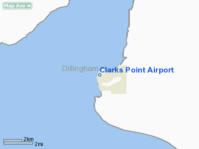
Clark's Point is located at 58°49'57"N,
158°33'9"W (58.832560, -158.552542)GR1.
According to the United States
Census Bureau, the city has a total area of 10.5 km² (4.1 mi²).
8.1 km² (3.1 mi²) of it is land and 2.4 km² (0.9 mi²)
of it (22.66%) is water.
Location & QuickFacts
|
FAA
Information Effective: |
2005-10-27 |
|
Airport Identifier: |
CLP |
|
Longitude/Latitude: |
158-32-42.8390W/58-50-32.2970N
-158.545233/58.842305 (Estimated) |
|
Elevation: |
10
ft / 3.05 m (Estimated) |
|
Land: |
0
acres |
|
From nearest city: |
0
nautical miles N of Clarks Point, AK |
|
Location: |
Bristol
Bay County, AK |
|
Magnetic Variation: |
20E
(1985) |
Owner & Manager
|
Ownership: |
Publicly owned |
|
Owner: |
State
Of Ak Dotpf-central Rgn |
|
Address: |
Pouch
196900
Anchorage, AK 99519-6900 |
|
Phone number: |
907-269-0767 |
|
Manager: |
Norman
Heyano |
|
Address: |
Box
250
Dillingham, AK 99576 |
|
Phone number: |
907-842-5511 |
Airport Operations and Facilities
|
Airport
Use: |
Open to public |
|
Wind indicator: |
Yes |
|
Segmented Circle: |
No |
|
Control Tower: |
No |
|
Attendance Schedule: |
UNATNDD |
|
Landing fee charge: |
No |
|
Sectional chart: |
Kodiak |
|
Region: |
AAL
- Alaska |
|
Boundary ARTCC: |
ZAN
- Anchorage |
|
Tie-in FSS: |
DLG
- Dillingham |
|
FSS on Airport: |
No |
|
FSS Phone: |
907-842-5275 |
|
FSS Toll Free: |
LC842-5275 |
|
Alternate FSS: |
ENA
- Kenai |
|
Alt. FSS Toll Free: |
1-800-WX-BRIEF |
|
NOTAMs Facility: |
DLG
(NOTAM-d service avaliable) |
|
Federal Agreements: |
N |
Airport Communications
Airport Services
|
Airframe
Repair: |
NONE |
|
Power
Plant Repair: |
NONE |
|
Bottled Oxygen: |
NONE |
|
Bulk Oxygen: |
NONE |
Runway Information
Runway 08/26
|
Dimension: |
2600 x 70 ft / 792.5
x 21.3 m |
|
Surface: |
GRVL,
Fair Condition |
|
|
Runway 08 |
Runway 26 |
|
Traffic Pattern: |
Left |
Left |
|
Markings: |
None,
/26 MKD BY REFLECTIVE CONES. THLDS MKD BY REFLECTIVE PANELS. |
None, |
|
Runway End
Identifier: |
No |
No |
|
Centerline
Lights: |
No |
No |
|
Touchdown Lights: |
No |
No |
|
Obstruction: |
,
50:1 slope to clear |
56 ft bluff, 1400.0 ft from runway, 25:1 slope
to clear |
|
Radio Navigation Aids
|
ID |
Type |
Name |
Ch |
Freq |
Var |
Dist |
|
BTS |
NDB |
Wood
River |
|
429.00 |
20E |
9.5
nm |
|
DLG |
VOR/DME |
Dillingham |
111X |
116.40 |
20E |
9.1
nm |
Remarks
- BIRDS
ON RWY.
- WATCH
FOR VEHICLES & PEDESTRIANS ON WEST END OF RWY. ROAD CROSSES RWY
APPRXLY 250' FROM END.
- CAUTION:
RY COND NOT MNTRD; RCMD VISUAL INSPECTION PRIOR TO USE.
- PILOTS
ARE REQUESTED TO SELF-ANNOUNCE ON CTAF PRIOR TO TAXIING ON RWY FOR DEPARTURE;
LEAVING THE RWY AND WITHIN 10 NM OF THE ARPT WHEN APPROACHING TO LAND.
Based Aircraft
|
Aircraft
based on field: |
3 |
|
Single Engine Airplanes: |
3 |
Operational Statistics
|
Aircraft
Operations: |
116/Week |
|
Air Taxi: |
66.7% |
|
General Aviation
Local: |
8.3% |
|
General Aviation
Itinerant: |
25.0% |
Clark's Point Airport
Address: Bristol
Bay County, AK
Tel:
907-269-0767,
907-842-5511
Images
and information placed above are from
http://www.airport-data.com/airport/CLP/
http://en.wikipedia.org/wiki/Clark%27s_Point%2C_Alaska
We
thank them for the data!
| General
Info |
| Country |
United
States |
| State |
ALASKA
|
| FAA ID |
CLP
|
| Latitude |
58-50-32.297N
|
| Longitude |
158-32-42.839W
|
| Elevation |
10 feet
|
| Near City |
CLARKS
POINT |
We don't guarantee the information is fresh and accurate. The data may be wrong or outdated.
For more up-to-date information please refer to other sources.
|
|


