 |
|
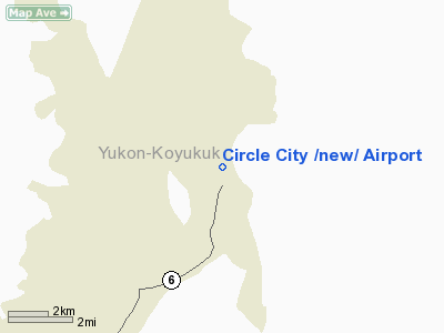
| Circle City Airport |
| IATA: IRC – ICAO: PACR – FAA LID: CRC |
| Summary |
| Airport type |
Public |
| Owner |
Alaska DOT&PF - Northern Region |
| Serves |
Circle, Alaska |
| Elevation AMSL |
613 ft / 187 m |
| Coordinates |
65°49′40″N 144°04′34″W / 65.82778°N 144.07611°W / 65.82778; -144.07611 |
| Runways |
| Direction |
Length |
Surface |
| ft |
m |
| 15/33 |
2,979 |
908 |
Gravel |
| Statistics (2005) |
| Aircraft operations |
1,110 |
| Source: Federal Aviation Administration |
Circle City Airport (IATA: IRC, ICAO: PACR, FAA LID: CRC) is a state-owned public-use airport located in Circle (also known as Circle City), in the Yukon-Koyukuk Census Area of the U.S. state of Alaska. It is also known as Circle City (New) Airport. Scheduled commercial airline service is subsidized by the Essential Air Service program.
Although most U.S. airports use the same three-letter location identifier for the FAA and IATA, this airport is assigned CRC by the FAA and IRC by the IATA (which assigned CRC to the Santa Ana Airport in Cartago, Colombia). The airport's ICAO identifier is PACR. Facilities and aircraft
Circle City Airport covers an area of 324 acres (131 ha) at an elevation of 613 feet (187 m) above mean sea level. It has one runway designated 15/33 with a gravel surface measuring 2,979 by 60 feet (908 x 18 m). For the 12-month period ending December 31, 2005, the airport had 1,110 aircraft operations, an average of 92 per month: 63% general aviation and 36% air taxi and 1% military.
Airline and destination
- Warbelow's Air Ventures (Fairbanks)
The above content comes from Wikipedia and is published under free licenses – click here to read more.
Location & QuickFacts
|
FAA
Information Effective: |
2005-10-27 |
|
Airport Identifier: |
CRC |
|
Longitude/Latitude: |
144-04-32.9260W/65-49-49.7780N
-144.075813/65.830494 (Estimated) |
|
Elevation: |
610
ft / 185.93 m (Estimated) |
|
Land: |
324
acres |
|
From nearest city: |
0
nautical miles N of Circle, AK |
|
Location: |
Upper
Yukon County, AK |
|
Magnetic Variation: |
30E
(1985) |
Owner & Manager
|
Ownership: |
Publicly owned |
|
Owner: |
St
Of Ak Dot Pf/n. Rgn |
|
Address: |
2301
Peger Road
Fairbanks, AK 99709-6394 |
|
Phone number: |
907-451-5250 |
|
Manager: |
Bill
O'halloran |
|
Address: |
2301
Peger Road
Fairbanks, AK 99709-6394 |
|
Phone number: |
907-451-5250 |
Airport Operations and Facilities
|
Airport
Use: |
Open to public |
|
Wind indicator: |
Yes |
|
Segmented Circle: |
Yes |
|
Control Tower: |
No |
|
Attendance Schedule: |
UNATNDD |
|
Lighting Schedule: |
DUSK-DAWN
ACTVT MIRL RY 15/33 - CTAF. |
|
Beacon Color: |
Clear-Green
(lighted land airport) |
|
Sectional chart: |
Dawson |
|
Region: |
AAL
- Alaska |
|
Boundary ARTCC: |
ZAN
- Anchorage |
|
Tie-in FSS: |
FAI
- Fairbanks |
|
FSS Phone: |
907-474-0788 |
|
FSS Toll Free: |
1-866-248-6516 |
|
NOTAMs Facility: |
FAI
(NOTAM-d service avaliable) |
|
Federal Agreements: |
NGY |
Airport Communications
Runway Information
Runway 15/33
|
Dimension: |
3000 x 60 ft / 914.4
x 18.3 m |
|
Surface: |
GRVL,
Good Condition
EDGES OVERGROWN - GRASS 4-6 INCHES GRVL BERMS UP TO 1 FT HIGH NEAR
LIGHTS & RY ENDS. |
|
Edge Lights: |
Medium |
|
|
Runway 15 |
Runway 33 |
|
Traffic Pattern: |
Left |
Left |
|
Obstruction: |
,
50:1 slope to clear |
50 ft trees, 1670.0 ft from runway, 60 ft right
of centerline, 33:1 slope to clear |
|
Radio Navigation Aids
|
ID |
Type |
Name |
Ch |
Freq |
Var |
Dist |
Remarks
- RY
COND NOT MONITORED OR MAINTAINED; RECOMMEND VISUAL INSPECTION PRIOR
TO LANDING.
- SUAIS
- 125.3(1-800-758-8723).
- NO
SNOW REMOVAL OPERATIONS DURING WINTER--MONITOR CTAF.
- FILED
FOR RECORD PURPOSES ONLY.
Operational Statistics
|
Aircraft
Operations: |
22/Week |
|
Air Taxi: |
36.0% |
|
General Aviation
Local: |
45.0% |
|
General Aviation
Itinerant: |
18.0% |
|
Military: |
0.9% |
Circle
City /new/ Airport
Address: Upper
Yukon County, AK
Tel:
907-451-5250
Images
and information placed above are from
http://www.airport-data.com/airport/CRC/
We
thank them for the data!
| General
Info |
| Country |
United
States |
| State |
ALASKA
|
| FAA ID |
CRC
|
| Latitude |
65-49-49.778N
|
| Longitude |
144-04-32.926W
|
| Elevation |
610 feet
|
| Near City |
CIRCLE
|
We don't guarantee the information is fresh and accurate. The data may be wrong or outdated.
For more up-to-date information please refer to other sources.
|
|


