|
|
| Chevak Airport |
 |
| IATA: VAK – ICAO: PAVA – FAA LID: VAK |
| Summary |
| Airport type |
Public |
| Owner |
State of Alaska DOT&PF - Central Region |
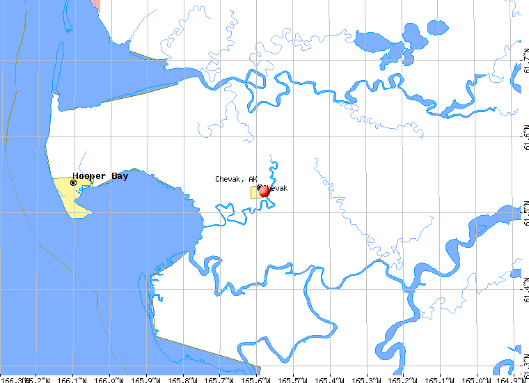
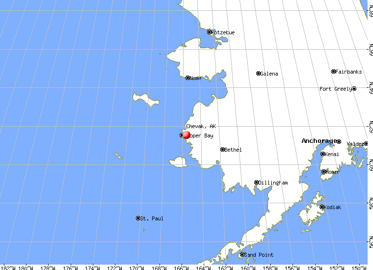
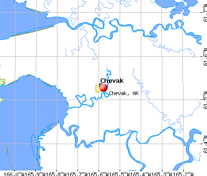
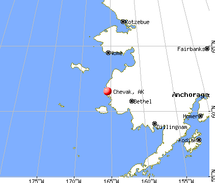
| Location |
Chevak, Alaska |
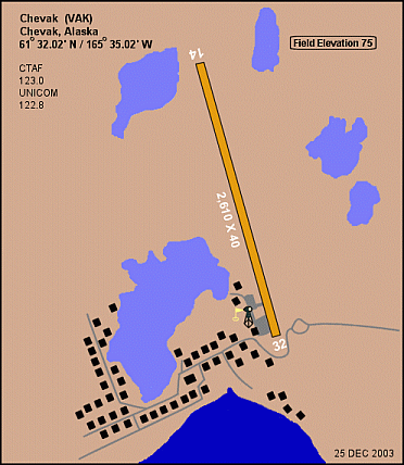
| Elevation AMSL |
75 ft / 23 m |
| Coordinates |
61°32′27″N 165°36′03″W / 61.54083°N 165.60083°W / 61.54083; -165.60083 |
| Runways |
| Direction |
Length |
Surface |
| ft |
m |
| 2/20 |
3,200 |
975 |
Gravel |
| 18W/36W |
2,000 |
610 |
Water |
| Source: Federal Aviation Administration |
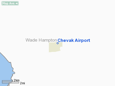
Chevak Airport (IATA: VAK, ICAO: PAVA, FAA LID: VAK) is a public airport located one mile (1.6 km) north of the central business district of Chevak, a city in the Wade Hampton Census Area of the U.S. state of Alaska. The airport is owned by the state. Facilities
Chevak Airport has one runway and one seaplane landing area:
- Runway 14/32: 2,680 x 50 ft. (817 x 15 m), Surface: Gravel
- Runway 18W/36W: 2,000 x 400 ft. (610 x 122 m), Surface: Water
Airlines and non-stop destinations
- Aero Flight (Bethel, Hooper Bay)
- Hageland Aviation Services (Hooper Bay)
The above content comes from Wikipedia and is published under free licenses – click here to read more.
Chevak is a city located in Wade Hampton Census Area,
Alaska. As of the 2000 census, the population of the city is 765.
Chevak is located at 61°31'40" North, 165°34'43"
West (61.527673, -165.578702)GR1.
|
 |
(Click on the photo to
enlarge) |
According to the United States Census Bureau, the city has a total area
of 3.0 km² (1.2 mi²). 3.0 km² (1.1 mi²) of it is land
and 0.1 km² (0.04 mi²) of it is water. The total area is 1.71%
water.
Location & QuickFacts
|
FAA
Information Effective: |
2005-10-27 |
|
Airport Identifier: |
VAK |
|
Longitude/Latitude: |
165-35-01.9390W/61-32-01.8370N
-165.583872/61.533844 (Estimated) |
|
Elevation: |
75 ft / 22.86 m (Estimated) |
|
Land: |
0
acres |
|
From nearest city: |
1 nautical miles
N of Chevak, AK |
|
Location: |
Wade
Hampton County, AK |
|
Magnetic Variation: |
13E (2005) |
Owner & Manager
|
Ownership: |
Publicly
owned |
|
Owner: |
State Of Ak Dotpf
Central Rgn |
|
Address: |
Po
Box 196900
Anchorage, AK 99519-6900 |
|
Phone number: |
907-243-0751 |
|
Manager: |
L.
J. Davis |
|
Address: |
2016 Airport Road
Bethel, AK 99559 |
|
Phone number: |
907-543-2495 |
Airport Operations and Facilities
|
Airport
Use: |
Open
to public |
|
Wind indicator: |
Yes |
|
Segmented Circle: |
No |
|
Control Tower: |
No |
|
Attendance Schedule: |
UNATNDD |
|
Lighting Schedule: |
RDO-CTL
ACTVT MIRL RY 14/32; NSTD ROTG BCN - CTAF. |
|
Beacon Color: |
Clear (unlighted
land airport)
NSTD WHITE FLASHING ROTG BCN. |
|
Landing fee charge: |
No |
|
Sectional chart: |
Bethel |
|
Region: |
AAL
- Alaska |
|
Boundary ARTCC: |
ZAN - Anchorage |
|
Tie-in FSS: |
ENA
- Kenai |
|
FSS on Airport: |
No |
|
FSS Phone: |
800-478-3576 |
|
FSS Toll Free: |
1-800-WX-BRIEF |
|
NOTAMs Facility: |
HPB
(NOTAM-d service avaliable) |
|
Federal Agreements: |
N |
Airport Communications
|
CTAF: |
123.000 |
|
Unicom: |
122.800
|
Airport Services
|
Airframe
Repair: |
NONE |
|
Power
Plant Repair: |
NONE |
|
Bottled Oxygen: |
NONE |
|
Bulk Oxygen: |
NONE |
Runway Information
Runway 14/32
|
Dimension: |
2680
x 50 ft / 816.9 x 15.2 m |
|
Surface: |
GRVL,
Fair Condition
LOOSE GRVL ON SFC. SHOULDERS SOFT. |
|
Edge Lights: |
Medium
NSTD PVT LGTS. |
|
|
Runway 14 |
Runway 32 |
|
Longitude: |
165-35-12.4400W |
165-34-51.4390W |
|
Latitude: |
61-32-14.0470N |
61-31-49.6270N |
|
Elevation: |
43.00 ft |
60.00 ft |
|
Alignment: |
127 |
127 |
|
Traffic Pattern: |
Left |
Left |
|
Markings: |
None,
/32 MKD WITH REFLECTIVE CONES & THR PANELS. |
None, |
|
Runway End Identifier: |
No |
No |
|
Centerline Lights: |
No |
No |
|
Touchdown Lights: |
No |
No |
|
Obstruction: |
,
50:1 slope to clear |
10 ft road, 160.0 ft from runway, 16:1 slope to clear |
|
Runway 18W/36W
|
Dimension: |
2000
x 400 ft / 609.6 x 121.9 m |
|
Surface: |
WATER,
LOOSE GRVL ON SFC. SHOULDERS SOFT. |
|
|
Runway 18W |
Runway 36W |
|
Traffic Pattern: |
Left |
Left |
|
Radio Navigation Aids
|
ID |
Type |
Name |
Ch |
Freq |
Var |
Dist |
|
CZF |
NDB/DME |
Cape
Romanzof |
114Y |
275.00 |
16E |
19.0
nm |
|
HPB |
VOR/DME |
Hooper Bay |
099X |
115.20 |
16E |
15.8
nm |
Remarks
-
STRONG CROSS WIND AT
THIS LCTN.
-
SPB LANDING AREA IN NINGIKFAF
RIVER; NO FLOAT OR DOCKING FACILITIES.
-
RY IS TROUGH SHAPED LOW
IN CENTER & HIGH AT BOTH ENDS.
-
CAUTION: RWY CONDITION
NOT MONITORED; RECOMMEND VISUAL INSPECTION PRIOR TO USING.
Operational Statistics
|
Aircraft
Operations: |
41/Week |
|
Air Taxi: |
85.7% |
|
General Aviation
Itinerant: |
14.3% |
Chevak
Airport
Address: Wade
Hampton County, AK
Tel:
907-243-0751,
907-543-2495
|
 |
(Click on the photo to
enlarge) |
Images
and information placed above are from
http://www.airport-data.com/airport/VAK/
http://www.city-data.com/city/Chevak-Alaska.html
http://en.wikipedia.org/wiki/Chevak%2C_Alaska
We
thank them for the data!
| General
Info |
| Country |
United
States |
| State |
ALASKA
|
| FAA ID |
VAK
|
| Latitude |
61-32-01.089N
|
| Longitude |
165-35-01.436W
|
| Elevation |
75 feet
|
| Near City |
CHEVAK
|
We don't guarantee the information is fresh and accurate. The data may be wrong or outdated.
For more up-to-date information please refer to other sources.
|
|