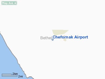
| Chefornak Airport |
 |
| IATA: CYF – ICAO: PACK – FAA LID: CFK |
| Summary |
| Airport type |
Public |
| Owner |
State of Alaska DOT&PF |
| Serves |
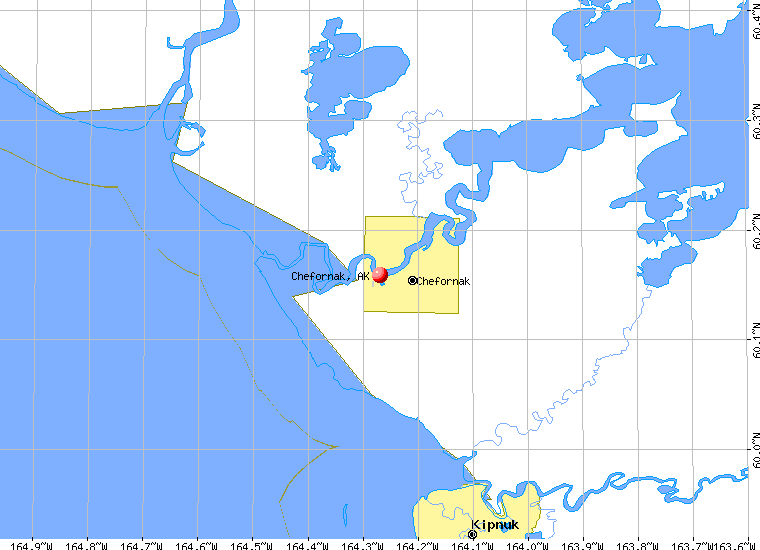
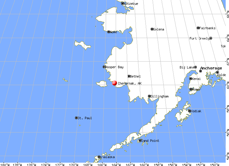
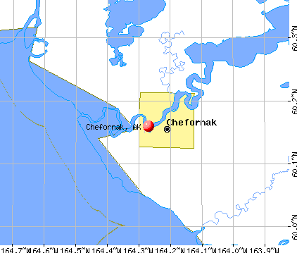
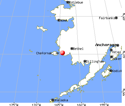
Chefornak, Alaska |
| Elevation AMSL |
40 ft / 12 m |
| Coordinates |
60°08′57″N 164°17′08″W / 60.14917°N 164.28556°W / 60.14917; -164.28556 |
| Runways |
| Direction |
Length |
Surface |
| ft |
m |
| 16/34 |
2,500 |
762 |
Gravel/Dirt |
| Source: Federal Aviation Administration |
Chefornak Airport (IATA: CYF, ICAO: PACK, FAA LID: CFK) is a state-owned public-use airport located in Chefornak, a city in the Bethel Census Area of the U.S. state of Alaska. The airport is situated on the Kinia River.
Although most U.S. airports use the same three-letter location identifier for the FAA and IATA, this airport is assigned CFK by the FAA and CYF by the IATA. The airport's ICAO identifier is PACK. Facilities
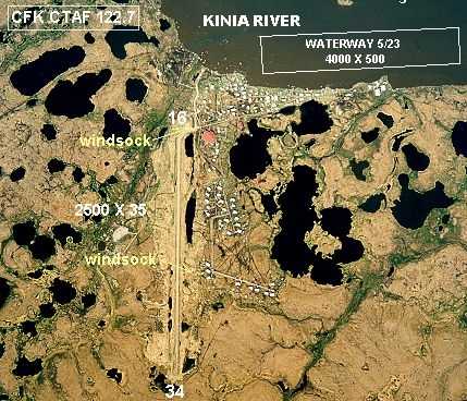
Chefornak Airport has one runway designated 16/34 with a gravel and dirt surface measuring 2,500 by 28 feet (762 x 9 m).
A new airstrip has been built further out from the village due to concerns with the proximity of the current airstrip to the school and pedestrian traffic, however, the runway must settle for several years before it is ready to be used.
Airlines and non-stop destinations
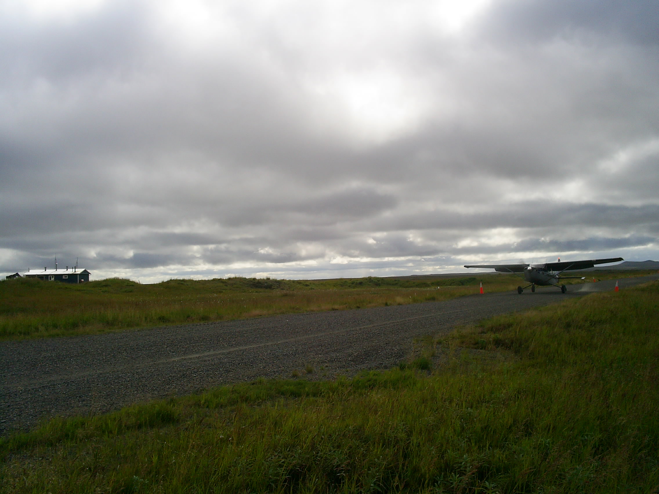
 | |
Plane landing at CYF. |
- Aero Flight (Nightmute)
- Flight Alaska (Bethel)
- Hageland Aviation Services (Kipnuk)
The above content comes from Wikipedia and is published under free licenses – click here to read more.
Chefornak is a city located in Bethel Census Area, Alaska. As
of the 2000 census, the population of the city is 394.
|
 |
(Click on the photo to
enlarge) |
Chefornak
is located at 60°9'33" North, 164°16'10" West (60.159070,
-164.269437)GR1.
According to the United
States Census Bureau, the city has a total area of 16.8 km² (6.5
mi²). 14.8 km² (5.7 mi²) of it is land and 2.0 km²
(0.8 mi²) of it is water. The total area is 11.71% water.
Location & QuickFacts
|
FAA
Information Effective: |
2005-10-27 |
|
Airport Identifier: |
CFK |
|
Longitude/Latitude: |
164-17-08.2770W/60-08-57.2120N
-164.285632/60.149226 (Estimated) |
|
Elevation: |
40 ft / 12.19 m (Estimated)
SEAPLANE BASE ELEVATION: 5 FT MSL. |
|
Land: |
0
acres |
|
From nearest city: |
0 nautical miles
E of Chefornak, AK |
|
Location: |
Bethel
County, AK |
|
Magnetic Variation: |
17E (1985) |
Owner & Manager
|
Ownership: |
Publicly
owned |
|
Owner: |
State Of Alaska Dotpf |
|
Address: |
Pouch
196900
Anchorage, AK 99519-6900 |
|
Phone number: |
907-269-0747 |
|
Manager: |
L.
J. Davis |
|
Address: |
Box 505
Bethel, AK 99559 |
|
Phone number: |
907-543-2495 |
Airport Operations and Facilities
|
Airport
Use: |
Open
to public |
|
Wind indicator: |
Yes
WINDSOCK LIGHT OTS INDEFLY. |
|
Segmented Circle: |
No |
|
Control Tower: |
No |
|
Attendance Schedule: |
UNATNDD |
|
Lighting Schedule: |
DUSK-DAWN |
|
Beacon Color: |
Clear (unlighted
land airport) |
|
Sectional chart: |
Bethel |
|
Region: |
AAL - Alaska |
|
Boundary ARTCC: |
ZAN
- Anchorage |
|
Tie-in FSS: |
ENA - Kenai |
|
FSS Phone: |
800-478-3576 |
|
FSS Toll Free: |
1-800-WX-BRIEF |
|
NOTAMs Facility: |
MYU
(NOTAM-d service avaliable) |
|
Federal Agreements: |
N |
Airport Communications
Runway Information
Runway 16/34
|
Dimension: |
2500
x 35 ft / 762.0 x 10.7 m |
|
Surface: |
GRVL-DIRT, Poor Condition
RY 16/34 SURFACE VARIATIONS DIPS DUE TO FROST HEAVING/THAWING. |
|
Edge Lights: |
Medium |
|
|
Runway 16 |
Runway 34 |
|
Traffic Pattern: |
Left |
Left |
|
Markings: |
None, |
None, |
|
Runway End Identifier: |
No |
No |
|
Centerline Lights: |
No |
No |
|
Touchdown Lights: |
No |
No |
|
Radio Navigation Aids
|
ID |
Type |
Name |
Ch |
Freq |
Var |
Dist |
|
IIK |
VOR/DME |
Kipnuk |
106X |
115.90 |
17E |
14.5
nm |
Remarks
-
BIRDS ON & INVOF
ARPT.
-
GRAVEL TURN AROUNDS MIDWAY
BOTH ENDS USABLE.
-
FLOAT AVBL FOR PARKING.
NO BEACHING FACILITIES. REEF ADJ NW OF FLOAT.
-
RY CONDITION NOT MONITORED;
RECOMMEND VISUAL INSPECTION PRIOR TO USING.
-
RY 34 HAS 8 INCH DIP
IN CNTRLN 100 FT FM APCH THLD.
Operational Statistics
|
Aircraft
Operations: |
29/Week |
|
Air Taxi: |
66.7% |
|
General Aviation
Itinerant: |
33.3% |
Chefornak
Airport
Address: Bethel
County, AK
Tel:
907-269-0747,
907-543-2495
|
 |
(Click on the photo to
enlarge) |
Images
and information placed above are from
http://www.airport-data.com/airport/CFK/
http://www.city-data.com/city/Chefornak-Alaska.html
http://en.wikipedia.org/wiki/Chefornak%2C_Alaska
We
thank them for the data!
| General
Info |
| Country |
United
States |
| State |
ALASKA
|
| FAA ID |
CFK
|
| Latitude |
60-08-57.212N
|
| Longitude |
164-17-08.277W
|
| Elevation |
40 feet
|
| Near City |
CHEFORNAK
|
We don't guarantee the information is fresh and accurate. The data may be wrong or outdated.
For more up-to-date information please refer to other sources.
|