 |
|
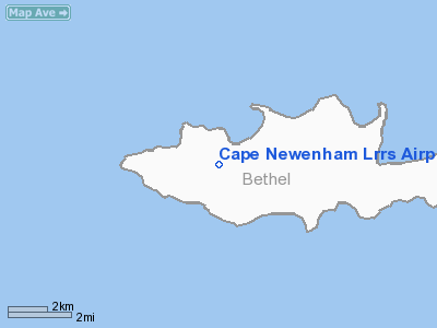
Cape Newenham Long Range Radar Site Airport |
Location & QuickFacts
|
FAA
Information Effective: |
2005-10-27 |
|
Airport Identifier: |
EHM |
|
Longitude/Latitude: |
162-03-45.9990W/58-38-47.1440N
-162.062777/58.646429 (Estimated) |
|
Elevation: |
541 ft / 164.90 m
(Surveyed) |
|
Land: |
0
acres |
|
From nearest city: |
1 nautical miles
SE of Cape Newenham, AK |
|
Location: |
Bethel
County, AK |
|
Magnetic Variation: |
18E (1985) |
Owner & Manager
|
Ownership: |
Air
Force owned |
|
Owner: |
U.s. Air Force |
|
Address: |
11
Acw, Elmendorf Afb
Anchorage, AK 99506-2270 |
|
Manager: |
Commander |
|
Address: |
11
Acw, 6900 9th St. Ste 301
Elmendorf Afb, AK 99506-2270 |
|
Phone number: |
907-552-5105 |
Airport Operations and Facilities
|
Wind indicator: |
Yes |
|
Segmented Circle: |
No |
|
Control Tower: |
No |
|
Attendance Schedule: |
ALL/ALL/DALGT
NORMALLY ATNDD 0800-1700 WKDAYS. |
|
Lighting Schedule: |
RDO
REQ
RDO REQ ON 126.2 |
|
Landing fee charge: |
Yes |
|
Sectional chart: |
Gnc
6 |
|
Region: |
AAL - Alaska |
|
Boundary ARTCC: |
ZAN
- Anchorage |
|
Tie-in FSS: |
ENA - Kenai |
|
FSS on Airport: |
No |
|
FSS Phone: |
800-478-3576 |
|
FSS Toll Free: |
1-800-WX-BRIEF |
|
NOTAMs Facility: |
PAEH (NOTAM-d service
avaliable) |
Airport Communications
Airport Services
|
Airframe
Repair: |
NONE |
|
Power
Plant Repair: |
NONE |
|
Bottled Oxygen: |
NONE |
|
Bulk Oxygen: |
NONE |
Runway Information
Runway 14/32
|
Dimension: |
3950
x 150 ft / 1204.0 x 45.7 m |
|
Surface: |
GRVL,
|
|
|
Runway 14 |
Runway 32 |
|
Elevation: |
230.00 ft |
541.00 ft |
|
Traffic Pattern: |
Left |
Left |
|
VASI: |
2-box on left side |
|
|
Runway End Identifier: |
Yes |
No |
|
Centerline Lights: |
No |
No |
|
Touchdown Lights: |
No |
No |
|
Radio Navigation Aids
|
ID |
Type |
Name |
Ch |
Freq |
Var |
Dist |
|
EHM |
NDB |
Cape
Newenham |
|
385.00 |
18E |
0.7
nm |
Remarks
-
RWY LCTD ON SLOPE OF
2305 FT MOUNTAIN.
-
ALL MIL, GOVT AND CIV
ACFT OPERATORS SHALL OBTAIN A PPR CTL NR A MIN OF 1-HR PRIOR TO DEP
FOR SITE, REQUEST NO EARLIER THAN DAY OF PLANNED TRAVEL, CTC SITE PERSONNEL
AT: DSN 317-552-9419/9370 C907-552-9419/9370. AFLD IS CLSD WEEKENDS
AND ALL FEDERAL HOL.
-
PASSENGERS MUST COORDINATE
ALL TRAVEL WITH ARS PROGRAM MANAGEMENT (DSN 317-552-4400/1989 OR C907-552-4400/1989)
ON ALL NON-EMERGENCY TRAVEL TO SITE.
-
APCH FM NW, LAND RWY
14 ONLY. TKOF RWY 32 ONLY. HIGH TERRAIN BOTH SIDES & S END. SUCCESSFUL
GO AROUND IMPROBABLE.
-
LAST 200' RWY 14 MAY
CONTAIN PARKED ACFT.
-
AFTER INITIAL RADIO CONTACT
ON FREQ 126.2 OR 121.5 EXPECT A 30 MIN DELAY FOR CURRENT AIRSTRIP CONDITION.
-
RADOME WINDS NOT ALWAYS
AVBL.
-
USAF INSTALLATION, ALL
CIVIL ACFT OPERS REQ CIVIL ACFT LNDG PERMITS PRIOR TO LANDING AT FACILITY.
FINES WILL BE LEVIED AGAINST VIOLATORS & REPORTS WILL BE FWDD TO
FAA FSDOS IAW 32CFR855 & USAF OPERG INSTRGS. OPERS MUST HAVE ON
BOARD A COPY OF CURRENT PERMIT. FOR PERMITS CALL 907-552-7384/3636/5265.
Operational Statistics
|
Aircraft
Operations: |
20/Week |
|
Air Taxi: |
97.7% |
|
Military: |
2.3% |
Cape
Newenham Lrrs Airport
Address: Bethel
County, AK
Tel:907-552-5105
Images
and information placed above are from
http://www.airport-data.com/airport/EHM/
We thank them for the
data!
| General
Info |
| Country |
United
States |
| State |
ALASKA
|
| FAA ID |
EHM
|
| Latitude |
58-38-47.144N
|
| Longitude |
162-03-45.999W
|
| Elevation |
541 feet
|
| Near City |
CAPE NEWENHAM
|
We don't guarantee the information is fresh and accurate. The data may be wrong or outdated.
For more up-to-date information please refer to other sources.
|
|


