 |
|
Location
& QuickFacts
|
FAA
Information Effective: |
2005-10-27 |
|
Airport Identifier: |
AK75 |
|
Longitude/Latitude: |
161-55-34.7010W/65-54-27.5690N
-161.926306/65.907658 (Estimated) |
|
Elevation: |
15 ft / 4.57 m (Estimated) |
|
Land: |
0
acres |
|
From nearest city: |
0 nautical miles
NE of Candle, AK |
|
Location: |
Unorganized
County, AK |
|
Magnetic Variation: |
20E (1985) |
Owner & Manager
|
Ownership: |
Privately
owned |
|
Owner: |
Reinhart Berg/thor
B Wetlesen |
|
Address: |
Rd1
Box 1435
Stroudsburg, PA 18360 |
|
Manager: |
Reinhart Berg/thor
B Wetlesen |
|
Address: |
Rd1
Box 1435
Stroudsberg, PA 18360 |
Airport Operations and Facilities
|
Airport
Use: |
Private |
|
Wind indicator: |
Yes |
|
Segmented Circle: |
No |
|
Control Tower: |
No |
|
Attendance Schedule: |
UNATNDD |
|
Sectional chart: |
Nome |
|
Region: |
AAL - Alaska |
|
Boundary ARTCC: |
ZAN
- Anchorage |
|
Tie-in FSS: |
OTZ - Kotzebue |
|
FSS Phone: |
907-442-3310 |
|
FSS Toll Free: |
1-478-7460 |
|
Alternate FSS: |
FAI
- Fairbanks |
|
Alt. FSS Toll Free: |
1-866-248-6516 |
Runway Information
Runway 02/20
|
Dimension: |
3880
x 90 ft / 1182.6 x 27.4 m |
|
Surface: |
GRVL,
Fair Condition
PORTIONS OF RY MUDDY AFTER HEAVY RAIN. RY HAS SHALLOW RUTS &
SLIGHT FROST HEAVING. |
|
|
Runway 02 |
Runway 20 |
|
Traffic Pattern: |
Left |
Left |
|
Obstruction: |
120 ft hill, 4000.0 ft from runway, 33:1 slope to clear |
50 ft ridge, 10000.0 ft from runway, 20:1 slope to clear |
|
Radio Navigation Aids
|
ID |
Type |
Name |
Ch |
Freq |
Var |
Dist |
|
BVK |
NDB/DME |
Buckland |
078X |
325.00 |
19E |
19.5
nm |
Remarks
-
BOTH SIDES RWY USED AS
ROAD.
-
NOT MAINTAINED IN WINTER.
-
DUMPSTER LOCATED WITHIN
20 FT OF R EDGE - RY 02 200 FT FROM THR.
-
RIDGES 30-50 FT RUN ALONG
BOTH SIDES RY 02/20.
-
ESTABD PRIOR TO 1959.
Operational Statistics
|
Aircraft
Operations: |
38/Month |
|
Air Taxi: |
66.7% |
|
General Aviation
Itinerant: |
33.3% |
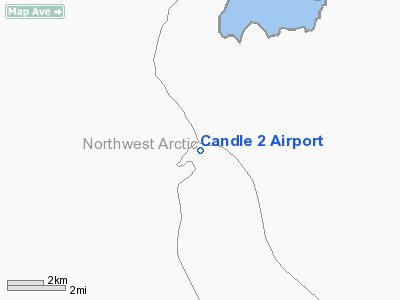
Candle
2 Airport
Address: Unorganized
County, AK
Tel:
Images
and information placed above are from
http://www.airport-data.com/airport/AK75/
We thank them for the
data!
| General
Info |
| Country |
United
States |
| State |
ALASKA
|
| FAA ID |
AK75
|
| Latitude |
65-54-27.569N
|
| Longitude |
161-55-34.701W
|
| Elevation |
15 feet
|
| Near City |
CANDLE
|
We don't guarantee the information is fresh and accurate. The data may be wrong or outdated.
For more up-to-date information please refer to other sources.
|
|


