|
|
| Butte Municipal Airport |
| IATA: none – ICAO: none – FAA LID: AK1 |
| Summary |
| Airport type |
Public |
| Owner |
Butte Airman's Association |
| Serves |
Butte, Alaska |
| Elevation AMSL |
64 ft / 20 m |
| Coordinates |
61°31′49″N 149°01′03″W / 61.53028°N 149.0175°W / 61.53028; -149.0175 |
| Runways |
| Direction |
Length |
Surface |
| ft |
m |
| 7/25 |
1,806 |
550 |
Gravel |
| Statistics (2005) |
| Aircraft operations |
860 |
| Source: Federal Aviation Administration |
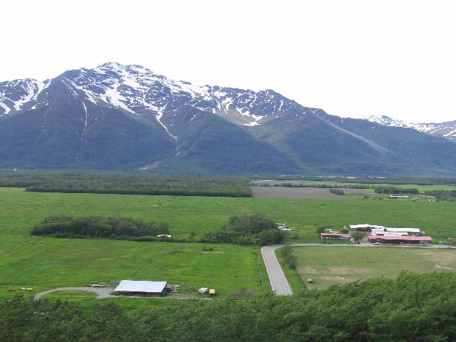
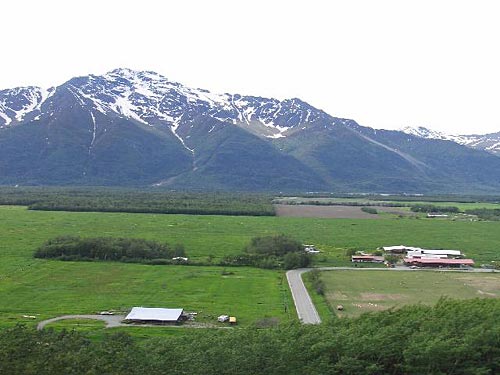
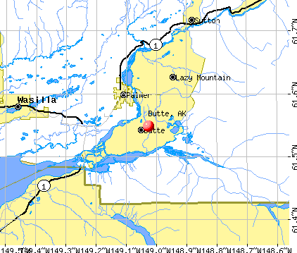
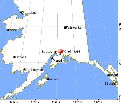
Butte Municipal Airport (FAA LID: AK1) is a public-use airport located in Butte, Alaska. It is five nautical miles (9 km) southeast of the central business district of Palmer, a city in the Matanuska-Susitna Borough of the U.S. state of Alaska. The airport is privately owned by the Butte Airman's Association.
Facilities and aircraft
Butte Municipal Airport has one runway designated 7/25 with a gravel surface measuring is 1,806 by 50 feet (550 x 15 m). For the 12-month period ending December 31, 2005, the airport had 860 general aviation aircraft operations, an average of 71 per month.
The above content comes from Wikipedia and is published under free licenses – click here to read more.

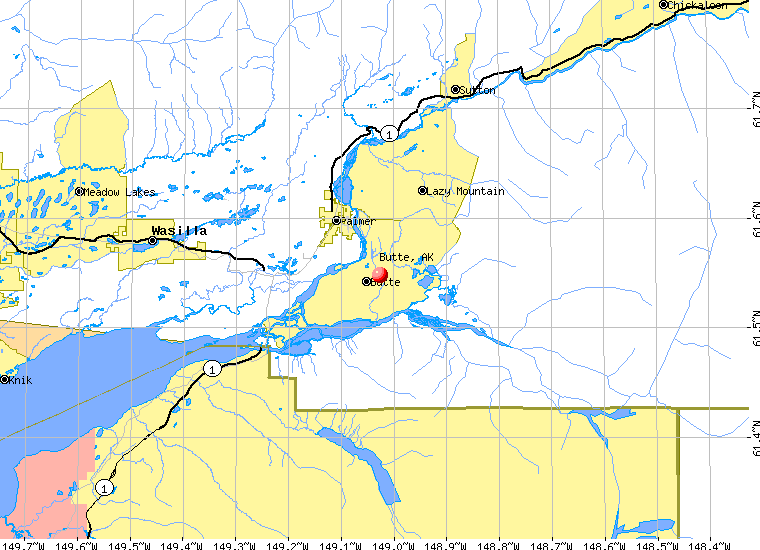
Butte is a census-designated place located in Matanuska-Susitna
Borough, Alaska.
As of the 2000 census, the population of the CDP is 2,561.
|
 |
(Click on the photo to
enlarge) |
Butte
is located at 61°32'53" North, 149°1'36" West (61.548030,
-149.026617)GR1.
According to the United States Census Bureau, the CDP
has a total area of 106.3 km² (41.0 mi²). 104.3 km² (40.3
mi²) of it is land and 1.9 km² (0.7 mi²) of it is water.
The total area is 1.80% water.
|
 |
(Click on the photo to
enlarge) |
Location & QuickFacts
|
FAA
Information Effective: |
2005-10-27 |
|
Airport Identifier: |
AK1 |
|
Longitude/Latitude: |
149-01-03.4900W/61-31-49.1350N
-149.017636/61.530315 (Estimated) |
|
Elevation: |
64 ft / 19.51 m (Estimated) |
|
Land: |
0
acres |
|
From nearest city: |
5 nautical miles
SE of Palmer, AK |
|
Location: |
Mata-sus
Borough County, AK |
|
Magnetic Variation: |
25E (1985) |
Owner & Manager
|
Ownership: |
Privately
owned |
|
Owner: |
Butte Airmans Assoc |
|
Address: |
8c02
P.o. Box 7556
Palmer, AK 99645 |
|
Phone number: |
907-745-4412 |
|
Manager: |
Butte
Airmans Assoc |
|
Address: |
8c02 P.o. Box 7556
Palmer, AK 99645 |
|
Phone number: |
907-745-4412 |
Airport Operations and Facilities
|
Airport
Use: |
Private |
|
Wind indicator: |
Yes |
|
Segmented Circle: |
No |
|
Control Tower: |
No |
|
Attendance Schedule: |
UNATNDD |
|
Landing fee charge: |
No |
|
Sectional chart: |
Anchorage |
|
Region: |
AAL
- Alaska |
|
Boundary ARTCC: |
ZAN - Anchorage |
|
Tie-in FSS: |
PAQ
- Palmer |
|
FSS on Airport: |
No |
|
FSS Phone: |
907-745-2495 |
|
FSS Toll Free: |
LC745-2495 |
|
Alternate FSS: |
ENA
- Kenai |
|
Alt. FSS Toll Free: |
1-800-WX-BRIEF |
|
NOTAMs Facility: |
PAQ
(NOTAM-d service avaliable) |
Airport Communications
Airport Services
|
Airframe
Repair: |
NONE |
|
Power
Plant Repair: |
NONE |
|
Bottled Oxygen: |
NONE |
|
Bulk Oxygen: |
NONE |
Runway Information
Runway 07/25
|
Dimension: |
1806
x 50 ft / 550.5 x 15.2 m |
|
Surface: |
GRAVEL, Poor Condition
RWY ROUGH WITH DIPS AND ROCKS TO 4 INCHS. |
|
|
Runway 07 |
Runway 25 |
|
Longitude: |
149-01-22.1200W |
149-00-44.8600W |
|
Latitude: |
61-31-49.2600N |
61-31-49.0100N |
|
Traffic Pattern: |
Left |
Left |
|
Obstruction: |
50 ft trees, 200.0 ft from runway, 4:1 slope to clear |
51 ft trees, 380.0 ft from runway, 90 ft right of centerline,
7:1 slope to clear |
|
Radio Navigation Aids
|
ID |
Type |
Name |
Ch |
Freq |
Var |
Dist |
|
CMQ |
NDB |
Campbell Lake |
|
338.00 |
21E |
36.7
nm |
|
BOB |
NDB |
Bruck |
|
387.00 |
21E |
39.9
nm |
|
EDF |
TACAN |
Elmendorf |
081X |
|
21E |
27.2
nm |
|
ANC |
VOR/DME |
Anchorage |
090X |
114.30 |
25E |
41.2
nm |
|
BGQ |
VORTAC |
Big
Lake |
072X |
112.50 |
25E |
27.3
nm |
|
MRI |
VOT |
Merrill |
|
111.00 |
|
30.5
nm |
|
ANC |
VOT |
Anchorage |
|
108.40 |
|
35.0
nm |
Remarks
-
ROAD RUNS ALONG NORTH
SIDE OF RWY.
-
ADVISE PILOT VISUALY
INSPECT RY PRIOR T0 LDG RY COND NOT MONITORED.
-
RWY SAFETY AREA CLEARED
1800' X 200'
Based Aircraft
|
Aircraft
based on field: |
10 |
|
Single Engine Airplanes: |
10 |
Operational Statistics
|
Aircraft
Operations: |
17/Week |
|
General Aviation
Local: |
93.0% |
|
General Aviation
Itinerant: |
7.0% |
Butte Municipal Airport
Address: Mata-sus
Borough County, AK
Tel:
907-745-4412
|
 |
(Click on the photo to
enlarge) |
Images
and information placed above are from
http://www.airport-data.com/airport/AK1/
http://www.city-data.com/city/Butte-Alaska.html
http://en.wikipedia.org/wiki/Butte%2C_Alaska
We
thank them for the data!
| General
Info |
| Country |
United
States |
| State |
ALASKA
|
| FAA ID |
AK1
|
| Latitude |
61-31-47.065N
|
| Longitude |
149-01-10.953W
|
| Elevation |
64 feet
|
| Near City |
PALMER
|
We don't guarantee the information is fresh and accurate. The data may be wrong or outdated.
For more up-to-date information please refer to other sources.
|
|