 |
|
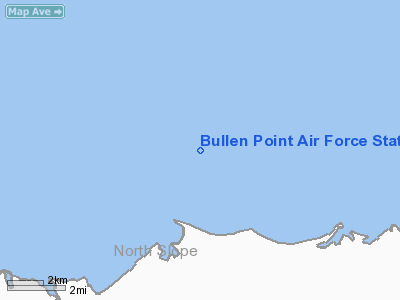
Bullen Point Air Force Station Airport |
Location & QuickFacts
|
FAA
Information Effective: |
2005-10-27 |
|
Airport Identifier: |
8AK7 |
|
Longitude/Latitude: |
146-50-10.0000W/70-10-22.0000N
-146.836111/70.172778 (Estimated) |
|
Elevation: |
18 ft / 5.49 m (Estimated) |
|
Land: |
605
acres |
|
From nearest city: |
64 nautical miles
E of Kaktovik, AK |
|
Location: |
North
Slope County, AK |
|
Magnetic Variation: |
28E (1965) |
Owner & Manager
|
Ownership: |
Privately
owned |
|
Owner: |
Usaf 11 Af |
|
Address: |
611
Osf/osr, 9840 Pease Ave Suite 222
Elmendorf Afb, AK 99506 |
|
Phone number: |
907-552-3636 |
|
Manager: |
Robert
L Hibbard |
|
Address: |
611 Osf/osr, 9840
Pease Ave Suite 222
Elmendorf Afb, AK 99506 |
|
Phone number: |
907-552-3636 |
Airport Operations and Facilities
|
Airport
Use: |
Private |
|
Segmented Circle: |
No |
|
Control Tower: |
No |
|
Attendance Schedule: |
UNATNDD |
|
Sectional chart: |
Point Barrow |
|
Region: |
AAL
- Alaska |
|
Boundary ARTCC: |
ZAN - Anchorage |
|
Tie-in FSS: |
FAI
- Fairbanks |
|
FSS Phone: |
907-474-0788 |
|
FSS Toll Free: |
1-866-248-6516 |
|
Certification type/date: |
LS 5/1973 |
Runway Information
Runway 15/33
|
Dimension: |
3520
x 100 ft / 1072.9 x 30.5 m |
|
Surface: |
GRVL,
|
|
|
Runway 15 |
Runway 33 |
|
Traffic Pattern: |
Left |
Left |
|
Helipad H1
|
Dimension: |
160
x 150 ft / 48.8 x 45.7 m |
|
Surface: |
GRVL,
|
|
|
Runway H1 |
Runway |
|
Traffic Pattern: |
Left |
Left |
|
Radio Navigation Aids
|
ID |
Type |
Name |
Ch |
Freq |
Var |
Dist |
|
PVQ |
NDB |
Put
River |
|
376.00 |
31E |
32.3
nm |
|
SCC |
VOR/DME |
Deadhorse |
086X |
113.90 |
31E |
32.2
nm |
Remarks
-
RECOMMEND VISUAL INSPECTION
PRIOR TO LANDING.
-
PRIOR COORDINATION WITH
11 AF, ELMENDORF AFB, AK REQUIRED PRIOR TO USING AIRFIELD.
Bullen Point Air Force
Station Airport
Address:
North Slope County, AK
Tel:
907-552-3636
Images
and information placed above are from
http://www.airport-data.com/airport/8AK7/
We
thank them for the data!
| General
Info |
| Country |
United
States |
| State |
ALASKA
|
| FAA ID |
8AK7
|
| Latitude |
70-10-22.000N
|
| Longitude |
146-50-10.000W
|
| Elevation |
18 feet
|
| Near City |
KAKTOVIK
|
We don't guarantee the information is fresh and accurate. The data may be wrong or outdated.
For more up-to-date information please refer to other sources.
|
|


