|
|
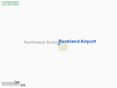
| Buckland Airport |
 |
| IATA: BKC – ICAO: PABL – FAA LID: BVK |
| Summary |
| Airport type |
Public |
| Owner |
State of Alaska DOT&PF - Northern Region |
| Serves |
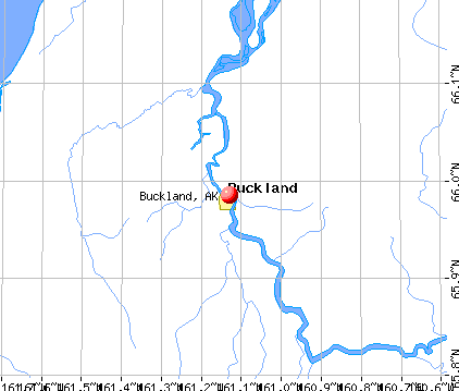
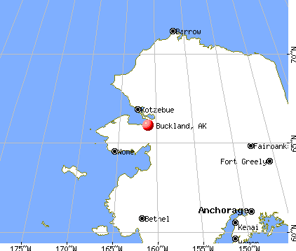
Buckland, Alaska |
| Elevation AMSL |
31 ft / 9 m |
| Coordinates |
65°58′54″N 161°08′57″W / 65.98167°N 161.14917°W / 65.98167; -161.14917 |
| Runways |
| Direction |
Length |
Surface |
| ft |
m |
| 11/29 |
3,200 |
975 |
Gravel |
| Source: Federal Aviation Administration |
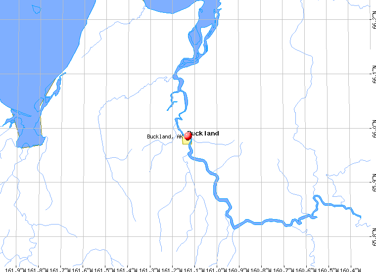
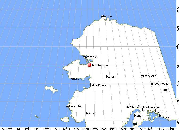
Buckland Airport (IATA: BKC, ICAO: PABL, FAA LID: BVK, formerly 7K5) is a state-owned public-use airport located one nautical mile (1.85 km) southwest of the central business district of Buckland, a city in the Northwest Arctic Borough of the U.S. state of Alaska. The airport is situated on the Buckland River.
Although most U.S. airports use the same three-letter location identifier for the FAA and IATA, this airport is assigned BVK by the FAA and BKC by the IATA (which assigned BVK to Huacaraje, Bolivia). The airport's ICAO identifier is PABL. Facilities and aircraft
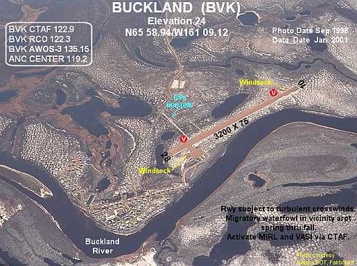
Buckland Airport covers an area of 184 acres (74 ha) at an elevation of 31 feet (9 m) above mean sea level. It has one runway designated 11/29 with a gravel surface measuring 3,200 by 75 feet (975 x 23 m).
Airlines and non-stop destinations
- Bering Air (Deering, Kotzebue)
- Frontier Flying Service (Deering, Kotzebue)
- Hageland Aviation Services (Deering)
The above content comes from Wikipedia and is published under free licenses – click here to read more.
Buckland is a city located in Northwest Arctic Borough, Alaska.
As of the 2000 census, the population of the city is 406.
Buckland is located at 65°59'5"
North, 161°7'47" West (65.984795, -161.129717)GR1.According to
the United States Census Bureau, the city has a total area of 3.7 km²
(1.4 mi²). 3.2 km² (1.2 mi²) of it is land and 0.5 km²
(0.2 mi²) of it is water. The total area is 13.48% water.
|
 |
(Click on the photo to
enlarge) |
Location & QuickFacts
|
FAA
Information Effective: |
2005-10-27 |
|
Airport Identifier: |
BVK |
|
Longitude/Latitude: |
161-08-56.6550W/65-58-53.6350N
-161.149071/65.981565 (Estimated) |
|
Elevation: |
31 ft / 9.45 m (Estimated) |
|
Land: |
184
acres |
|
From nearest city: |
1 nautical miles
SW of Buckland, AK |
|
Location: |
Unorganized
County, AK |
|
Magnetic Variation: |
19E (1995) |
Owner & Manager
|
Ownership: |
Publicly
owned |
|
Owner: |
State Of Ak Dotpf
N Rgn |
|
Address: |
2301
Peger Road
Fairbanks, AK 99701 |
|
Phone number: |
907-451-5250 |
|
Manager: |
Kenny
Gallahorn |
|
Address: |
Po Box 55
Kotzebue, AK 99752 |
|
Phone number: |
907-442-3147 |
Airport Operations and Facilities
|
Airport
Use: |
Open
to public |
|
Wind indicator: |
Yes |
|
Segmented Circle: |
Yes |
|
Control Tower: |
No |
|
Attendance Schedule: |
UNATNDD |
|
Lighting Schedule: |
DUSK-DAWN
ACTVT MIRL RY 10/28 & VASI RYS 10 & 28 - CTAF. |
|
Beacon Color: |
Clear-Green (lighted
land airport) |
|
Sectional chart: |
Nome |
|
Region: |
AAL - Alaska |
|
Boundary ARTCC: |
ZAN
- Anchorage |
|
Tie-in FSS: |
OTZ - Kotzebue |
|
FSS Phone: |
907-442-3310 |
|
FSS Toll Free: |
1-478-7460 |
|
Alternate FSS: |
FAI
- Fairbanks |
|
Alt. FSS Toll Free: |
1-866-248-6516 |
|
NOTAMs Facility: |
BVK
(NOTAM-d service avaliable) |
|
Federal Agreements: |
N |
Airport Communications
Runway Information
Runway 10/28
|
Dimension: |
3200
x 75 ft / 975.4 x 22.9 m |
|
Surface: |
GRVL,
Good Condition |
|
Edge Lights: |
Medium |
|
|
Runway 10 |
Runway 28 |
|
Longitude: |
161-09-29.7000W |
161-08-24.0100W |
|
Latitude: |
65-59-01.9300N |
65-58-45.3400N |
|
Elevation: |
29.00 ft |
30.00 ft |
|
Alignment: |
122 |
127 |
|
Traffic Pattern: |
Left |
Left |
|
Crossing Height: |
25.00 ft |
29.00 ft |
|
VASI: |
4-box on right side |
4-box on left side |
|
Visual Glide Angle: |
3.00� |
3.50� |
|
Radio Navigation Aids
|
ID |
Type |
Name |
Ch |
Freq |
Var |
Dist |
|
BVK |
NDB/DME |
Buckland |
078X |
325.00 |
19E |
0.1
nm |
|
WLK |
VOR/DME |
Selawik |
089X |
114.20 |
21E |
46.5
nm |
Remarks
-
RWY SUBJECT TO TURBULENT
CROSSWINDS IN SUMMER MONTHS.
-
RY COND NOT MONITORED;
RECOMMEND VISUAL INSPECTION PRIOR TO LANDING.
-
MIGRATORY WATERFOWL INVOF
ARPT SPRING THROUGH FALL.
Operational Statistics
|
Aircraft
Operations: |
68/Week |
|
Air Taxi: |
57.1% |
|
General Aviation
Local: |
14.3% |
|
General Aviation
Itinerant: |
28.6% |
Buckland
Airport
Address: Unorganized
County, AK
Tel:
907-451-5250,
907-442-3147
|
 |
(Click on the photo to
enlarge) |
Images
and information placed above are from
http://www.airport-data.com/airport/BVK/
http://www.city-data.com/city/Buckland-Alaska.html
http://en.wikipedia.org/wiki/Buckland%2C_Alaska
We thank them for the data!
| General
Info |
| Country |
United
States |
| State |
ALASKA
|
| FAA ID |
BVK
|
| Latitude |
65-58-53.635N
|
| Longitude |
161-08-56.655W
|
| Elevation |
31 feet
|
| Near City |
BUCKLAND
|
We don't guarantee the information is fresh and accurate. The data may be wrong or outdated.
For more up-to-date information please refer to other sources.
|
|