|
|
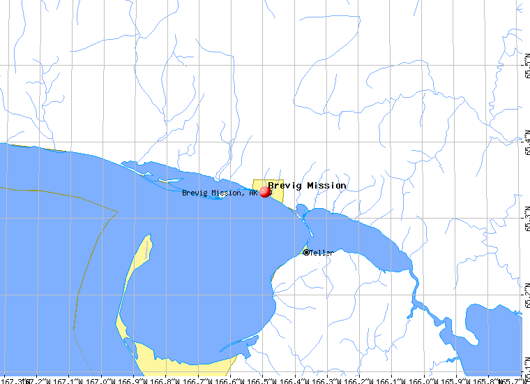
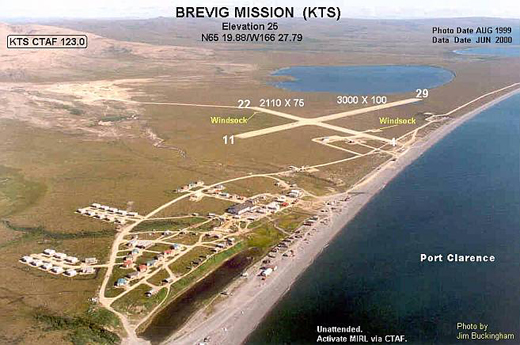
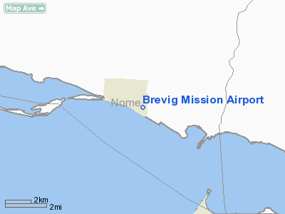
| Brevig Mission Airport |
 |
| IATA: KTS – ICAO: PFKT – FAA LID: KTS |
| Summary |
| Airport type |
Public |
| Owner |
Alaska DOT&PF - Northern Region |
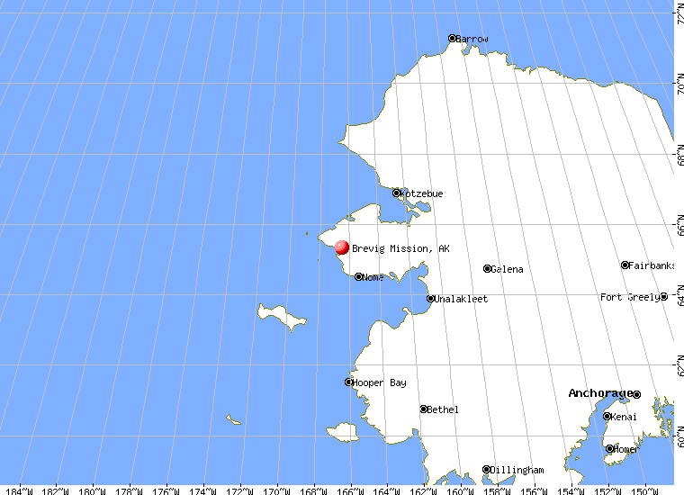
| Serves |
Brevig Mission, Alaska |
| Elevation AMSL |
35 ft / 11 m |
| Coordinates |
65°19′53″N 166°27′57″W / 65.33139°N 166.46583°W / 65.33139; -166.46583 |
| Runways |
| Direction |
Length |
Surface |
| ft |
m |
| 11/29 |
3,000 |
914 |
Gravel |
| 4/22 |
2,110 |
643 |
Gravel |
| Statistics |
| Enplanements (2007) |
2,696 |
| Source: Federal Aviation Administration |
Brevig Mission Airport (IATA: KTS, ICAO: PFKT, FAA LID: KTS) is a state-owned public-use airport located in Brevig Mission, a city in the Nome Census Area of the U.S. state of Alaska.
As per Federal Aviation Administration records, this airport had 2,696 passenger boardings (enplanements) in calendar year 2007, a decrease of 14% from the 3,152 enplanements in 2006. Facilities
Brevig Mission Airport covers an area of 344 acres (139 ha) at an elevation of 38 feet (12 m) above mean sea level. It has two gravel surfaced runways: 11/29 is 3,000 by 100 feet (914 x 30 m); 4/22 is 2,110 by 75 feet (643 x 23 m).
Airlines and non-stop destinations
- Bering Air (Nome, Wales)
- Frontier Flying Service (Nome, Teller)
- Hageland Aviation Services
The above content comes from Wikipedia and is published under free licenses – click here to read more.
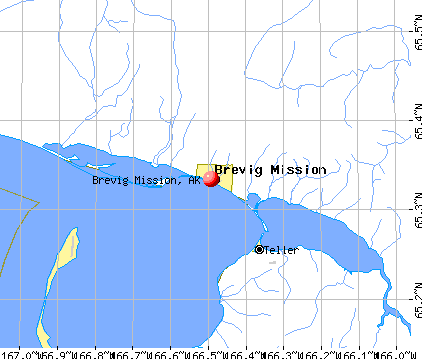
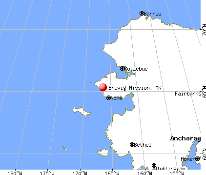
Brevig Mission is a city located in Nome Census Area, Alaska.
As of 2004, the population of the city is 432.
Brevig Mission is located at 65°20'3"
North, 166°29'35" West (65.334235, -166.492952)GR1.
According to the United States Census Bureau, the city
has a total area of 6.8 km² (2.6 mi²). 6.7 km² (2.6 mi²)
of it is land and 0.1 km² (0.1 mi²) of it is water. The total
area is 1.89% water.
|
 |
(Click on the photo to
enlarge) |
Location & QuickFacts
|
FAA
Information Effective: |
2005-10-27 |
|
Airport Identifier: |
KTS |
|
Longitude/Latitude: |
166-27-56.6077W/65-19-52.7862N
-166.465724/65.331329 (Estimated) |
|
Elevation: |
35 ft / 10.67 m (Surveyed) |
|
Land: |
344
acres |
|
From nearest city: |
0 nautical miles
E of Brevig Mission, AK |
|
Location: |
Nome
County, AK |
|
Magnetic Variation: |
17E (1985) |
Owner & Manager
|
Ownership: |
Publicly
owned |
|
Owner: |
St Of Ak Dotpf/n
Rgn |
|
Address: |
2301
Peger Rd
Fairbanks, AK 99701 |
|
Phone number: |
907-443-3444 |
|
Manager: |
Jerry
Oliver |
|
Address: |
Box 1048
Nome, AK 99762 |
|
Phone number: |
907-443-2500 |
Airport Operations and Facilities
|
Airport
Use: |
Open
to public |
|
Wind indicator: |
Yes |
|
Segmented Circle: |
Yes |
|
Control Tower: |
No |
|
Attendance Schedule: |
UNATNDD |
|
Lighting Schedule: |
DUSK-DAWN
ACTVT MIRL RY 04/22 & 11/29 - CTAF. |
|
Beacon Color: |
Clear-Green (lighted
land airport) |
|
Sectional chart: |
Nome |
|
Region: |
AAL - Alaska |
|
Boundary ARTCC: |
ZAN
- Anchorage |
|
Tie-in FSS: |
OME - Nome |
|
FSS Phone: |
LC
443-2291 |
|
FSS Toll Free: |
1-800-478-8400 |
|
Alternate FSS: |
FAI
- Fairbanks |
|
Alt. FSS Toll Free: |
1-866-248-6516 |
|
NOTAMs Facility: |
OME
(NOTAM-d service avaliable) |
|
Federal Agreements: |
NGSY |
Airport Communications
Runway Information
Runway 04/22
|
Dimension: |
2110
x 75 ft / 643.1 x 22.9 m |
|
Surface: |
GRVL,
Good Condition |
|
Edge Lights: |
Medium |
|
|
Runway 04 |
Runway 22 |
|
Longitude: |
166-28-23.9600W |
166-27-43.4100W |
|
Latitude: |
65-19-49.2000N |
65-20-01.2100N |
|
Elevation: |
30.00 ft |
34.00 ft |
|
Alignment: |
55 |
127 |
|
Traffic Pattern: |
Left |
Left |
|
Obstruction: |
,
50:1 slope to clear |
1215 ft hill, 9500.0 ft from runway, 8:1 slope to clear |
|
Runway 11/29
|
Dimension: |
3000
x 100 ft / 914.4 x 30.5 m |
|
Surface: |
GRVL,
|
|
Edge Lights: |
Medium |
|
|
Runway 11 |
Runway 29 |
|
Longitude: |
166-28-18.8200W |
166-27-24.4400W |
|
Latitude: |
65-20-00.5100N |
65-19-41.6600N |
|
Elevation: |
33.00 ft |
32.00 ft |
|
Alignment: |
127 |
127 |
|
Traffic Pattern: |
Left |
Left |
|
Radio Navigation Aids
|
ID |
Type |
Name |
Ch |
Freq |
Var |
Dist |
|
TNC |
NDB/DME |
Tin
City |
119Y |
347.00 |
13E |
39.0
nm |
Remarks
-
RY COND NOT MONITORED;
RECOMMEND VISUAL INSPECTION PRIOR TO LANDING.
-
ESTABD PRIOR TO 1959.
Operational Statistics
|
Aircraft
Operations: |
50/Week |
|
Air Taxi: |
98.1% |
|
General Aviation
Itinerant: |
1.9% |
Brevig
Mission Airport
Address: Nome
County, AK
Tel:
907-443-3444,
907-443-2500
|
 |
(Click on the photo to
enlarge) |
Images
and information placed above are from
http://www.airport-data.com/airport/KTS/
http://en.wikipedia.org/wiki/Brevig_Mission%2C_Alaska
http://www.city-data.com/city/Brevig-Mission-Alaska.html
We
thank them for the data!
| General
Info |
| Country |
United
States |
| State |
ALASKA
|
| FAA ID |
KTS
|
| Latitude |
65-19-52.900N
|
| Longitude |
166-27-47.400W
|
| Elevation |
25 feet
|
| Near City |
BREVIG
MISSION |
We don't guarantee the information is fresh and accurate. The data may be wrong or outdated.
For more up-to-date information please refer to other sources.
|
|