 |
|
Bob Baker Memorial Airport |
| Bob Baker Memorial Airport |
| IATA: IAN – ICAO: PAIK – FAA LID: IAN |
| Summary |
| Airport type |
Public |
| Owner |
State of Alaska DOT&PF - Northern Region |
| Location |
Kiana, Alaska |
| Elevation AMSL |
166 ft / 51 m |
| Coordinates |
66°58′33″N 160°26′12″W / 66.97583°N 160.43667°W / 66.97583; -160.43667 |
| Runways |
| Direction |
Length |
Surface |
| ft |
m |
| 6/24 |
3,400 |
1,036 |
Gravel |
| Source: Federal Aviation Administration |
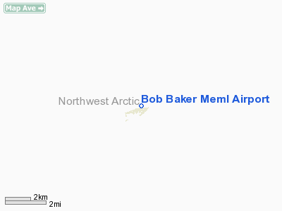
Bob Baker Memorial Airport (IATA: IAN, ICAO: PAIK, FAA LID: IAN) is a public airport located one mile (2 km) north of the central business district of Kiana, a city in the Northwest Arctic Borough of the U.S. state of Alaska. The airport is owned by the state. Facilities
Bob Baker Memorial Airport has one gravel surfaced runway (6/24) measuring 3,400 x 100 ft. (1,036 x 30 m).
Airlines and non-stop destinations
- Bering Air (Kotzebue, Noorvik)
- Frontier Flying Service (Kotzebue, Noorvik)
- Hageland Aviation Services (Selawik)
The above content comes from Wikipedia and is published under free licenses – click here to read more.
Bob Baker Meml Airport serves
Kiana and is owned by Alaska Dotpf Northern Reg. The gravel runway extends
for 3400 feet. The facility is at an elevation of 150 feet at a distance
of about one mile from Kiana.
Location & QuickFacts
|
FAA
Information Effective: |
2005-10-27 |
|
Airport Identifier: |
IAN |
|
Longitude/Latitude: |
160-26-11.5240W/66-58-33.4340N
-160.436534/66.975954 (Estimated) |
|
Elevation: |
166 ft / 50.60 m
(Estimated) |
|
Land: |
0
acres |
|
From nearest city: |
1 nautical miles
N of Kiana, AK |
|
Location: |
Kobuk
County, AK |
|
Magnetic Variation: |
18E (2005) |
Owner & Manager
|
Ownership: |
Publicly
owned |
|
Owner: |
Alaska Dotpf Northern
Reg |
|
Address: |
2301
Peger Rd
Fairbanks, AK 99709 |
|
Phone number: |
907-451-5250 |
|
Manager: |
Kenny
Gallahorn |
|
Address: |
Box 55
Kotzebue, AK 99752 |
|
Phone number: |
907-442-3147 |
Airport Operations and Facilities
|
Airport
Use: |
Open
to public |
|
Wind indicator: |
Yes |
|
Segmented Circle: |
Yes |
|
Control Tower: |
No |
|
Attendance Schedule: |
UNATNDD |
|
Lighting Schedule: |
RDO-CTL
ACTVT MIRL RY 06/24 & ROTG BCN - CTAF. |
|
Beacon Color: |
Clear-Green (lighted
land airport) |
|
Landing fee charge: |
No |
|
Sectional chart: |
Nome |
|
Region: |
AAL
- Alaska |
|
Boundary ARTCC: |
ZAN - Anchorage |
|
Tie-in FSS: |
OTZ
- Kotzebue |
|
FSS on Airport: |
No |
|
FSS Phone: |
907-442-3310 |
|
FSS Toll Free: |
1-478-7460 |
|
Alternate FSS: |
FAI
- Fairbanks |
|
Alt. FSS Toll Free: |
1-866-248-6516 |
|
NOTAMs Facility: |
OTZ
(NOTAM-d service avaliable) |
|
Federal Agreements: |
NGSY |
Airport Communications
Airport Services
|
Airframe
Repair: |
NONE |
|
Power
Plant Repair: |
NONE |
|
Bottled Oxygen: |
NONE |
|
Bulk Oxygen: |
NONE |
Runway Information
Runway 06/24
|
Dimension: |
3400
x 100 ft / 1036.3 x 30.5 m |
|
Surface: |
GRAVEL, Good Condition |
|
Edge Lights: |
Medium |
|
|
Runway 06 |
Runway 24 |
|
Longitude: |
160-26-53.8250W |
160-25-29.2230W |
|
Latitude: |
66-58-31.0880N |
66-58-35.7810N |
|
Elevation: |
166.00 ft |
141.00 ft |
|
Alignment: |
82 |
127 |
|
Traffic Pattern: |
Left |
Left |
|
Obstruction: |
205 ft hill, 4000.0 ft from runway, 20:1 slope to clear |
,
50:1 slope to clear |
|
Radio Navigation Aids
|
ID |
Type |
Name |
Ch |
Freq |
Var |
Dist |
|
WLK |
VOR/DME |
Selawik |
089X |
114.20 |
21E |
24.9
nm |
|
OTZ |
VOR/DME |
Kotzebue |
104X |
115.70 |
19E |
49.8
nm |
Remarks
-
ARPT USED BY BLM SUMMER
MONTHS AS FIRE FIGHTING BASE.
-
RY CONDITION NOT MONITORED;
RECOMMEND VISUAL INSPECTION PRIOR TO LANDING.
-
RY PLOWED IN WINTER.
Based Aircraft
|
Aircraft
based on field: |
4 |
|
Single Engine Airplanes: |
4 |
Operational Statistics
|
Aircraft
Operations: |
152/Week |
|
Air Taxi: |
74.7% |
|
General Aviation
Local: |
12.7% |
|
General Aviation
Itinerant: |
12.7% |
Bob Baker Meml Airport
Address: Kobuk
County, AK
Tel:
907-451-5250,
907-442-3147
Images
and information placed above are from
http://www.airport-data.com/airport/IAN/
http://www.ohwy.com/usa/alaska/kiana/airports/ian.htm
We
thank them for the data!
| General
Info |
| Country |
United
States |
| State |
ALASKA
|
| FAA ID |
IAN
|
| Latitude |
66-58-45.754N
|
| Longitude |
160-26-09.095W
|
| Elevation |
150 feet
|
| Near City |
KIANA
|
We don't guarantee the information is fresh and accurate. The data may be wrong or outdated.
For more up-to-date information please refer to other sources.
|
|


