 |
|
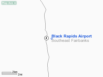
Location & QuickFacts
|
FAA
Information Effective: |
2005-10-27 |
|
Airport Identifier: |
5BK |
|
Longitude/Latitude: |
145-51-39.1900W/63-32-06.5270N
-145.860886/63.535146 (Estimated) |
|
Elevation: |
2125 ft / 647.70
m (Estimated) |
|
Land: |
0
acres |
|
From nearest city: |
0 nautical miles
N of Black Rapids, AK |
|
Location: |
Fairbanks
North Star County, AK |
|
Magnetic Variation: |
28E (1985) |
Owner & Manager
|
Ownership: |
Publicly
owned |
|
Owner: |
Bureau Of Land Mgmt |
|
Address: |
P.o.
Box 147
Glenallen, AK 99588 |
|
Phone number: |
907-822-3217 |
|
Manager: |
Dave
Muschovic |
|
Address: |
P.o. Box 147
Glenallen, AK 99588 |
|
Phone number: |
907-822-3217 |
Airport Operations and Facilities
|
Airport
Use: |
Open
to public |
|
Segmented Circle: |
No |
|
Control Tower: |
No |
|
Attendance Schedule: |
UNATNDD |
|
Sectional chart: |
Anchorage |
|
Region: |
AAL
- Alaska |
|
Boundary ARTCC: |
ZAN - Anchorage |
|
Tie-in FSS: |
FAI
- Fairbanks |
|
FSS Phone: |
907-474-0788 |
|
FSS Toll Free: |
1-866-248-6516 |
|
NOTAMs Facility: |
FAI |
Airport Communications
Runway Information
Runway 14/32
|
Dimension: |
2250
x 60 ft / 685.8 x 18.3 m
NORTH 1100 FT OF RY UNUSABLE OVERGROAWN WITH 4 -6 FT BRUSH. |
|
Surface: |
GRAVEL, Poor Condition
ROCKS TO 5 FT, WEEDS TO 1.5 FT, BRUSH 4 TO 6 FT. |
|
|
Runway 14 |
Runway 32 |
|
Traffic Pattern: |
Left |
Left |
|
Markings: |
None, |
None, |
|
Runway End Identifier: |
No |
No |
|
Centerline Lights: |
No |
No |
|
Touchdown Lights: |
No |
No |
|
Obstruction: |
17 ft trees, 130.0 ft from runway, 7:1 slope to clear |
25 ft pole, 110.0 ft from runway, 55 ft right of centerline,
4:1 slope to clear |
|
Radio Navigation Aids
|
ID |
Type |
Name |
Ch |
Freq |
Var |
Dist |
|
DJN |
NDB |
Delta
Junction |
|
347.00 |
29E |
29.7
nm |
|
BIG |
VORTAC |
Big
Delta |
096X |
114.90 |
29E |
28.5
nm |
Remarks
-
RWY 14/32 RUNS PARALLEL
TO HIWAY.
-
ARPT NOT MAINTAINED OCCASIONAL
MILITARY HELICOPTER USE. N HALF OF RY OVERGROWN WITH GRASS AND BURSH
4 TO 6 FEET HIGH.
-
SUAIS - 125.3 (1-800-758-8723).
Operational Statistics
|
Aircraft
Operations: |
10/Month |
|
Air Taxi: |
9.1% |
|
General Aviation
Itinerant: |
45.5% |
|
Military: |
45.5% |
Black Rapids Airport
Address: Fairbanks
North Star County, AK
Tel:
907-822-3217
Images
and information placed above are from
http://www.airport-data.com/airport/5BK/
We
thank them for the data!
| General
Info |
| Country |
United
States |
| State |
ALASKA
|
| FAA ID |
5BK
|
| Latitude |
63-32-06.527N
|
| Longitude |
145-51-39.190W
|
| Elevation |
2125 feet
|
| Near City |
BLACK
RAPIDS |
We don't guarantee the information is fresh and accurate. The data may be wrong or outdated.
For more up-to-date information please refer to other sources.
|
|


