 |
|
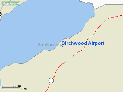
Location & QuickFacts
|
FAA
Information Effective: |
2005-10-27 |
|
Airport Identifier: |
BCV |
|
Longitude/Latitude: |
149-30-26.4600W/61-24-59.3600N
-149.507350/61.416489 (Estimated) |
|
Elevation: |
96 ft / 29.26 m (Surveyed) |
|
Land: |
196
acres |
|
From nearest city: |
2 nautical miles
NW of Birchwood, AK |
|
Location: |
Anchorage
County, AK |
|
Magnetic Variation: |
25E (1985) |
Owner & Manager
|
Ownership: |
Publicly
owned |
|
Owner: |
State Of Alaska Dotpf |
|
Address: |
Po
Box 196900
Anchorage, AK 99519-6900 |
|
Phone number: |
907-266-1450 |
|
Manager: |
Jerry
Reed |
|
Address: |
Po Box 6900
Chugiak, AK 99519-6900 |
|
Phone number: |
907-338-1432 |
Airport Operations and Facilities
|
Airport
Use: |
Open
to public |
|
Wind indicator: |
Yes |
|
Segmented Circle: |
Yes |
|
Control Tower: |
No |
|
Attendance Schedule: |
APR-AUG/ALL/0800-1800,SEP-MAR/ALL/0800-1700 |
|
Lighting Schedule: |
DUSK-DAWN
ACTVT VASI RY 19R - CTAF. |
|
Beacon Color: |
Clear-Green (lighted
land airport) |
|
Sectional chart: |
Anchorage |
|
Region: |
AAL - Alaska |
|
Boundary ARTCC: |
ZAN
- Anchorage |
|
Tie-in FSS: |
ENA - Kenai |
|
FSS Phone: |
800-478-3576 |
|
FSS Toll Free: |
1-800-WX-BRIEF |
|
NOTAMs Facility: |
BCV
(NOTAM-d service avaliable) |
|
Federal Agreements: |
NGY |
Airport Communications
|
CTAF: |
123.000 |
|
Unicom: |
123.000
|
Airport Services
|
Fuel
available: |
100LL |
|
Airframe
Repair: |
MAJOR |
|
Power
Plant Repair: |
MAJOR |
Runway Information
Runway 01L/19R
|
Dimension: |
4010
x 100 ft / 1222.2 x 30.5 m
N 600 FT OF RY 19L ASPH S 1600 FT GRVL. |
|
Surface: |
ASPH,
Fair Condition |
|
Edge Lights: |
Medium
RY 01L/19R MIRL ACTVTD BY PHOTOCELL DUSK - DAWN & ACTVT VASI
RY 19R - CTAF. |
|
|
Runway 01L |
Runway 19R |
|
Longitude: |
149-30-58.2300W |
149-30-05.9400W |
|
Latitude: |
61-24-42.3200N |
61-25-12.8400N |
|
Elevation: |
96.00 ft |
81.00 ft |
|
Alignment: |
39 |
127 |
|
Traffic Pattern: |
Left |
Right |
|
Markings: |
Non-precision instrument, Fair Condition
HOLD BAR - APCH END RWY 01 MISSING. |
Non-precision instrument, Fair Condition |
|
VASI: |
|
4-box on left side |
|
Obstruction: |
50 ft trees, 500.0 ft from runway, 180 ft right of centerline,
6:1 slope to clear
-5' FENCE 195' FROM PAVEMENT EDGE. |
36 ft trees, 950.0 ft from runway, 125 ft right of centerline,
20:1 slope to clear |
|
Runway 01R/19L
|
Dimension: |
2200
x 50 ft / 670.6 x 15.2 m
N 600 FT OF RY 19L ASPH S 1600 FT GRVL. |
|
Surface: |
ASPH-GRVL, |
|
|
Runway 01R |
Runway 19L |
|
Traffic Pattern: |
Left |
Right |
|
Radio Navigation Aids
|
ID |
Type |
Name |
Ch |
Freq |
Var |
Dist |
|
CMQ |
NDB |
Campbell Lake |
|
338.00 |
21E |
21.5
nm |
|
BOB |
NDB |
Bruck |
|
387.00 |
21E |
24.4
nm |
|
EDF |
TACAN |
Elmendorf |
081X |
|
21E |
12.3
nm |
|
ANC |
VOR/DME |
Anchorage |
090X |
114.30 |
25E |
25.7
nm |
|
BGQ |
VORTAC |
Big
Lake |
072X |
112.50 |
25E |
16.1
nm |
|
MRI |
VOT |
Merrill |
|
111.00 |
|
15.6
nm |
|
ANC |
VOT |
Anchorage |
|
108.40 |
|
19.9
nm |
Remarks
-
RWY USED FOR SAILPLANE
OPERATIONS OCCASIONALLY.
-
AIRPORT HAS DESIGNATED
TRANSIENT AIRCRAFT PARKING AVAILABLE.
-
HELICOPTERS AVOID FIXED
WING AND ULTRALIGHT TRAFFIC PATTERN.
-
MID 1500 FT OF TWY A
DESIGNATED AS RY FOR ULTRALIGHT & SKI/TUNDRA TIRE EQUIPPED ACFT,
NO PARALLEL OPS ALLOWED - SEQUENCE ON CTAF.
-
FOR WSO PHONE 271-3491.
-
ULTRALIGHT RY SKI/TUNDRA
TIRE RWY.
-
PILOTS ARE REQUESTED
TO SELF-ANNOUNCE ON CTAF PRIOR TO TAXIING ON RWY FOR DEPARTURE; LEAVING
THE RWY AND WITHIN 10 NM OF THE ARPT WHEN APPROACHING TO LAND.
-
RGT TFC PATTERN RY 19L
AND 19R EXCEPT ULTRALIGHT ACFT USE LEFT TFC PATTERN EAST AWAY FROM ALL
RYS.
Based Aircraft
|
Aircraft
based on field: |
200 |
|
Single Engine Airplanes: |
188 |
|
Multi Engine Airplanes: |
2 |
|
Helicopters: |
3 |
|
Gliders: |
2 |
|
Ultralights: |
5 |
Operational Statistics
|
Aircraft
Operations: |
154/Day |
|
Air Taxi: |
2.7% |
|
General Aviation
Local: |
89.2% |
|
General Aviation
Itinerant: |
8.0% |
|
Military: |
0.1% |
Birchwood Airport
Address: Anchorage
County, AK
Tel:
907-266-1450,
907-338-1432
Images
and information placed above are from
http://www.airport-data.com/airport/BCV/
We
thank them for the data!
| General
Info |
| Country |
United
States |
| State |
ALASKA
|
| FAA ID |
BCV
|
| Latitude |
61-24-59.360N
|
| Longitude |
149-30-26.460W
|
| Elevation |
96 feet
|
| Near City |
BIRCHWOOD
|
We don't guarantee the information is fresh and accurate. The data may be wrong or outdated.
For more up-to-date information please refer to other sources.
|
|


