|
 |
|
||||
|
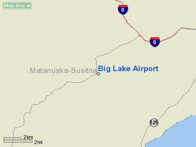
Big Lake Airport (IATA: BGQ, ICAO: PAGQ, FAA LID: BGQ) is a state-owned public-use airport located one nautical mile (1.8 km) southeast of the central business district of Big Lake, in the Matanuska-Susitna Borough of the U.S. state of Alaska. Facilities and aircraftBig Lake Airport has one runway (7/25) with a gravel surface measuring 2,435 by 70 feet (742 x 21 m). For the 12-month period ending December 31, 2005, the airport had 20,000 aircraft operations, an average of 54 per day, all of which were general aviation. At that time there were 79 aircraft based at this airport: 95% single-engine, 4% ultralight and 1% helicopter. The above content comes from Wikipedia and is published under free licenses – click here to read more.
Big Lake is located at 61°32'15" North, 149°53'28" West (61.537449, -149.891104)GR1. According to the United States Census Bureau, the CDP
has a total area of 375.0 km² (144.8 mi²). 341.7 km² (131.9
mi²) of it is land and 33.3 km² (12.9 mi²) of it is water.
|
||||||||||||||||||||||||||||||||||||||||||||||||||||||||||||||||||||||||||||||||||||||||||||||||||||||||||||||||||||||||||||||||||||||||||||||||||||||||||||||||||||||||||||||||||||||||||||||||||||||||||||||||||||||||||||||||||||||||||||||||||||||||||||||||||||||||||||||||||||||||||||||||||||||||||||||
|
FAA Information Effective: |
2005-10-27 |
| Airport Identifier: |
BGQ |
| Longitude/Latitude: |
149-48-50.0300W/61-32-10.0400N |
| Elevation: |
158 ft / 48.16 m (Estimated) |
| Land: |
0 acres |
| From nearest city: |
1 nautical miles SE of Big Lake, AK |
| Location: |
Unorganized County, AK |
| Magnetic Variation: |
25E (1985) |
|
Ownership: |
Publicly owned |
| Owner: |
State Of Alaska Dotpf |
| Address: |
Po
Box 196900 |
| Phone number: |
907-266-1450 |
| Manager: |
Rick Dolfi |
| Address: |
289 Inner Spring
Loop |
| Phone number: |
907-745-2101 |
|
Airport Use: |
Open to public |
| Wind indicator: |
Yes |
| Segmented Circle: |
No |
| Control Tower: |
No |
| Attendance Schedule: |
UNATNDD |
| Lighting Schedule: |
DUSK-DAWN |
| Beacon Color: |
Clear-Green (lighted land airport) |
| Sectional chart: |
Anchorage |
| Region: |
AAL - Alaska |
| Boundary ARTCC: |
ZAN - Anchorage |
| Tie-in FSS: |
ENA - Kenai |
| FSS Phone: |
800-478-3576 |
| FSS Toll Free: |
1-800-WX-BRIEF |
| NOTAMs Facility: |
ANC (NOTAM-d service avaliable) |
| Federal Agreements: |
N |
|
CTAF: |
122.800 |
|
Airframe Repair: |
MAJOR |
|
Power Plant Repair: |
MAJOR |
|
Dimension: |
2435 x 70 ft / 742.2 x 21.3 m |
|||||||||||||||||||||||||||
| Surface: |
GRAVEL, Good Condition |
|||||||||||||||||||||||||||
| Edge Lights: |
Medium |
|||||||||||||||||||||||||||
|
||||||||||||||||||||||||||||
| ID |
Type |
Name |
Ch |
Freq |
Var |
Dist |
| CMQ |
NDB |
Campbell Lake |
|
338.00 |
21E |
23.0 nm |
| BOB |
NDB |
Bruck |
|
387.00 |
21E |
24.5 nm |
| PEE |
NDB |
Peters Creek |
|
305.00 |
26E |
48.5 nm |
| EDF |
TACAN |
Elmendorf |
081X |
|
21E |
16.9 nm |
| ANC |
VOR/DME |
Anchorage |
090X |
114.30 |
25E |
25.8 nm |
| TKA |
VOR/DME |
Talkeetna |
109X |
116.20 |
26E |
46.6 nm |
| BGQ |
VORTAC |
Big Lake |
072X |
112.50 |
25E |
4.8 nm |
| MRI |
VOT |
Merrill |
|
111.00 |
|
19.4 nm |
| ANC |
VOT |
Anchorage |
|
108.40 |
|
22.1 nm |
|
Aircraft based on field: |
79 |
| Single Engine Airplanes: |
75 |
| Helicopters: |
1 |
| Ultralights: |
3 |
|
Aircraft Operations: |
55/Day |
| General Aviation Local: |
60.0% |
| General Aviation Itinerant: |
40.0% |
Big Lake Airport
Address: Unorganized County, AK
Tel: 907-266-1450, 907-745-2101
 |
(Click on the photo to
enlarge) |
Images
and information placed above are from
http://www.airport-data.com/airport/BGQ/
http://www.city-data.com/city/Big-Lake-Alaska.html
http://en.wikipedia.org/wiki/Big_Lake%2C_Alaska
We thank them for the data!
| General Info | |
|---|---|
| Country | United States |
| State | ALASKA |
| FAA ID | BGQ |
| Latitude | 61-32-04.270N |
| Longitude | 149-48-46.800W |
| Elevation | 150 feet |
| Near City | BIG LAKE |

 |
|
Copyright 2004-2026 © by Airports-Worldwide.com, Vyshenskoho st. 36, Lviv 79010, Ukraine Legal Disclaimer |