 |
|
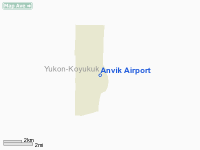
| Anvik Airport |
| IATA: ANV – ICAO: PANV – FAA LID: ANV |
| Summary |
| Airport type |
Public |
| Owner |
State of Alaska DOT&PF - Northern Region |
| Location |
Anvik, Alaska |
| Elevation AMSL |
309 ft / 94 m |
| Coordinates |
62°38′48″N 160°11′26″W / 62.64667°N 160.19056°W / 62.64667; -160.19056 |
| Runways |
| Direction |
Length |
Surface |
| ft |
m |
| 17/35 |
2,960 |
902 |
Gravel |
| Source: Federal Aviation Administration |
Anvik Airport (IATA: ANV, ICAO: PANV, FAA LID: ANV) is a public airport located one mile (2 km) southeast of the central business district of Anvik, a city in the Yukon-Koyukuk Census Area, Alaska of the U.S. state of Alaska. It is owned by the state. Facilities
Anvik Airport has one runway (17/35) with a gravel surface measuring 2,960 x 75 ft. (902 x 23 m).
Airlines and non-stop destinations
- Frontier Flying Service (Grayling, Holy Cross)
- Hageland Aviation Services (Aniak, Grayling)
The above content comes from Wikipedia and is published under free licenses – click here to read more.
Anvik is located at 62°39'20" North, 160°12'33"
West (62.655659, -160.209237)GR1.
According to the United
States Census Bureau, the city has a total area of 30.9 km² (11.9
mi²). 24.6 km² (9.5 mi²) of it is land and 6.3 km²
(2.4 mi²) of it is water. The total area is 20.44% water.
Location & QuickFacts
|
FAA
Information Effective: |
2005-10-27 |
|
Airport Identifier: |
ANV |
|
Longitude/Latitude: |
160-11-26.3720W/62-38-48.2435N
-160.190659/62.646734 (Estimated) |
|
Elevation: |
309 ft / 94.18 m
(Surveyed) |
|
Land: |
0
acres |
|
From nearest city: |
1 nautical miles
SE of Anvik, AK |
|
Location: |
Kuskokwim
County, AK |
|
Magnetic Variation: |
20E (1985) |
Owner & Manager
|
Ownership: |
Publicly
owned |
|
Owner: |
St Of Ak Dotpf Northern
Rgn |
|
Address: |
2301
Peger Road
Fairbanks, AK 99709 |
|
Phone number: |
907-443-3444 |
|
Manager: |
George
Beans |
|
Address: |
Box 135
St Mary's, AK 99658 |
|
Phone number: |
907-438-2416 |
Airport Operations and Facilities
|
Airport
Use: |
Open
to public |
|
Wind indicator: |
Yes
TALL TREES NEAR WINDSOCK MAY RESULT IN ERRONEOUS WIND INDICATIONS. |
|
Segmented Circle: |
No |
|
Control Tower: |
No |
|
Attendance Schedule: |
UNATNDD |
|
Lighting Schedule: |
RDO-CTL
ACTVT MIRL RY 17/35 & VASI RYS 17 & 35 & STROBE LIGHT
- 122.7. |
|
Beacon Color: |
Clear (unlighted
land airport)
WGUTE STROBE USED AS BEACON. |
|
Landing fee charge: |
No |
|
Sectional chart: |
Mc Grath |
|
Region: |
AAL
- Alaska |
|
Boundary ARTCC: |
ZAN - Anchorage |
|
Tie-in FSS: |
ENA
- Kenai |
|
FSS Phone: |
800-478-3576 |
|
FSS Toll Free: |
1-800-WX-BRIEF |
|
NOTAMs Facility: |
ANV (NOTAM-d service
avaliable) |
|
Federal Agreements: |
N |
Airport Communications
|
CTAF: |
122.700 |
|
Unicom: |
122.700
|
Runway Information
Runway 17/35
|
Dimension: |
2960
x 75 ft / 902.2 x 22.9 m |
|
Surface: |
GRVL,
Poor Condition
HAS NUMEROUS RUTS. |
|
Edge Lights: |
Medium |
|
|
Runway 17 |
Runway 35 |
|
Longitude: |
160-11-22.2500W |
160-11-30.4940W |
|
Latitude: |
62-39-02.6900N |
62-38-33.7970N |
|
Elevation: |
297.00 ft |
309.00 ft |
|
Alignment: |
127 |
7 |
|
Traffic Pattern: |
Left |
Left |
|
Crossing Height: |
25.00 ft |
25.00 ft |
|
VASI: |
4-box on left side
VASI ALIGNED 5 DEGS TOWARD CNTRLN. |
4-box on left side |
|
Visual Glide Angle: |
4.00� |
4.00� |
|
Obstruction: |
20 ft trees, 500.0 ft from runway, 150 ft right of centerline,
25:1 slope to clear |
46 ft trees, 750.0 ft from runway, 100 ft right of centerline,
16:1 slope to clear |
|
Radio Navigation Aids
|
ID |
Type |
Name |
Ch |
Freq |
Var |
Dist |
|
ANV |
NDB/DME |
Anvik |
071X |
365.00 |
20E |
0.3
nm |
Remarks
-
RY IS DISH SHAPED.
-
SEVERAL RY LIGHTS &
THR PANELS MISSING OR DESTROYED.
-
RY COND NOT MONITORED;
RECOMMEND VISUAL INSPECTION PRIOR TO LANDING.
-
ROTGBCN 50' NORTH OF
APRON NOT VISIBLE TO ACFT DUE TO TREES.
Based Aircraft
|
Aircraft
based on field: |
3 |
|
Single Engine Airplanes: |
3 |
Operational Statistics
|
Aircraft
Operations: |
50/Week |
|
Air Taxi: |
46.9% |
|
General Aviation
Local: |
14.1% |
|
General Aviation
Itinerant: |
39.1% |
Anvik Airport
Address: Kuskokwim
County, AK
Tel:
907-443-3444,
907-438-2416
Images
and information placed above are from
http://www.airport-data.com/airport/ANV/
http://en.wikipedia.org/wiki/Anvik%2C_Alaska
We thank them for the data!
| General
Info |
| Country |
United
States |
| State |
ALASKA
|
| ICAO ID |
PANV
|
| FAA ID |
ANV
|
| Latitude |
62.646733
62� 38' 48.24" N |
| Longitude |
-160.190658
160� 11' 26.37" W |
| Elevation |
309 feet
94 meters |
| Magnetic
Variation |
016� E
(01/06) |
| Beacon |
Yes
|
| Operating
Agency |
U.S.CIVIL
AIRPORT WHEREIN PERMIT COVERS USE BY TRANSIT MILITARY AIRCRAFT
|
| Daylight
Savings Time |
First
Sunday in April at 0200 to last Sunday in October at 0200 local time
(Exception Arizona and that portion of Indiana in the Eastern Time
Zone) |
We don't guarantee the information is fresh and accurate. The data may be wrong or outdated.
For more up-to-date information please refer to other sources.
|
|


