 |
|
Location &
QuickFacts
|
FAA
Information Effective: |
2005-10-27 |
|
Airport Identifier: |
5Z4 |
|
Longitude/Latitude: |
158-31-56.8720W/59-00-06.3100N
-158.532464/59.001753 (Estimated) |
|
Elevation: |
100 ft / 30.48 m
(Estimated) |
|
Land: |
0
acres |
|
From nearest city: |
0 nautical miles
NE of Kanakanak, AK |
|
Location: |
Bristol
Bay County, AK |
|
Magnetic Variation: |
20E (1985) |
Owner & Manager
|
Ownership: |
Publicly
owned |
|
Owner: |
Us Dept Of Hew |
|
Address: |
Box
7-714
Anchorage, AK 99501 |
|
Address: |
|
|
Phone number: |
907-277-3511 |
Airport Operations and Facilities
|
Airport
Use: |
Open
to public |
|
Wind indicator: |
Yes |
|
Segmented Circle: |
No |
|
Control Tower: |
No |
|
Attendance Schedule: |
UNATNDD |
|
Landing fee charge: |
No |
|
Sectional chart: |
Kodiak |
|
Region: |
AAL
- Alaska |
|
Boundary ARTCC: |
ZAN - Anchorage |
|
Tie-in FSS: |
DLG
- Dillingham |
|
FSS on Airport: |
No |
|
FSS Phone: |
907-842-5275 |
|
FSS Toll Free: |
LC842-5275 |
|
Alternate FSS: |
ENA
- Kenai |
|
Alt. FSS Toll Free: |
1-800-WX-BRIEF |
|
NOTAMs Facility: |
DLG
(NOTAM-d service avaliable) |
Airport Communications
Airport Services
|
Airframe
Repair: |
NONE |
|
Power
Plant Repair: |
NONE |
|
Bottled Oxygen: |
NONE |
|
Bulk Oxygen: |
NONE |
Runway Information
Helipad H1
|
Dimension: |
200
x 100 ft / 61.0 x 30.5 m |
|
Surface: |
TURF,
|
|
Edge Lights: |
Medium |
|
|
Runway H1 |
Runway |
|
Traffic Pattern: |
Left |
Left |
|
Markings: |
None, |
,
|
|
Runway End Identifier: |
No |
|
|
Centerline Lights: |
No |
|
|
Touchdown Lights: |
No |
|
|
Radio Navigation Aids
|
ID |
Type |
Name |
Ch |
Freq |
Var |
Dist |
|
BTS |
NDB |
Wood
River |
|
429.00 |
20E |
0.5
nm |
|
DLG |
VOR/DME |
Dillingham |
111X |
116.40 |
20E |
0.8
nm |
Remarks
-
GOOD APCHS ALL QUADS;
FAVORED APCH OVER WATER TO W.
Operational Statistics
|
Aircraft
Operations: |
2/Month |
|
General Aviation
Itinerant: |
33.3% |
|
Military: |
66.7% |
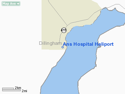
Ans Hospital Heliport
Address: Bristol
Bay County, AK
Tel:
907-277-3511
Images
and information placed above are from
http://www.airport-data.com/airport/5Z4/
We
thank them for the data!
| General
Info |
| Country |
United
States |
| State |
ALASKA
|
| FAA ID |
5Z4
|
| Latitude |
59-00-06.310N
|
| Longitude |
158-31-56.872W
|
| Elevation |
100 feet
|
| Near City |
KANAKANAK
|
We don't guarantee the information is fresh and accurate. The data may be wrong or outdated.
For more up-to-date information please refer to other sources.
|
|


