 |
|
Allen Army Forces Airport |
| Allen AAF |
| IATA: BIG – ICAO: PABI – FAA LID: BIG |
| Summary |
| Airport type |
Public/Military |
| Owner |
United States Army |
| Serves |
Fort Greely, Alaska |
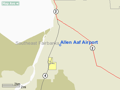
| Location |
Delta Junction, Alaska |
| Elevation AMSL |
1,291 ft / 393 m |
| Coordinates |
63°59′42″N 145°43′12″W / 63.995°N 145.72°W / 63.995; -145.72 |
| Runways |
| Direction |
Length |
Surface |
| ft |
m |
| 1/19 |
9,000 |
2,743 |
Asphalt |
| 10/28 |
6,115 |
1,864 |
Asphalt |
| 7/25 |
4,679 |
1,426 |
Asphalt |
| Statistics (1984) |
| Aircraft operations |
29,200 |
| Source: Federal Aviation Administration |
Allen Army Airfield (IATA: BIG, ICAO: PABI, FAA LID: BIG) is a public/military airport serving Fort Greely and located three miles (5 km) south of the central business district of Delta Junction, a city in the Southeast Fairbanks Census Area of the U.S. state of Alaska. It is owned by the United States Army, which has an agreement with the City of Delta Junction for joint use of the airfield by both military and civilian aircraft. History
Established in 1942 as Big Delta Army Airfield, it was named for river delta formed by the confluence of the Delta River and the Tanana River. It was later renamed Allen Army Airfield. Fort Greely was built south of the airfield after World War II.
Facilities and aircraft
Allen Army Airfield has three asphalt paved runways:
- Runway 1/19: 9,000 x 150 ft (2,743 x 46 m)
- Runway 10/28: 6,115 x 150 ft (1,864 x 46 m)
- Runway 7/25: 4,679 x 164 ft (1,426 x 50 m)
Two runways are lighted and can accommodate heavy cargo aircraft year-round, including the C-141. Between December and April the runways can accommodate any aircraft, including the C-5A. A 37,600-square-foot (3,490 m) hangar accommodates military aircraft as large as the CH-47. Approximately 920,000 square feet (85,000 m) of airport ramp space is available. For the 12-month period ending January 3, 1984, the airport had 29,200 aircraft operations, an average of 80 per day: 91% military and 9% general aviation.
The above content comes from Wikipedia and is published under free licenses – click here to read more.
Location & QuickFacts
|
FAA
Information Effective: |
2005-10-27 |
|
Airport Identifier: |
BIG |
|
Longitude/Latitude: |
145-43-17.9100W/63-59-40.3700N
-145.721642/63.994547 (Estimated) |
|
Elevation: |
1277 ft / 389.23
m (Surveyed) |
|
Land: |
0
acres |
|
From nearest city: |
3 nautical miles
S of Delta Junction Ft Greely, AK |
|
Location: |
Fairbanks
County, AK |
|
Magnetic Variation: |
28E (1985) |
Owner & Manager
|
Ownership: |
Army
owned |
|
Owner: |
U.s. Army |
|
Address: |
U.s.
Army Forces Command
Atlanta, GA |
|
Manager: |
Hq 172 Infantry Brigade |
|
Address: |
Ft
Richardson
Alaska 99505 |
|
Phone number: |
907-873-4171 |
Airport Operations and Facilities
|
Wind indicator: |
Yes |
|
Segmented Circle: |
Yes |
|
Control Tower: |
No |
|
Attendance Schedule: |
ALL/MON-FRI/1600-0200Z++ |
|
Lighting Schedule: |
DUSK-DAWN
ACTVT MIRL RYS 06/24 & 09/27, HIRL RY 18/36 - CTAF. |
|
Beacon Color: |
Clear-Green (lighted
land airport) |
|
Landing fee charge: |
No |
|
Sectional chart: |
Anchorage |
|
Region: |
AAL
- Alaska |
|
Boundary ARTCC: |
ZAN - Anchorage |
|
Tie-in FSS: |
FAI
- Fairbanks |
|
FSS on Airport: |
No |
|
FSS Phone: |
907-474-0788 |
|
FSS Toll Free: |
1-866-248-6516 |
|
NOTAMs Facility: |
BIG
(NOTAM-d service avaliable) |
|
Certification type/date: |
LU 3/1978 |
Airport Communications
Airport Services
|
Airframe
Repair: |
NONE |
|
Power
Plant Repair: |
NONE |
|
Bottled Oxygen: |
NONE |
|
Bulk Oxygen: |
NONE |
Runway Information
Runway 06/24
|
Dimension: |
4671
x 150 ft / 1423.7 x 45.7 m |
|
Surface: |
ASPH,
Good Condition |
|
Weight Limit: |
Single wheel: 30000 lbs.
Dual wheel: 42000 lbs.
TT174 & TDT490 |
|
Edge Lights: |
Medium |
|
|
Runway 06 |
Runway 24 |
|
Longitude: |
145-43-58.8000W |
145-42-14.4000W |
|
Latitude: |
63-59-31.1999N |
63-59-27.5999N |
|
Elevation: |
1267.00 ft |
1256.00 ft |
|
Alignment: |
94 |
127 |
|
Traffic Pattern: |
Left |
Right |
|
Markings: |
Non-precision instrument, Good Condition |
Non-precision instrument, Good Condition |
|
VASI: |
4-light PAPI on right side |
|
|
Runway 09/27
|
Dimension: |
6193
x 150 ft / 1887.6 x 45.7 m |
|
Surface: |
ASPH,
Good Condition |
|
Edge Lights: |
Medium |
|
|
Runway 09 |
Runway 27 |
|
Longitude: |
145-44-07.8720W |
145-42-14.4000W |
|
Latitude: |
63-59-59.1360N |
63-59-24.0000N |
|
Elevation: |
1248.00 ft |
1255.00 ft |
|
Traffic Pattern: |
Left |
Left |
|
VASI: |
4-light PAPI on right side |
4-light PAPI on right side |
|
Runway End Identifier: |
Yes |
Yes |
|
Runway 18/36
|
Dimension: |
9216
x 150 ft / 2809.0 x 45.7 m |
|
Surface: |
ASPH,
Good Condition |
|
Weight Limit: |
Single wheel: 30000 lbs.
Dual wheel: 42000 lbs.
TT174 & TDT490 |
|
Edge Lights: |
High |
|
|
Runway 18 |
Runway 36 |
|
Longitude: |
145-42-25.1999W |
145-44-06.0000W |
|
Latitude: |
64-00-28.7999N |
63-59-09.5999N |
|
Elevation: |
1225.00 ft |
1291.00 ft |
|
Alignment: |
127 |
30 |
|
Traffic Pattern: |
Right |
Left |
|
Markings: |
Basic, Good Condition |
Basic, Good Condition |
|
Displaced threshold: |
1198.00 ft |
1198.00 ft |
|
VASI: |
4-light PAPI on right side |
|
|
Runway End Identifier: |
|
No |
|
Centerline Lights: |
|
No |
|
Touchdown Lights: |
|
No |
|
Obstruction: |
,
300.0 ft from runway, 5:1 slope to clear |
25 ft trees, 0.0 ft from runway, 100 ft right of centerline |
|
Decleard distances: |
Take off run available 8018.00 ft
Take off distance available 9216.00 ft
Actual stop distance available 9216.00 ft
Landing distance available 8018.00 ft |
Take off run available 8018.00 ft
Take off distance available 9216.00 ft
Actual stop distance available 9216.00 ft
Landing distance available 8018.00 ft |
|
Radio Navigation Aids
|
ID |
Type |
Name |
Ch |
Freq |
Var |
Dist |
|
DJN |
NDB |
Delta
Junction |
|
347.00 |
29E |
2.0
nm |
|
BIG |
VORTAC |
Big
Delta |
096X |
114.90 |
29E |
0.6
nm |
Remarks
-
PPR ALL OPERS ON MILITARY
RAMP.
-
WT RESTRICTIONS ARE IN
EFFECT FOR ALL FIXED WING ACFR.
-
GWT RWY 18/36 - ST127.
-
RY 09/27 CLOSED TO ACFT
OVER 13500 LBS.
-
RY CONDS ONLY MONITORED
DURING OPER HRS, RECOMMEND VISUAL INSPN PRIOR TO LANDING.
-
SEASONAL MIGRATING BIRDS
& OTR WILDLIFE ON & INVOF RYS.
-
ALL ACFT AVOID OVERFLYING
SENSITIVE TEST AMMUNITION STORAGE AREA LCTD 1.5 MILES SE OF AFLD.
-
AVOID OVERFLIGHT OF MAIN
POST AREA.
-
CHECK NOTAMS FOR CURRENT
AIRFIELD CONDITIONS, UPDATED WEEKLY. AUTHORIZED USE ONLY, VIOLATORS
WILL BE PROSECUTED.
-
24 HR PPR FOR ALL ACFT,CALL
DSN 873-4172/4171, C907-873-4172/4171. AFT HRS CTC DSN-873-3889, C907-873-3889.
PPR FOR ALL FIXED WING ACFT. 24 HR PPR FOR ALL LANDINGS & REFUELINGS
CALL BASE OPS DSN 873-4172/4171 OR C907-873-4172/4171.
-
AFT DUTY HRS CTC STAFF
DUTY OFFICER DSN 873-4720 C 907-873-4720.
-
5 WORKING DAYS PPR, CALL
DSN 873-4171 OR C907-873-4171.
-
JASU; 2 (CE-13) 1 AIR
STARTS (CA-1).
-
CIVIL ACFT AUZD USE OF
ARPT; PARK ON W SIDE OF HGR; PPR REQUIRED FOR CIVIL ACFT MANDATORY 24
HR NOTICE. CIVILIAN ACFT BY LANDING PERMIT ONLY V317-873-4170/4171 C907-873-4170/4171.
-
WX OBSERVER AVBL FOR
LOCAL ARPT WX ON CTAF CALL SIGN; BIG DELTA WX; CALL C907-873-4401 0600-2130
DAILY.
-
RY 09/27 OPEN FOR DALGT
OPERATIONS ONLY.
-
THERE ARE 3 CONTROLLED
FIRING RANGES, 7 DROP ZONES & ONE RESTRICTED AREA WITHIN 35 NM RADIUS
OF FIELD; STATUS OF THESE AREAS ARE AVBL THROUGH FT GREELY RANGE CONTROL
DSN 873-4714/4715 OR C907-873-4714/4715.
-
GWT RWY 06/24 - ST127.
-
EXISTED PRIOR TO 1959.
Based Aircraft
|
Aircraft
based on field: |
3 |
|
Helicopters: |
3 |
Operational Statistics
|
Aircraft
Operations: |
80/Day |
|
General Aviation
Local: |
4.1% |
|
General Aviation
Itinerant: |
5.1% |
|
Military: |
90.8% |
Allen Aaf Airport
Address: Fairbanks
County, AK
Tel:
907-873-4171
Images
and information placed above are from
http://www.airport-data.com/airport/BIG/
We
thank them for the data!
| General
Info |
| Country |
United
States |
| State |
ALASKA
|
| FAA ID |
BIG
|
| Latitude |
63-59-40.370N
|
| Longitude |
145-43-17.910W
|
| Elevation |
1277 feet
|
| Near City |
DELTA
JUNCTION FT GREELY |
We don't guarantee the information is fresh and accurate. The data may be wrong or outdated.
For more up-to-date information please refer to other sources.
|
|


