 |
|
Facilities and aircraft
Akutan Seaplane Base has one seaplane landing area designated E/W which measures 10,000 by 1,000 feet (3,048 x 305 m). For the 12-month period ending December 31, 2006, the airport had 52 aircraft operations, an average of one per week, 100% of which were air taxi service.
Airline and destination
- Peninsula Airways (Dutch Harbor/Unalaska)
The above content comes from Wikipedia and is published under free licenses – click here to read more.
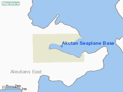
Location & QuickFacts
|
FAA
Information Effective: |
2005-10-27 |
|
Airport Identifier: |
KQA |
|
Longitude/Latitude: |
165-47-07.1200W/54-07-56.8810N
-165.785311/54.132467 (Estimated) |
|
Elevation: |
0 ft / 0.00 m (Estimated) |
|
Land: |
0
acres |
|
From nearest city: |
0 nautical miles
S of Akutan, AK |
|
Location: |
Aleutian
Islands County, AK |
|
Magnetic Variation: |
15E (1985) |
Owner & Manager
|
Ownership: |
Publicly
owned |
|
Owner: |
Public Domain |
|
Address: |
|
|
Address: |
|
Airport Operations and Facilities
|
Airport
Use: |
Open
to public |
|
Wind indicator: |
No |
|
Segmented Circle: |
No |
|
Control Tower: |
No |
|
Attendance Schedule: |
UNATNDD |
|
Landing fee charge: |
No |
|
Sectional chart: |
Dutch
Harbor |
|
Region: |
AAL - Alaska |
|
Boundary ARTCC: |
ZAN
- Anchorage |
|
Tie-in FSS: |
CDB - Cold Bay |
|
FSS on Airport: |
No |
|
FSS Phone: |
907-532-2454 |
|
FSS Toll Free: |
1-800-478-7250 |
|
Alternate FSS: |
ENA - Kenai |
|
Alt. FSS Toll Free: |
1-800-WX-BRIEF |
|
NOTAMs Facility: |
DUT (NOTAM-d service
avaliable) |
|
Federal Agreements: |
N |
Airport Communications
Airport Services
|
Airframe
Repair: |
NONE |
|
Power
Plant Repair: |
NONE |
|
Bottled Oxygen: |
NONE |
|
Bulk Oxygen: |
NONE |
Runway Information
Runway E/W
|
Dimension: |
10000
x 1000 ft / 3048.0 x 304.8 m |
|
Surface: |
WATER,
|
|
|
Runway E |
Runway W |
|
Traffic Pattern: |
Left |
Left |
|
Markings: |
None, |
None, |
|
Runway End Identifier: |
No |
No |
|
Centerline Lights: |
No |
No |
|
Touchdown Lights: |
No |
No |
|
Radio Navigation Aids
|
ID |
Type |
Name |
Ch |
Freq |
Var |
Dist |
|
DUT |
NDB/DME |
Dutch
Harbor |
086X |
283.00 |
14E |
30.2
nm |
Remarks
-
OPERG AREA IN AKUTAN
HARBOR
Operational Statistics
|
Aircraft
Operations: |
1/Month |
|
Air Taxi: |
100.0% |
Akutan Seaplane Base
Address: Aleutian
Islands County, AK
Tel:
Images and information placed above are from
http://www.airport-data.com/airport/KQA/
We thank them for the data!
| General
Info |
| Country |
United
States |
| State |
ALASKA
|
| FAA ID |
KQA
|
| Latitude |
54-07-56.881N
|
| Longitude |
165-47-07.120W
|
| Elevation |
0 feet
|
| Near City |
AKUTAN
|
We don't guarantee the information is fresh and accurate. The data may be wrong or outdated.
For more up-to-date information please refer to other sources.
|
|


